MyTopo
Bentley Oklahoma US Topo Map
Couldn't load pickup availability
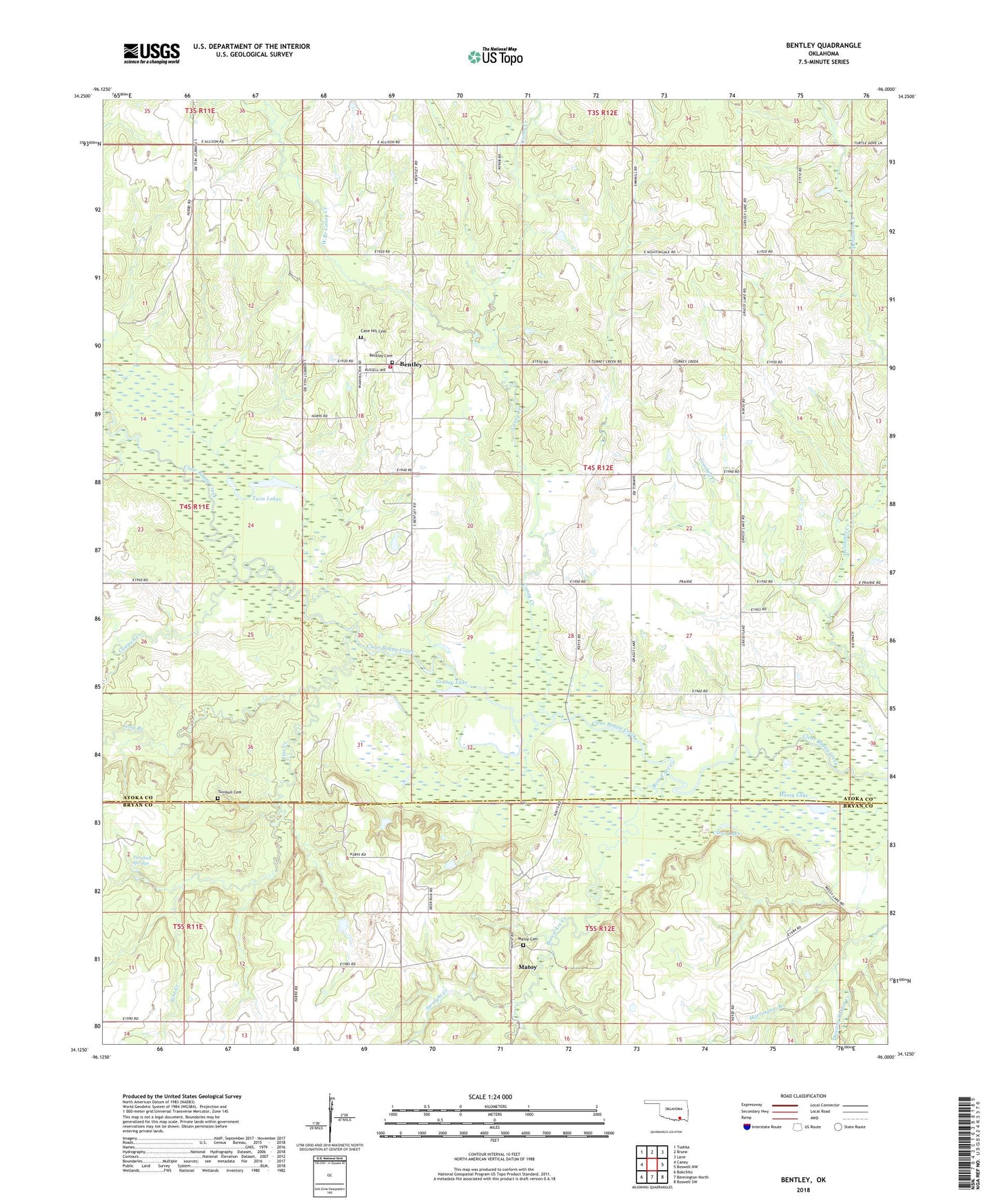
2018 topographic map quadrangle Bentley in the state of Oklahoma. Scale: 1:24000. Based on the newly updated USGS 7.5' US Topo map series, this map is in the following counties: Atoka, Bryan. The map contains contour data, water features, and other items you are used to seeing on USGS maps, but also has updated roads and other features. This is the next generation of topographic maps. Printed on high-quality waterproof paper with UV fade-resistant inks.
Quads adjacent to this one:
West: Caney
Northwest: Tushka
North: Bruno
Northeast: Lane
East: Boswell NW
Southeast: Boswell SW
South: Bennington North
Southwest: Bokchito
Contains the following named places: Bentley, Bentley Cemetery, Bentley Census Designated Place, Bentley Volunteer Fire Department, Bois d'Arc Creek, Cane Hill Cemetery, Cane Hill United Methodist Church, Caney Creek, Canyon Springs Ranch Airport, Clear Lake, Cowpen Creek, Crooked Creek, Dancing Rabbit Creek, Grassy Lake, Long Branch, Matoy, Matoy Cemetery, Mossy Lake, Pine Creek, Straight Creek, Township of Bentley, Turnbull Cemetery, Turnbull Springs, Twin Lakes, West Branch Caney Creek