MyTopo
Lane Oklahoma US Topo Map
Couldn't load pickup availability
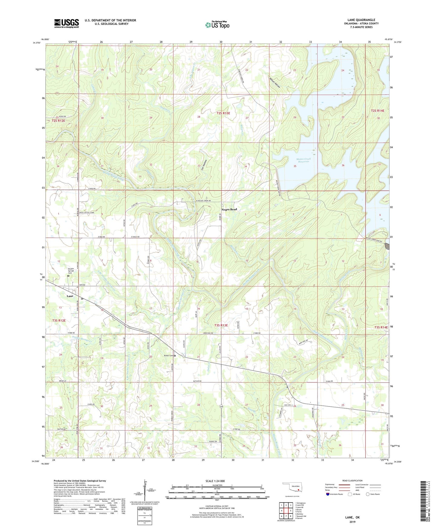
2022 topographic map quadrangle Lane in the state of Oklahoma. Scale: 1:24000. Based on the newly updated USGS 7.5' US Topo map series, this map is in the following counties: Atoka. The map contains contour data, water features, and other items you are used to seeing on USGS maps, but also has updated roads and other features. This is the next generation of topographic maps. Printed on high-quality waterproof paper with UV fade-resistant inks.
Quads adjacent to this one:
West: Bruno
Northwest: Stringtown
North: Lane NW
Northeast: Lane NE
East: Farris
Southeast: Darwin
South: Boswell NW
Southwest: Bentley
This map covers the same area as the classic USGS quad with code o34095c8.
Contains the following named places: August Creek, Butler Cemetery, Butler School, Cabin Creek, Cat Hollow, Cedar Creek, Central Atoka Division, Double Springs Cemetery, Double Springs Creek, East Branch August Creek, Iron Stob Church, Lane, Lane Census Designated Place, Lane Elementary School, Lane Post Office, McGee Creek, Medicine Branch, Negro Bend, North Branch Double Springs Creek, Payton Crossing, Potapo Creek, Sand Branch, South Branch Double Springs Creek, Wilson Creek, Wilson Hollow