MyTopo
Caney Oklahoma US Topo Map
Couldn't load pickup availability
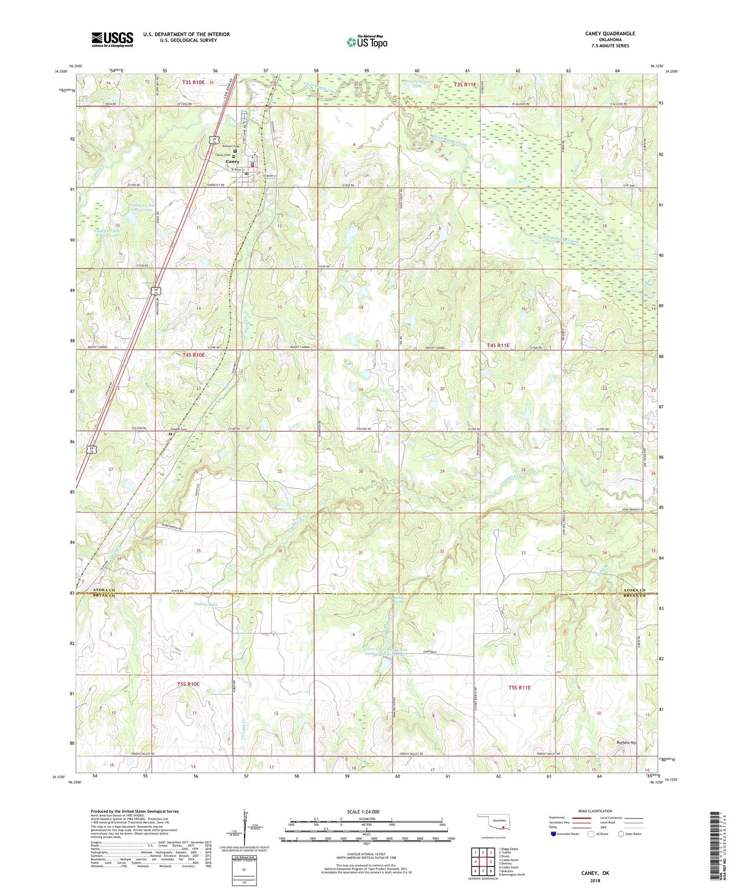
2022 topographic map quadrangle Caney in the state of Oklahoma. Scale: 1:24000. Based on the newly updated USGS 7.5' US Topo map series, this map is in the following counties: Atoka, Bryan. The map contains contour data, water features, and other items you are used to seeing on USGS maps, but also has updated roads and other features. This is the next generation of topographic maps. Printed on high-quality waterproof paper with UV fade-resistant inks.
Quads adjacent to this one:
West: Caddo North
Northwest: Boggy Depot
North: Tushka
Northeast: Bruno
East: Bentley
Southeast: Bennington North
South: Bokchito
Southwest: Caddo South
This map covers the same area as the classic USGS quad with code o34096b2.
Contains the following named places: Bachelor Springs, Buffalo Hill, Caney, Caney Creek Site 1 Dam, Caney Creek Site 1 Reservoir, Caney Creek Site 2 Dam, Caney Creek Site 2 Reservoir, Caney Elementary School, Caney High School, Caney Police Department, Caney Post Office, Caney Volunteer Fire Department, Davis Creek, Folsom Cemetery, Fronterhouse Creek, Fronterhouse Lake, Little Cowpen Creek, Lower Clear Boggy Site Number 38 Dam, Lower Clear Boggy Site Number 38 Reservoir, Mount Carmel Church, Nickles Lake, Nickles Lake Dam, Sand Creek, Stewart Cemetery, Stewart Gammon Cemetery, Stuart Ranch, Stuart Ranch Airport, Town of Caney, Township of Caney, ZIP Code: 74533