MyTopo
Boswell NW Oklahoma US Topo Map
Couldn't load pickup availability
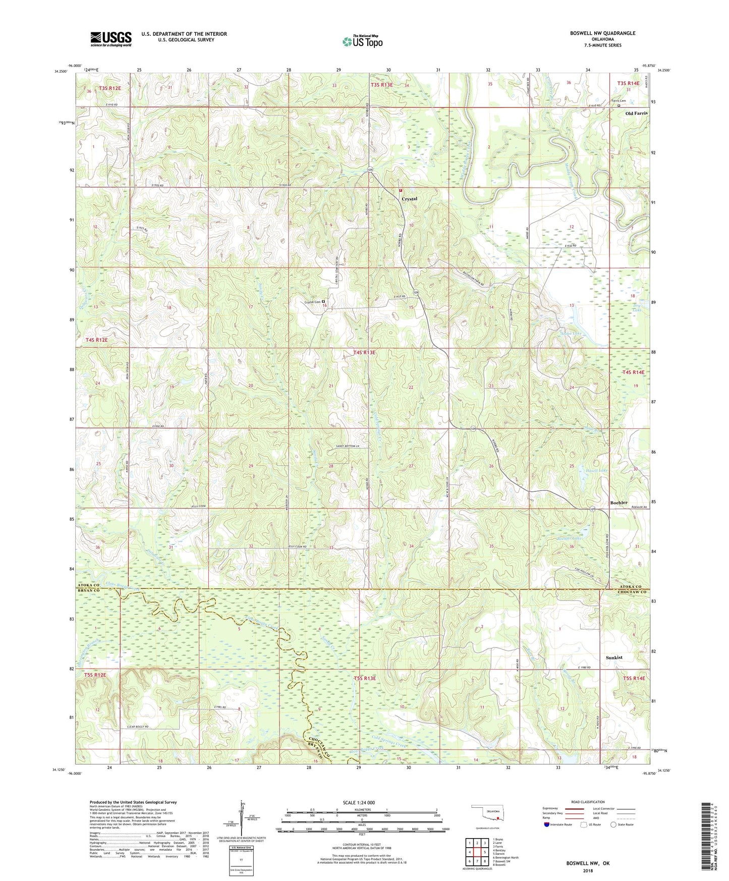
2022 topographic map quadrangle Boswell NW in the state of Oklahoma. Scale: 1:24000. Based on the newly updated USGS 7.5' US Topo map series, this map is in the following counties: Atoka, Choctaw, Bryan. The map contains contour data, water features, and other items you are used to seeing on USGS maps, but also has updated roads and other features. This is the next generation of topographic maps. Printed on high-quality waterproof paper with UV fade-resistant inks.
Quads adjacent to this one:
West: Bentley
Northwest: Bruno
North: Lane
Northeast: Farris
East: Darwin
Southeast: Boswell
South: Boswell SW
Southwest: Bennington North
This map covers the same area as the classic USGS quad with code o34095b8.
Contains the following named places: Atoka Lake, Boehler, Boehler Lake, Crab Tree Branch, Crystal, Crystal Cemetery, Crystal Church, Crystal Volunteer Fire Department, Delaware Creek, Dobbins Lake, Farris Cemetery, Harrington Branch, Hasell Lake, Myrtle Day Church, Newkirk Lake, Oknoname 023002 Dam, Oknoname 023002 Reservoir, Old Farris, Pine Pole Church, Sandy Creek, Shawnee Creek, Spring Branch, Sunkist, ZIP Code: 74555