MyTopo
Berlin Oklahoma US Topo Map
Couldn't load pickup availability
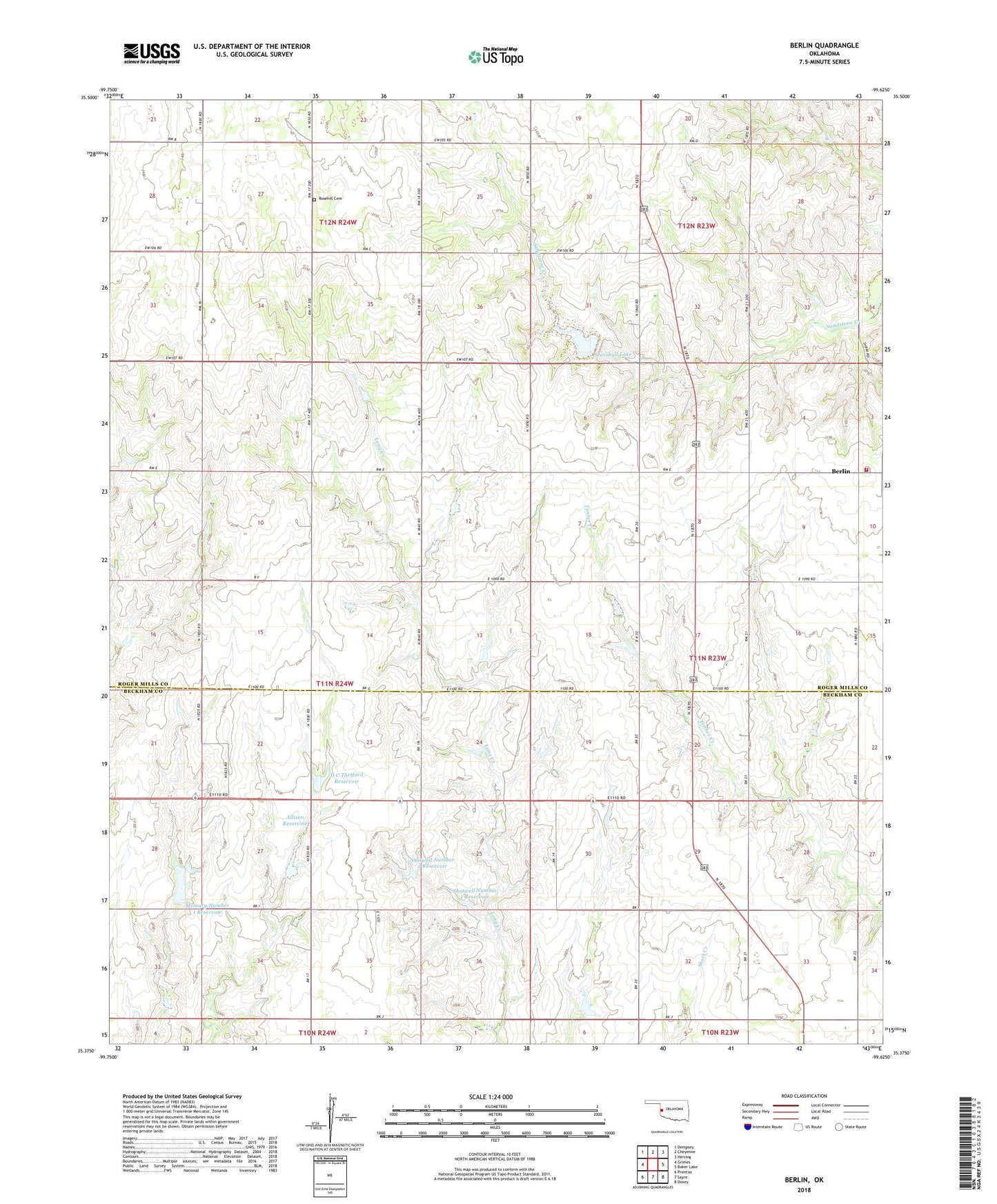
2018 topographic map quadrangle Berlin in the state of Oklahoma. Scale: 1:24000. Based on the newly updated USGS 7.5' US Topo map series, this map is in the following counties: Roger Mills, Beckham. The map contains contour data, water features, and other items you are used to seeing on USGS maps, but also has updated roads and other features. This is the next generation of topographic maps. Printed on high-quality waterproof paper with UV fade-resistant inks.
Quads adjacent to this one:
West: Grimes
Northwest: Dempsey
North: Cheyenne
Northeast: Herring
East: Baker Lake
Southeast: Doxey
South: Sayre
Southwest: Prentiss
Contains the following named places: Allison Dam, Allison Reservoir, Baker Dam, Baker Reservoir, Berlin, Berlin Volunteer Fire Station, D C Thetford Dam, D C Thetford Reservoir, Marshall Lake, Mclaury Number 1 Dam, Mclaury Number 1 Reservoir, Oknoname 129010 Dam, Oknoname 129010 Reservoir, Rosehill Cemetery, Sandstone Creek Site 16a Dam, Sandstone Creek Site 16a Reservoir, Shotwell Number 1 Dam, Shotwell Number 1 Reservoir, Shotwell Number 2 Dam, Shotwell Number 2 Reservoir, Township of Berlin