MyTopo
Blackwell Oklahoma US Topo Map
Couldn't load pickup availability
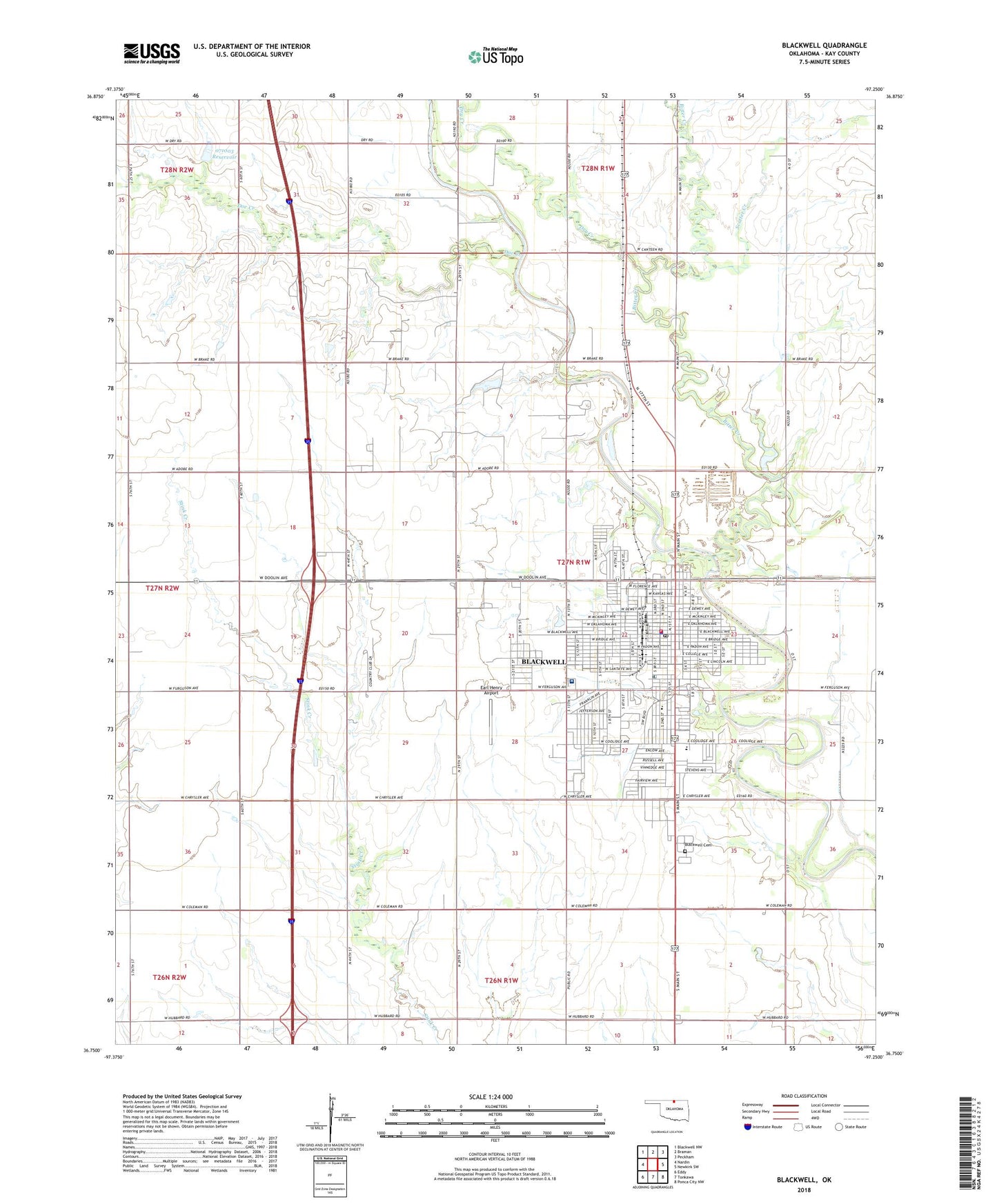
2018 topographic map quadrangle Blackwell in the state of Oklahoma. Scale: 1:24000. Based on the newly updated USGS 7.5' US Topo map series, this map is in the following counties: Kay. The map contains contour data, water features, and other items you are used to seeing on USGS maps, but also has updated roads and other features. This is the next generation of topographic maps. Printed on high-quality waterproof paper with UV fade-resistant inks.
Quads adjacent to this one:
West: Nardin
Northwest: Blackwell NW
North: Braman
Northeast: Peckham
East: Newkirk SW
Southeast: Ponca City NW
South: Tonkawa
Southwest: Eddy
Contains the following named places: Bitter Creek, Blackwell, Blackwell Cemetery, Blackwell Country Club, Blackwell Division, Blackwell Fire Department and Ambulance Service, Blackwell High School, Blackwell Middle School, Blackwell Oil and Gas Field, Blackwell Plaza Shopping Center, Blackwell Police Department, Blackwell Post Office, Camp Ta-Wa, Canteen, Christs Church, Church of Christ, City of Blackwell, City of Blackwell Dam, Dam Number 2, Doe Creek, Dry Creek, Earl Henry Airport, First Assembly of God, First Christian Church, First Church of God, First Church of the Nazarene, First Presbyterian Preschool, First United Methodist Church, Hubbard Oil Field, Huston Center Elementary School, Immanuel Baptist Church, Integris Blackwell Regional Hospital, Kingdom Hall Jehovahs Witness, KOKB-AM (Blackwell), Legion Park, New Bethel School, Northside School, Oknoname 071003 Dam, Oknoname 071003 Reservoir, Parkside Elementary School, Riverside Park, Saint Josephs Catholic Church, Scatter Creek, Tabernacle, Township of Blackwell, Trinity Lutheran Church, Union School, Victory Fellowship Church, Wesleyan Church, ZIP Code: 74631