MyTopo
Newkirk SW Oklahoma US Topo Map
Couldn't load pickup availability
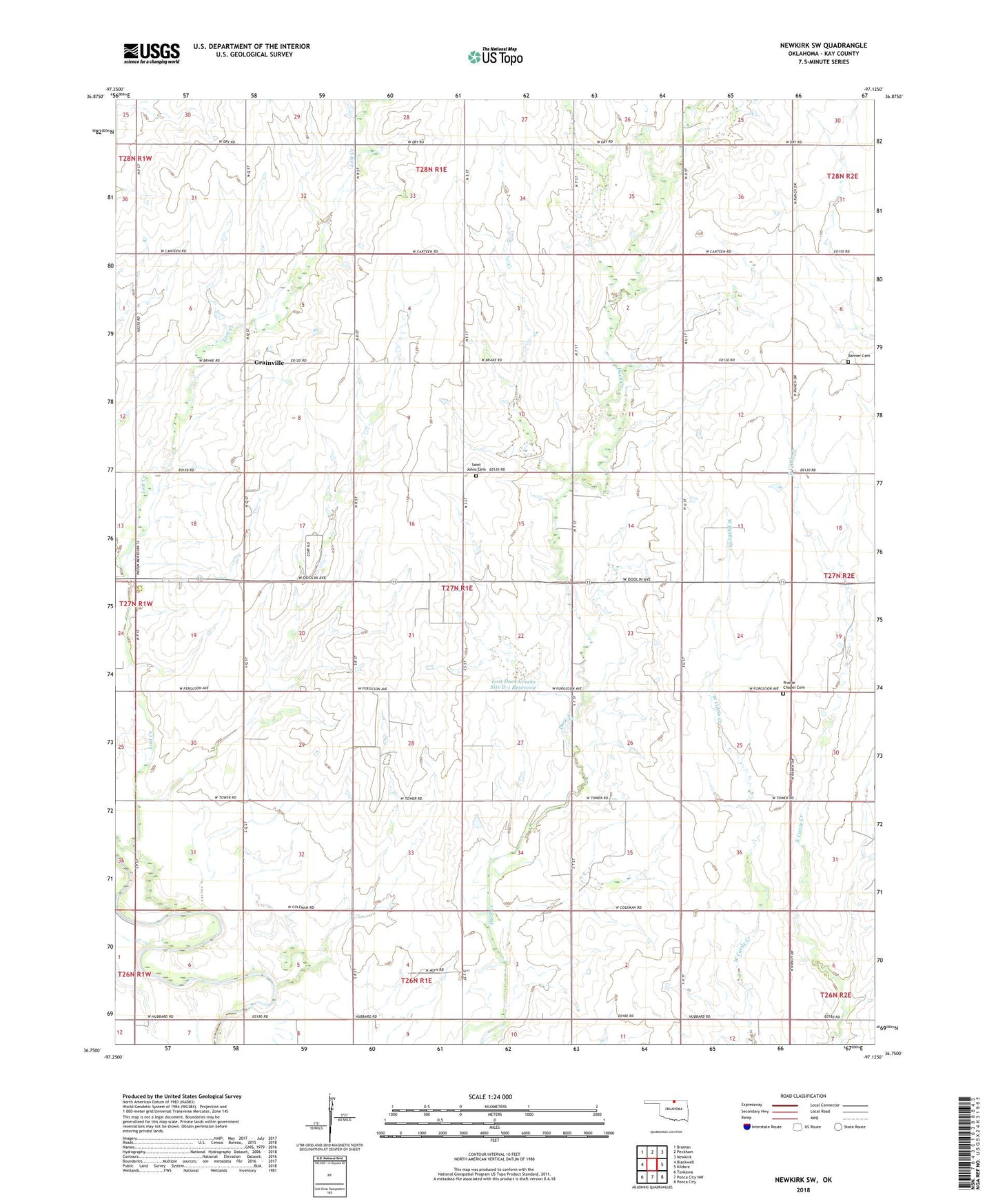
2022 topographic map quadrangle Newkirk SW in the state of Oklahoma. Scale: 1:24000. Based on the newly updated USGS 7.5' US Topo map series, this map is in the following counties: Kay. The map contains contour data, water features, and other items you are used to seeing on USGS maps, but also has updated roads and other features. This is the next generation of topographic maps. Printed on high-quality waterproof paper with UV fade-resistant inks.
Quads adjacent to this one:
West: Blackwell
Northwest: Braman
North: Peckham
Northeast: Newkirk
East: Kildare
Southeast: Ponca City
South: Ponca City NW
Southwest: Tonkawa
This map covers the same area as the classic USGS quad with code o36097g2.
Contains the following named places: Banner Cemetery, Blackwell East Oil Field, Blackwell Southeast Oil and Gas Field, Garrett Oil Field, Garrett West Oil and Gas Field, Grainville, Kay County, Lost Creek, Lost Duck Creeks Site D-1 Dam, Lost Duck Creeks Site D-1 Reservoir, Northwest Garrett Oil and Gas Field, Prairie Chapel Cemetery, Prairie Chapel Church, Prairie Chapel School, Saint Johns Cemetery, Saint Johns Church, Township of Weston