MyTopo
Bokchito Oklahoma US Topo Map
Couldn't load pickup availability
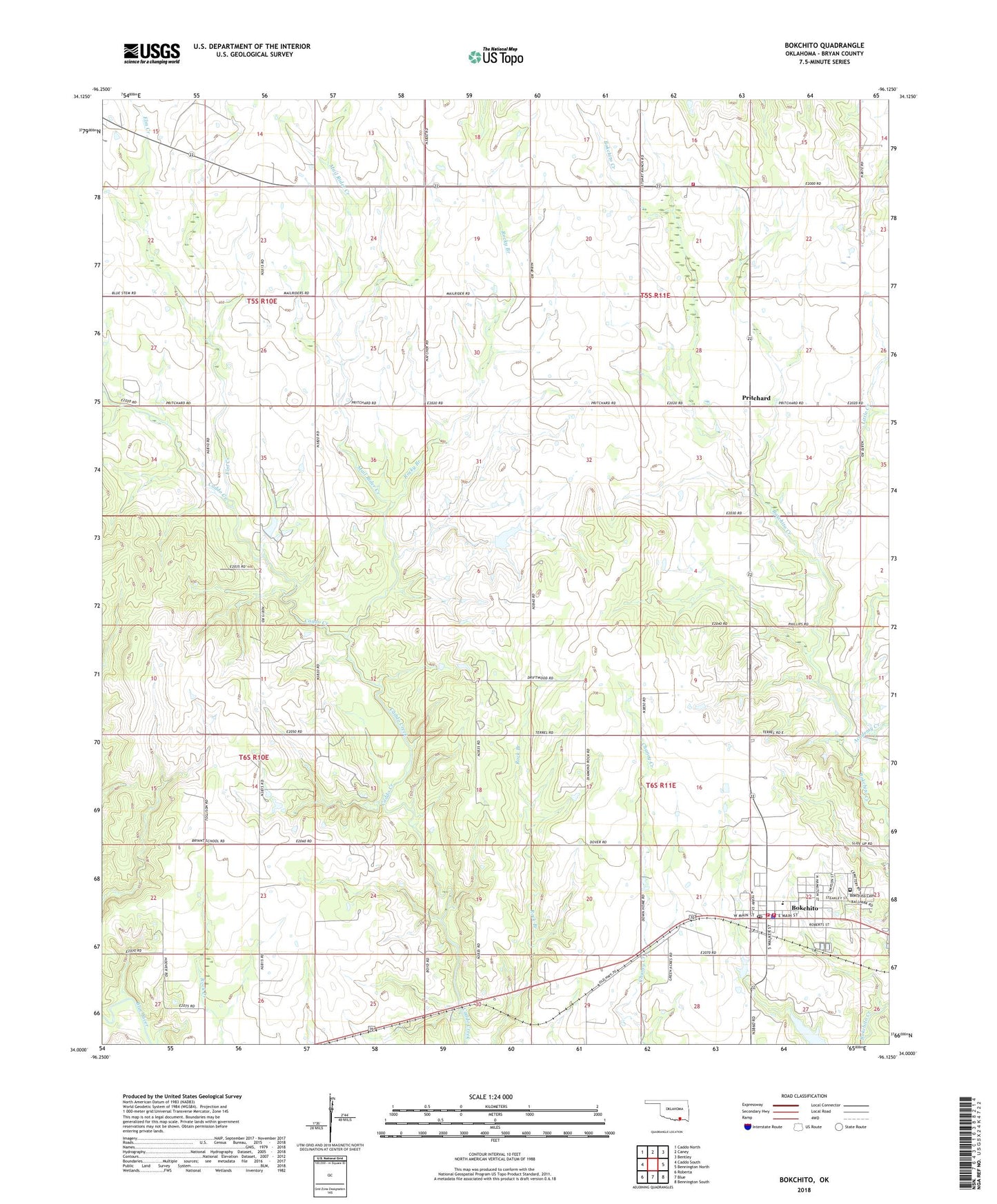
2018 topographic map quadrangle Bokchito in the state of Oklahoma. Scale: 1:24000. Based on the newly updated USGS 7.5' US Topo map series, this map is in the following counties: Bryan. The map contains contour data, water features, and other items you are used to seeing on USGS maps, but also has updated roads and other features. This is the next generation of topographic maps. Printed on high-quality waterproof paper with UV fade-resistant inks.
Quads adjacent to this one:
West: Caddo South
Northwest: Caddo North
North: Caney
Northeast: Bentley
East: Bennington North
Southeast: Bennington South
South: Blue
Southwest: Roberta
Contains the following named places: Academy Creek, Big Creek Airport, Bokchito, Bokchito Cemetery, Bokchito Police Department, Bokchito Post Office, Bokchito Volunteer Fire Department Station 1, Bokchito Volunteer Fire Department Station 2, Double Springs Church, Eastern Bryan County Ambulance Service, Elm Creek, Frank Lake, Frank Lake Dam, Frank Ranch Field, Freeny Valley Volunteer Fire Department, Full Gospel Fellowship Church, Little Creek, Mail Rider Creek, North Central Bryan Division, Oknoname 013020 Dam, Oknoname 013020 Reservoir, Pritchard, Robinson Church, Rock Creek High School, Rocky Branch, Sevenmile Corner, Town of Bokchito, Township of Bokchito