MyTopo
Bridge Creek Oklahoma US Topo Map
Couldn't load pickup availability
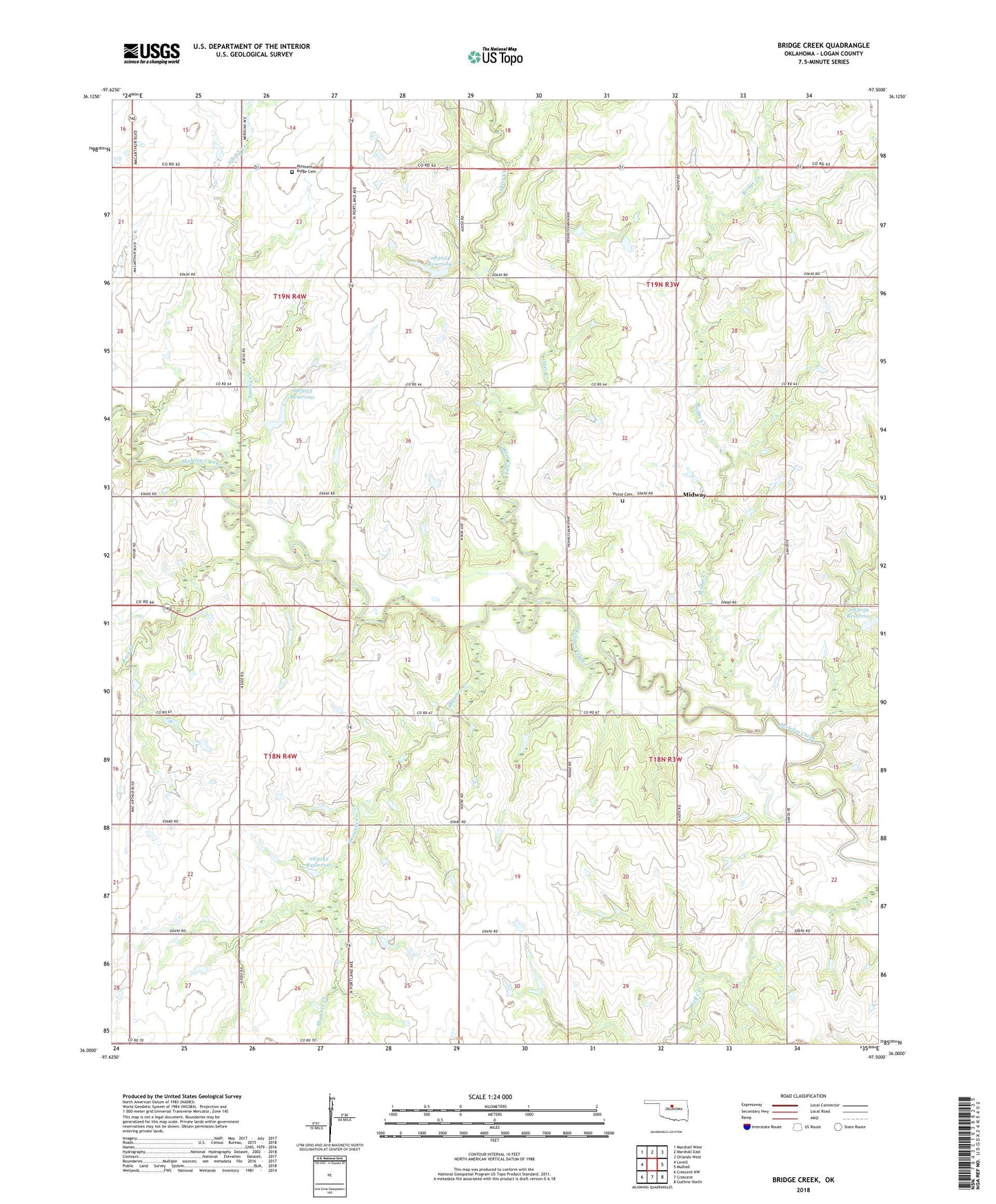
2018 topographic map quadrangle Bridge Creek in the state of Oklahoma. Scale: 1:24000. Based on the newly updated USGS 7.5' US Topo map series, this map is in the following counties: Logan. The map contains contour data, water features, and other items you are used to seeing on USGS maps, but also has updated roads and other features. This is the next generation of topographic maps. Printed on high-quality waterproof paper with UV fade-resistant inks.
Quads adjacent to this one:
West: Lovell
Northwest: Marshall West
North: Marshall East
Northeast: Orlando West
East: Mulhall
Southeast: Guthrie North
South: Crescent
Southwest: Crescent NW
Contains the following named places: Bridge Creek, Midway, Mount Carmel Church, Oknoname 083039 Dam, Oknoname 083039 Reservoir, Oknoname 083052 Dam, Oknoname 083052 Reservoir, Oknoname 083054 Dam, Oknoname 083054 Reservoir, Oknoname 083055 Dam, Oknoname 083055 Reservoir, Otter Creek, Pleasant Ridge Cemetery, Rock Creek, Shawnee Creek, Simmering Park, Spring Creek, Township of LeBron, Township of Marshall, Township of Oak View, Township of Rose Hill, Victor Cemetery