MyTopo
Bruno Oklahoma US Topo Map
Couldn't load pickup availability
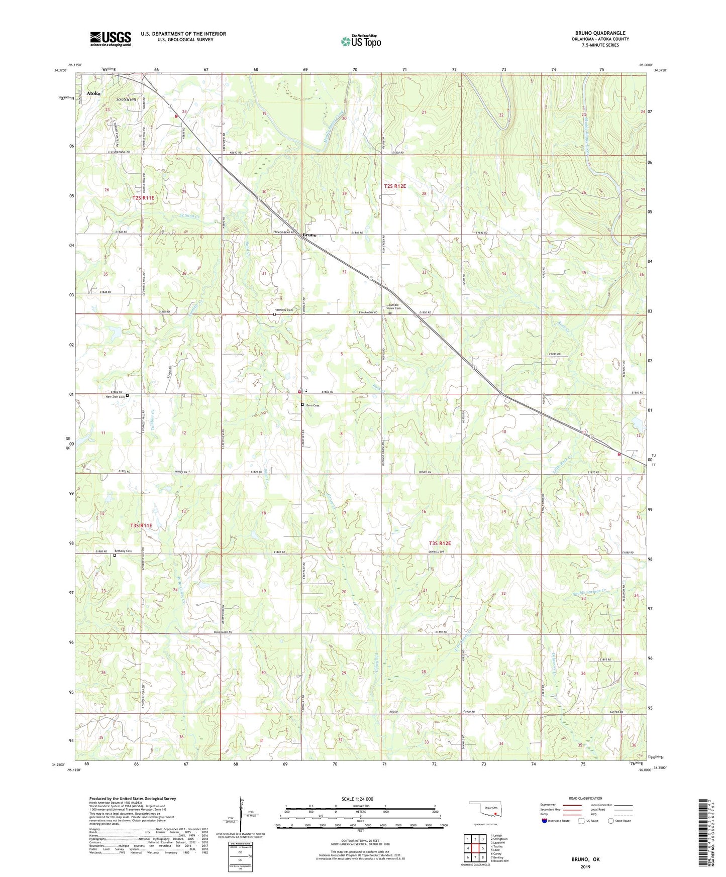
2019 topographic map quadrangle Bruno in the state of Oklahoma. Scale: 1:24000. Based on the newly updated USGS 7.5' US Topo map series, this map is in the following counties: Atoka. The map contains contour data, water features, and other items you are used to seeing on USGS maps, but also has updated roads and other features. This is the next generation of topographic maps. Printed on high-quality waterproof paper with UV fade-resistant inks.
Quads adjacent to this one:
West: Tushka
Northwest: Lehigh
North: Stringtown
Northeast: Lane NW
East: Lane
Southeast: Boswell NW
South: Bentley
Southwest: Caney
Contains the following named places: Atoka County, Bera Cemetery, Bethany Cemetery, Bethany School, Blackjack School, Bruno, Buffalo Church, Buffalo Creek Cemetery, East Branch Caney Creek, Faith Tabernacle, Farris Volunteer Fire Department, Forest Hill School, General Assembly Church, Half Bank Crossing, Harmony Cemetery, Harmony Elementary School, Harmony Fire Department, Lane Fire District, Little Rock Creek, New Zion Cemetery, New Zion Church, Rock Creek, Sand Creek, Scratch Hill, Tumbler Creek, Vera Church, West Sand Creek, ZIP Code: 74525