MyTopo
Bushyhead Oklahoma US Topo Map
Couldn't load pickup availability
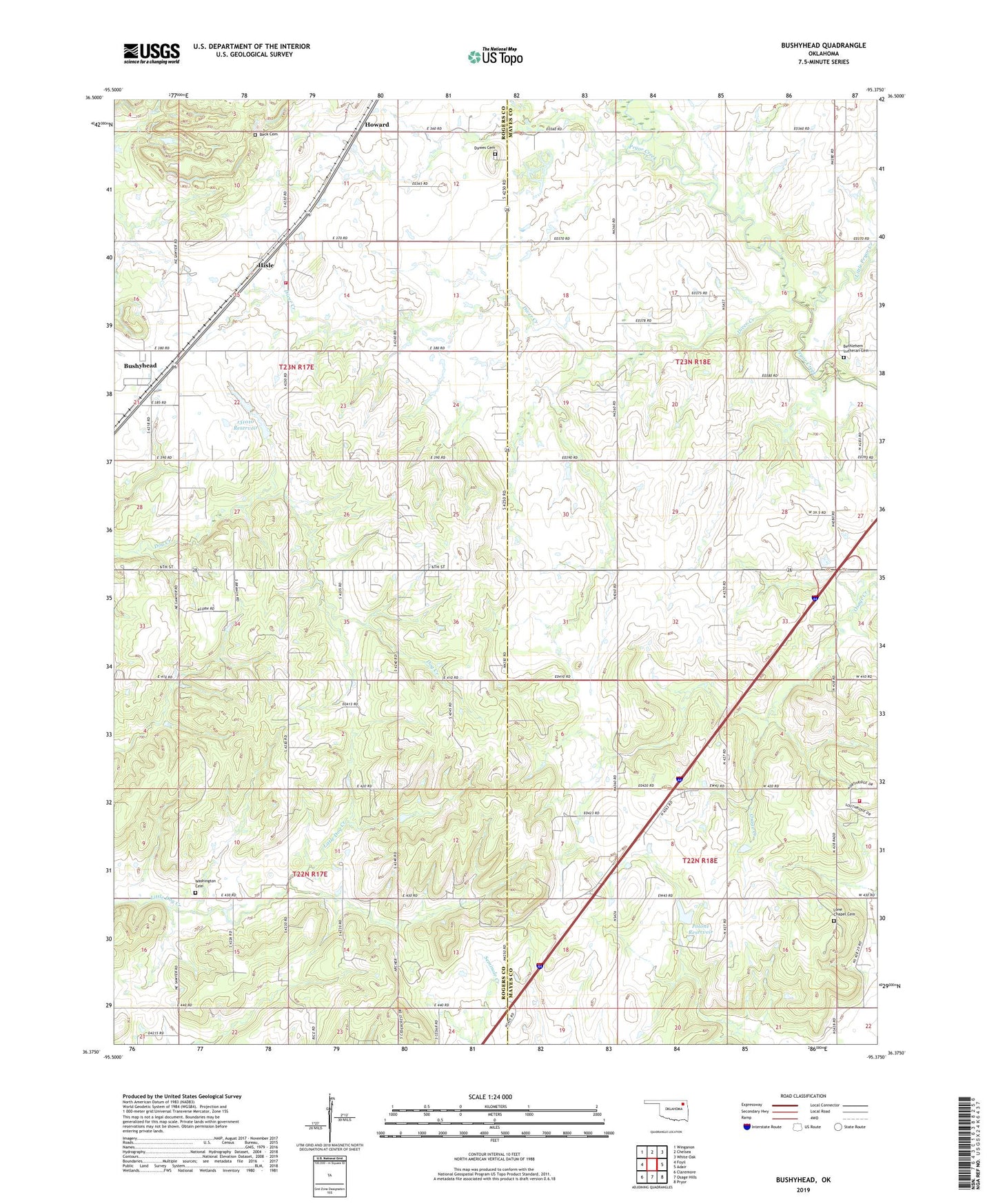
2019 topographic map quadrangle Bushyhead in the state of Oklahoma. Scale: 1:24000. Based on the newly updated USGS 7.5' US Topo map series, this map is in the following counties: Rogers, Mayes. The map contains contour data, water features, and other items you are used to seeing on USGS maps, but also has updated roads and other features. This is the next generation of topographic maps. Printed on high-quality waterproof paper with UV fade-resistant inks.
Quads adjacent to this one:
West: Foyil
Northwest: Winganon
North: Chelsea
Northeast: White Oak
East: Adair
Southeast: Pryor
South: Osage Hills
Southwest: Claremore
Contains the following named places: Beck Cemetery, Bethel Church, Bethlehem Church, Bethlehem Lutheran Cemetery, Bushyhead, Dawes Cemetery, Diamondhead - Lone Chapel Fire and Rescue, Diver Creek, Foyil Fire Protection District Station 2, Good Hope Church, Hisle, Howard, Little Pryor Creek, Lone Chapel, Lone Chapel Cemetery, Oknoname 131010 Dam, Oknoname 131010 Reservoir, Polone Dam, Polone Reservoir, Washington Cemetery, Washington Church