MyTopo
Byars Oklahoma US Topo Map
Couldn't load pickup availability
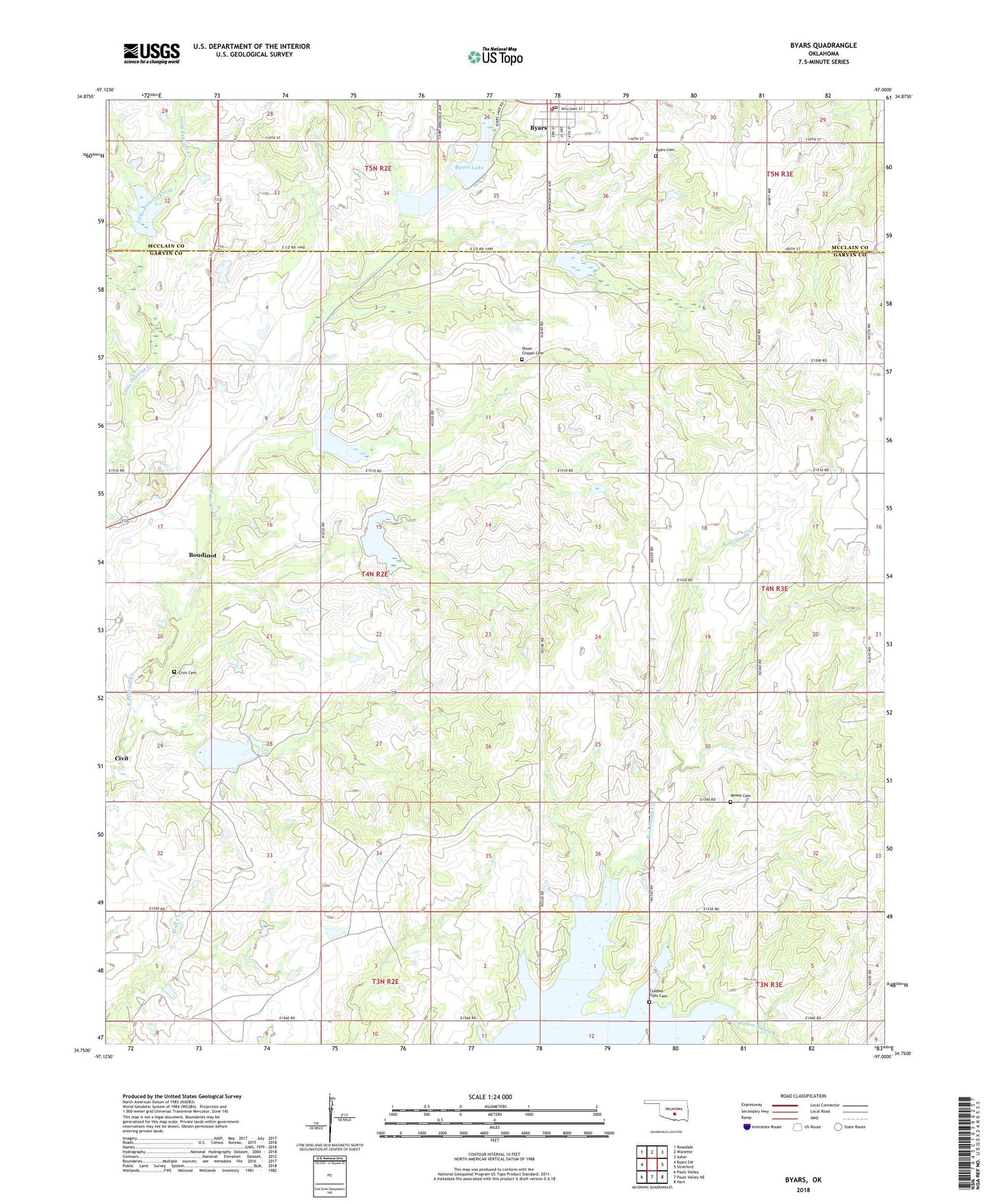
2018 topographic map quadrangle Byars in the state of Oklahoma. Scale: 1:24000. Based on the newly updated USGS 7.5' US Topo map series, this map is in the following counties: Garvin, McClain. The map contains contour data, water features, and other items you are used to seeing on USGS maps, but also has updated roads and other features. This is the next generation of topographic maps. Printed on high-quality waterproof paper with UV fade-resistant inks.
Quads adjacent to this one:
West: Byars SW
Northwest: Rosedale
North: Wanette
Northeast: Asher
East: Stratford
Southeast: Hart
South: Pauls Valley NE
Southwest: Pauls Valley
Contains the following named places: Abney Cemetery, Boudinot, Byars, Byars Cemetery, Byars Elementary School, Byars Lake, Byars Lake Dam, Byars Post Office, Byars Volunteer Fire Department, Cherokee Sandy Site 3 Dam, Cherokee Sandy Site 3 Reservoir, Cherokee Sandy Site 4 Dam, Cherokee Sandy Site 4 Reservoir, Cherokee Sandy Site 6 Dam, Cherokee Sandy Site 6 Reservoir, Civit Cemetery, Clabber Flats Cemetery, Dixon Chapel Cemetery, Dixon Chapel Presbyterian Church, Northeast Civit Oil Field, Oknoname 04921 Dam, Oknoname 04921 Reservoir, Peavine Creek Site 1 Dam, Peavine Creek Site 1 Reservoir, Peavine Creek Site 11 Dam, Peavine Creek Site 11 Reservoir, Peavine Creek Site 2 Dam, Peavine Creek Site 2 Reservoir, Peavine Creek Site 3 Dam, Peavine Creek Site 3 Reservoir, Peavine Creek Site 4 Dam, Peavine Creek Site 4 Reservoir, Peavine Creek Site 5 Dam, Peavine Creek Site 5 Reservoir, Peavine Creek Site 6 Dam, Peavine Creek Site 6 Reservoir, Town of Byars, Township of Stratford