MyTopo
Wanette Oklahoma US Topo Map
Couldn't load pickup availability
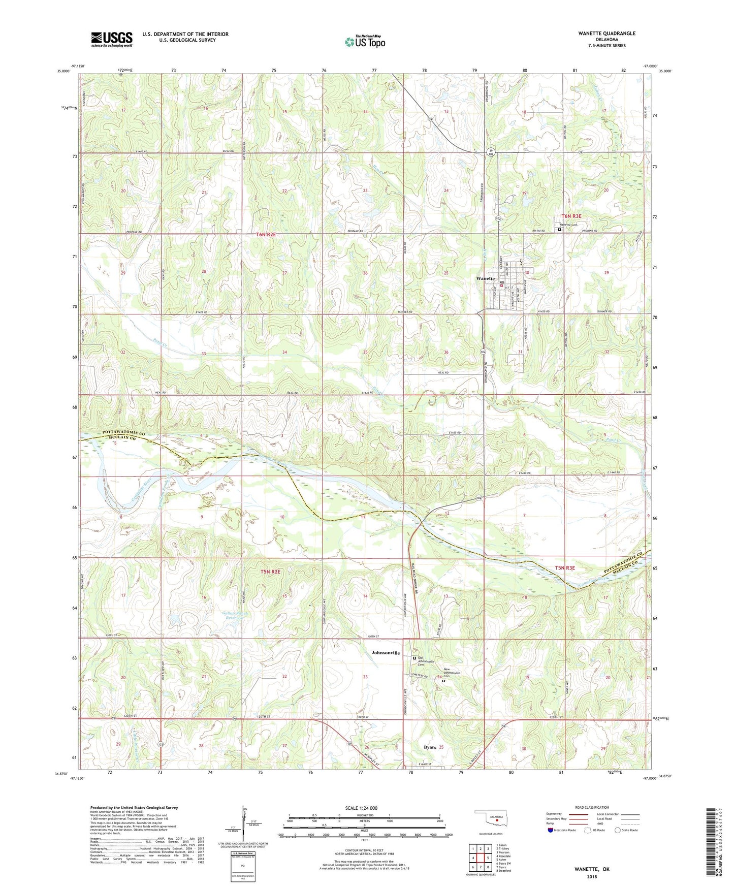
2022 topographic map quadrangle Wanette in the state of Oklahoma. Scale: 1:24000. Based on the newly updated USGS 7.5' US Topo map series, this map is in the following counties: Pottawatomie, McClain. The map contains contour data, water features, and other items you are used to seeing on USGS maps, but also has updated roads and other features. This is the next generation of topographic maps. Printed on high-quality waterproof paper with UV fade-resistant inks.
Quads adjacent to this one:
West: Rosedale
Northwest: Eason
North: Tribbey
Northeast: Pearson
East: Asher
Southeast: Stratford
South: Byars
Southwest: Byars SW
This map covers the same area as the classic USGS quad with code o34097h1.
Contains the following named places: Canadian Sandy Creek, East McClain Division, East Rosedale Oil Field, Gallup Ranch Dam, Gallup Ranch Reservoir, Hog Creek, Johnsonville, Martin Hill Cemetery, New Johnsonville Cemetery, Northeast Crossroads Oil Field, Northwest Wanette Oil Field, Old Johnsonville Cemetery, Pitts Field, South Wanette Oil Field, Town of Wanette, Township of Byars, Township of Eason, Wanette, Wanette Cemetery, Wanette Elementary School, Wanette High School, Wanette Oil Field, Wanette Post Office, Wanette Volunteer Fire Department Station 1, West Wanette Oil Field, ZIP Code: 74831