MyTopo
Rosedale Oklahoma US Topo Map
Couldn't load pickup availability
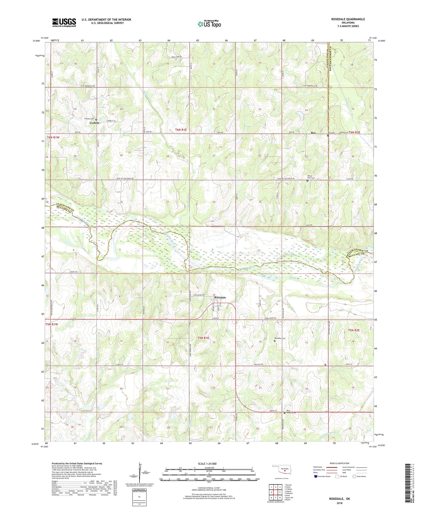
2022 topographic map quadrangle Rosedale in the state of Oklahoma. Scale: 1:24000. Based on the newly updated USGS 7.5' US Topo map series, this map is in the following counties: McClain, Cleveland, Pottawatomie. The map contains contour data, water features, and other items you are used to seeing on USGS maps, but also has updated roads and other features. This is the next generation of topographic maps. Printed on high-quality waterproof paper with UV fade-resistant inks.
Quads adjacent to this one:
West: Wayne
Northwest: Purcell
North: Eason
Northeast: Tribbey
East: Wanette
Southeast: Byars
South: Byars SW
Southwest: Paoli
This map covers the same area as the classic USGS quad with code o34097h2.
Contains the following named places: Blue Branch Cemetery, Box, Box Cemetery, Buckhead Creek, Corbett, Corbett Cemetery, Douglas Church, Mount Zion Cemetery, North Red Springs Oil Field, Northeast Rosedale Oil Field, Oknoname 087046 Dam, Oknoname 087046 Reservoir, Owl Creek Site 11 Dam, Owl Creek Site 11 Reservoir, Owl Creek Site 12 Dam, Owl Creek Site 12 Reservoir, Owl Creek Site 13 Dam, Owl Creek Site 13 Reservoir, Owl Creek Site 14 Dam, Owl Creek Site 14 Reservoir, Red Rock Church, Rosedale, Rosedale Cemetery, Rosedale Oil Field, Rosedale School, Rosedale Volunteer Fire Department, Southeast Red Springs Oil Field, Spores Lake, Spores Lake Dam, Tom London Dam, Tom London Reservoir, Tomike Creek, Town of Rosedale, Township of Hopping