MyTopo
Calvin West Oklahoma US Topo Map
Couldn't load pickup availability
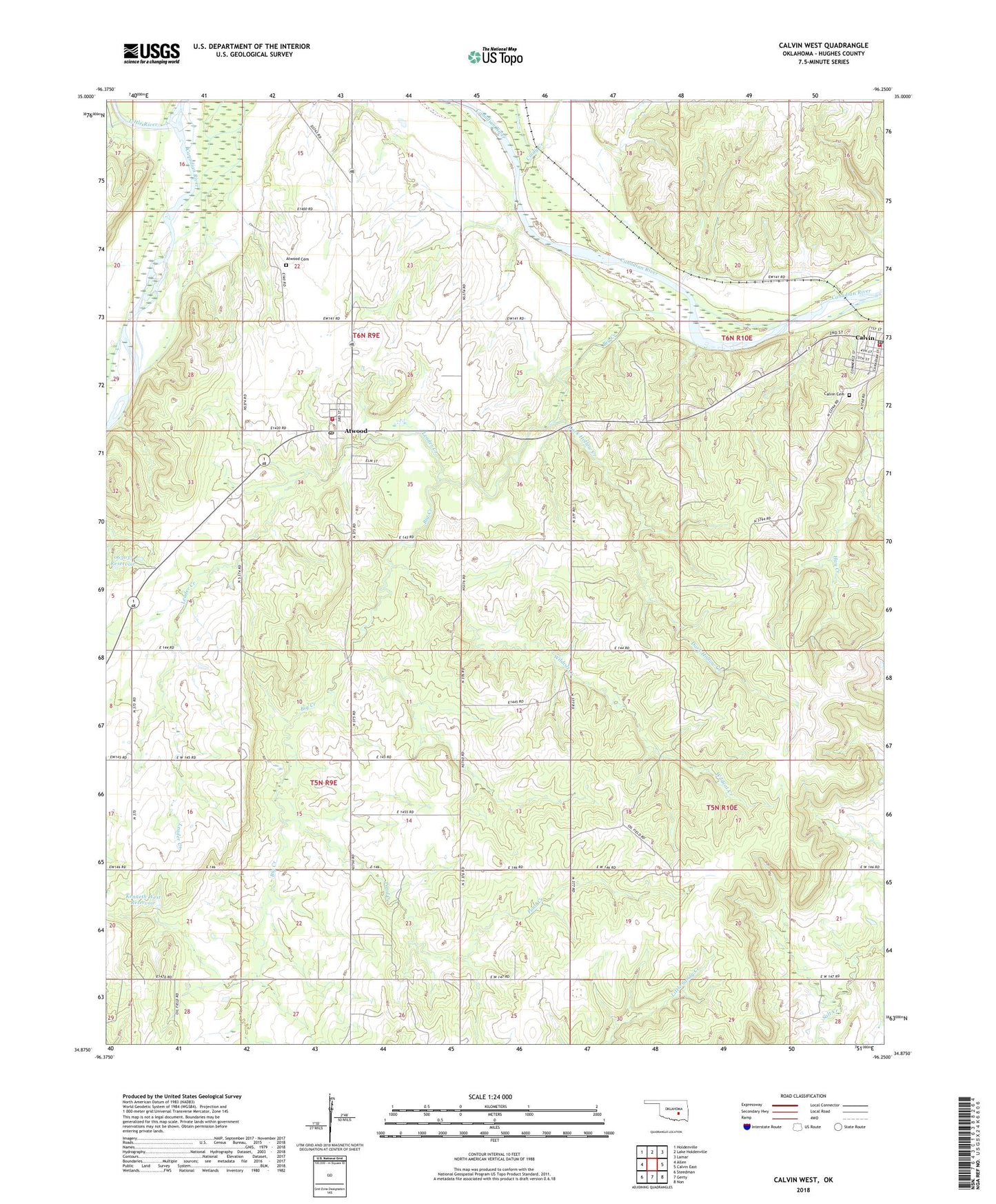
2018 topographic map quadrangle Calvin West in the state of Oklahoma. Scale: 1:24000. Based on the newly updated USGS 7.5' US Topo map series, this map is in the following counties: Hughes. The map contains contour data, water features, and other items you are used to seeing on USGS maps, but also has updated roads and other features. This is the next generation of topographic maps. Printed on high-quality waterproof paper with UV fade-resistant inks.
Quads adjacent to this one:
West: Allen
Northwest: Holdenville
North: Lake Holdenville
Northeast: Lamar
East: Calvin East
Southeast: Non
South: Gerty
Southwest: Steedman
Contains the following named places: Atwood, Atwood Cemetery, Atwood Post Office, Atwood Rural Fire District, Atwood School, Big Creek, C H Black Dam, C H Black Reservoir, Calvin Cemetery, Calvin Post Office, Calvin Volunteer Fire Department, Cindy Creek, Dark Hollow Creek, Jack Coppedge Dam, Jack Coppedge Reservoir, Kenneth West Dam, Kenneth West Reservoir, Laverne Cates Dam, Laverne Cates Reservoir, Leader Creek, Little River, Marvin Sells Dam, Marvin Sells Reservoir, North Atwood Oil Field, Oknoname 063001 Dam, Oknoname 063001 Reservoir, Oknoname 063027 Dam, Oknoname 063027 Reservoir, Oknoname 063028 Dam, Oknoname 063033 Dam, Oknoname 063033 Reservoir, Oknoname 063037 Reservoir, Pace Field, Pond Creek, Town of Atwood, Wildcat Creek, ZIP Codes: 74531, 74827