MyTopo
Calvin East Oklahoma US Topo Map
Couldn't load pickup availability
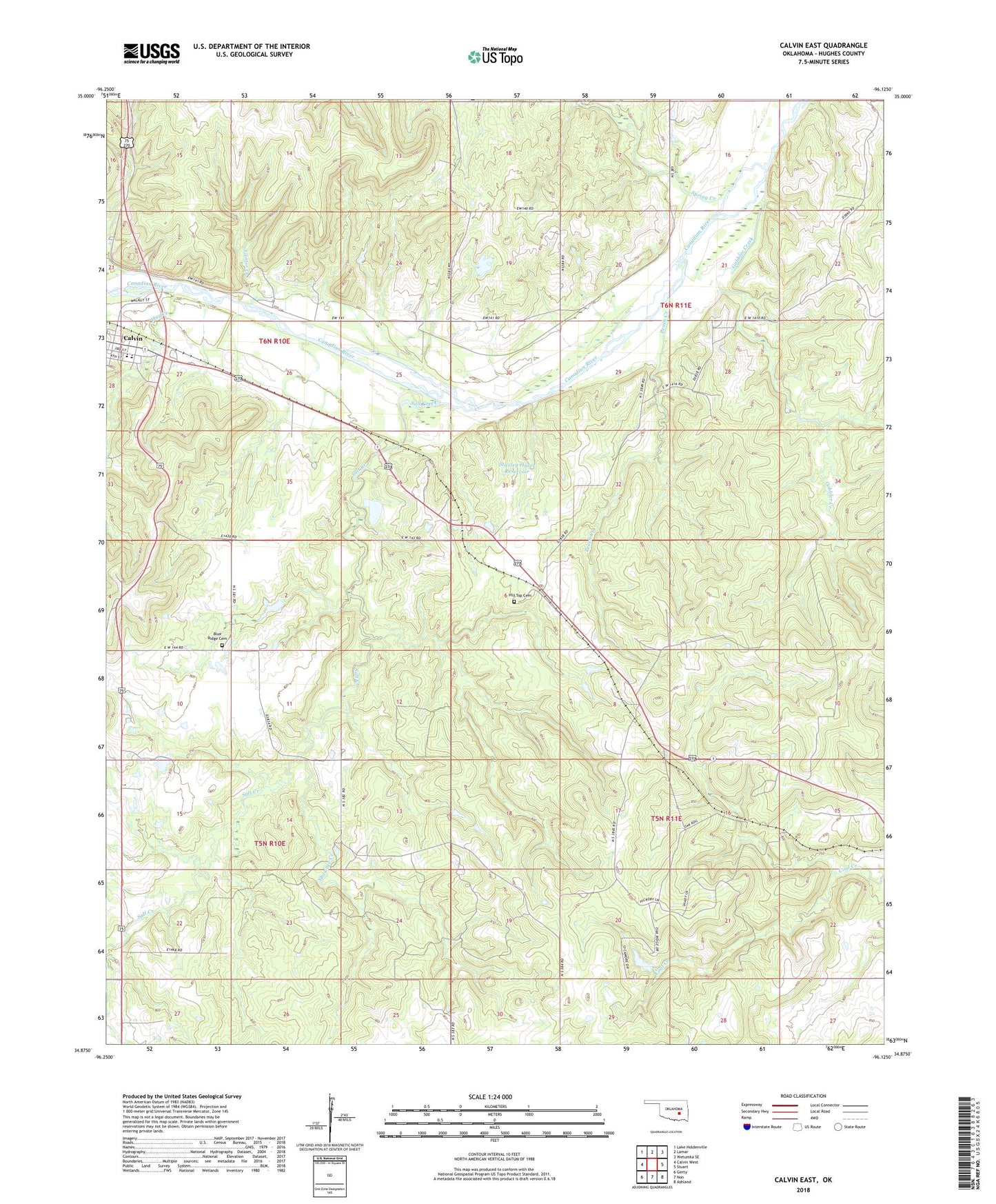
2022 topographic map quadrangle Calvin East in the state of Oklahoma. Scale: 1:24000. Based on the newly updated USGS 7.5' US Topo map series, this map is in the following counties: Hughes. The map contains contour data, water features, and other items you are used to seeing on USGS maps, but also has updated roads and other features. This is the next generation of topographic maps. Printed on high-quality waterproof paper with UV fade-resistant inks.
Quads adjacent to this one:
West: Calvin West
Northwest: Lake Holdenville
North: Lamar
Northeast: Wetumka SE
East: Stuart
Southeast: Ashland
South: Non
Southwest: Gerty
This map covers the same area as the classic USGS quad with code o34096h2.
Contains the following named places: Blue Ridge Cemetery, Calvin, Calvin Elementary School, Calvin High School, Gobbler Creek, Hay Creek, Hilltop Cemetery, Hilltop Church, Jointer Creek, Lindley Robertson Dam, Lindley Robertson Reservoir, Lobo Field, Peach Creek, Salt Creek, Shawnee Creek, South Hughes Division, Spring Creek, Spring Creek Church, Stanley Huser Dam, Stanley Huser Reservoir, Stony Point Church, Stuart Mountain Airpark, Town of Calvin, Township of Calvin, Township of Stuart