MyTopo
Lake Holdenville Oklahoma US Topo Map
Couldn't load pickup availability
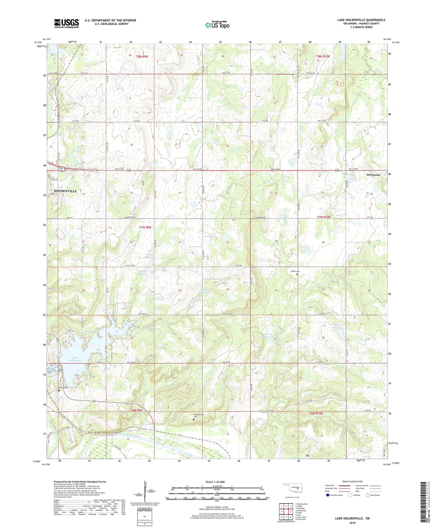
2022 topographic map quadrangle Lake Holdenville in the state of Oklahoma. Scale: 1:24000. Based on the newly updated USGS 7.5' US Topo map series, this map is in the following counties: Hughes. The map contains contour data, water features, and other items you are used to seeing on USGS maps, but also has updated roads and other features. This is the next generation of topographic maps. Printed on high-quality waterproof paper with UV fade-resistant inks.
Quads adjacent to this one:
West: Holdenville
Northwest: Wewoka East
North: Yeager
Northeast: Wetumka
East: Lamar
Southeast: Calvin East
South: Calvin West
Southwest: Allen
This map covers the same area as the classic USGS quad with code o35096a3.
Contains the following named places: Fort Holmes, Glory Cemetery, Grief Creek, Hickory Grove Church, Holdenville City Dam, Holdenville City Lake, Holdenville Division, Holdenville State Fish Hatchery, Hughes County, Hulsey Church, Lake Holdenville, Many Springs Church, Oknoname 063019 Dam, Oknoname 063019 Reservoir, Oknoname 063020 Dam, Oknoname 063020 Reservoir, Oknoname 063021 Dam, Oknoname 063021 Reservoir, Oknoname 063022 Dam, Oknoname 063022 Reservoir, Oknoname 063024 Dam, Oknoname 063024 Reservoir, Oknoname 063029 Dam, Oknoname 063029 Reservoir, Oknoname 063030 Dam, Oknoname 063030 Reservoir, Shiloh Cemetery, Shiloh Church, Stubblefield Cemetery, Township of Jacobs, ZIP Code: 74848