MyTopo
Caney Mountain Oklahoma US Topo Map
Couldn't load pickup availability
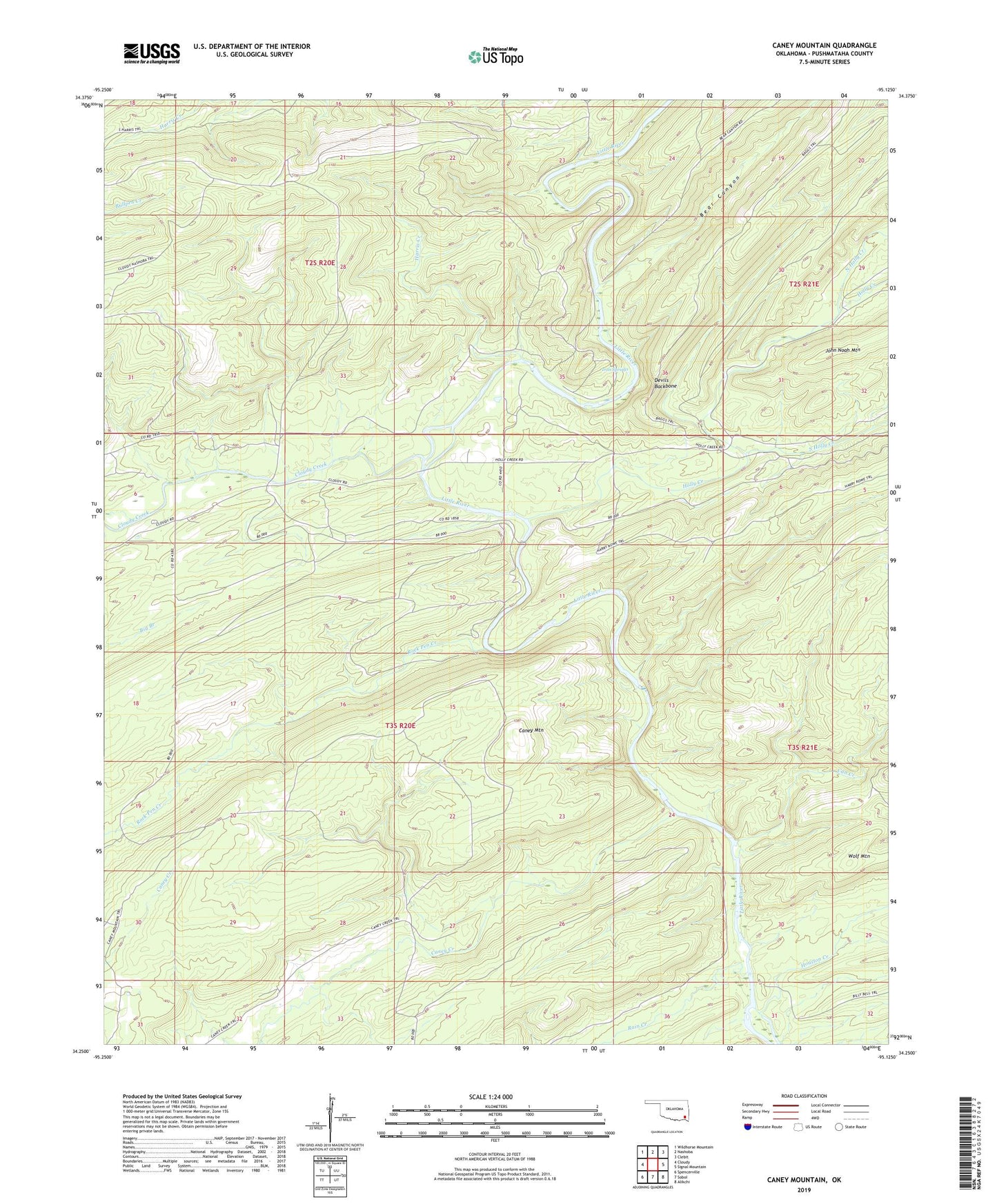
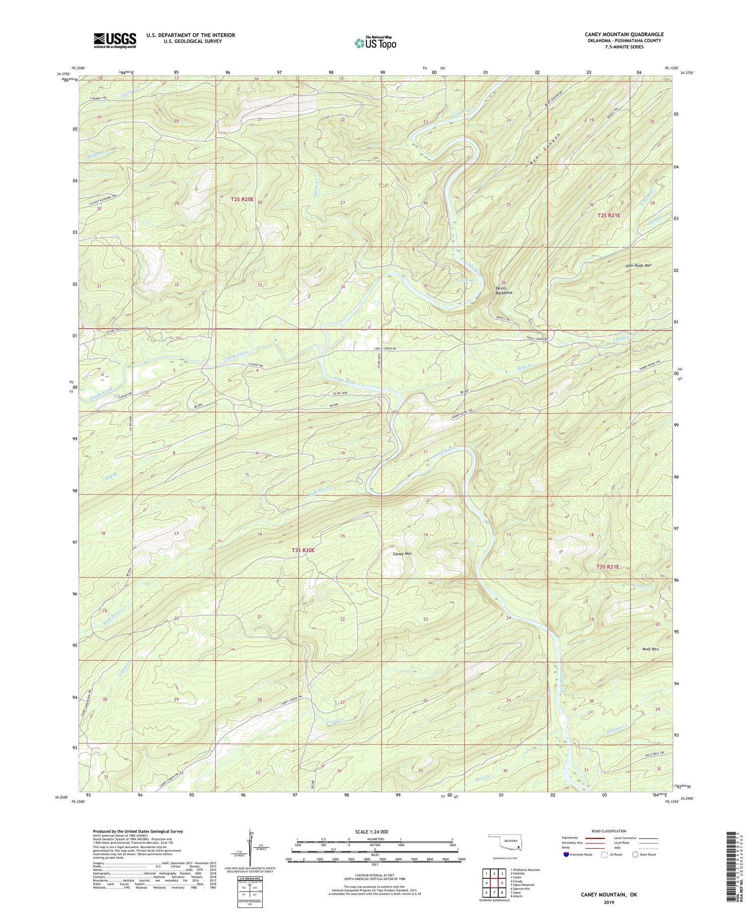
2019 topographic map quadrangle Caney Mountain in the state of Oklahoma. Scale: 1:24000. Based on the newly updated USGS 7.5' US Topo map series, this map is in the following counties: Pushmataha. The map contains contour data, water features, and other items you are used to seeing on USGS maps, but also has updated roads and other features. This is the next generation of topographic maps. Printed on high-quality waterproof paper with UV fade-resistant inks.
Quads adjacent to this one:
West: Cloudy
Northwest: Wildhorse Mountain
North: Nashoba
Northeast: Clebit
East: Signal Mountain
Southeast: Alikchi
South: Sobol
Southwest: Spencerville
Contains the following named places: Bear Canyon, Big Branch, Can Creek, Caney Creek, Caney Creek School, Caney Creek Trail, Caney Mountain, Caney Mountain Trail, Cloudy Creek, Cloudy Nashoba Trail, Devils Backbone, East Cloudy School, Harris Creek, Holly Creek, Houston Creek, Iron Springs, Iron Springs Trail, North Holly Creek, Rain Creek, Rock Pen Creek, South Holly Creek, Wolf Mountain