MyTopo
Nashoba Oklahoma US Topo Map
Couldn't load pickup availability
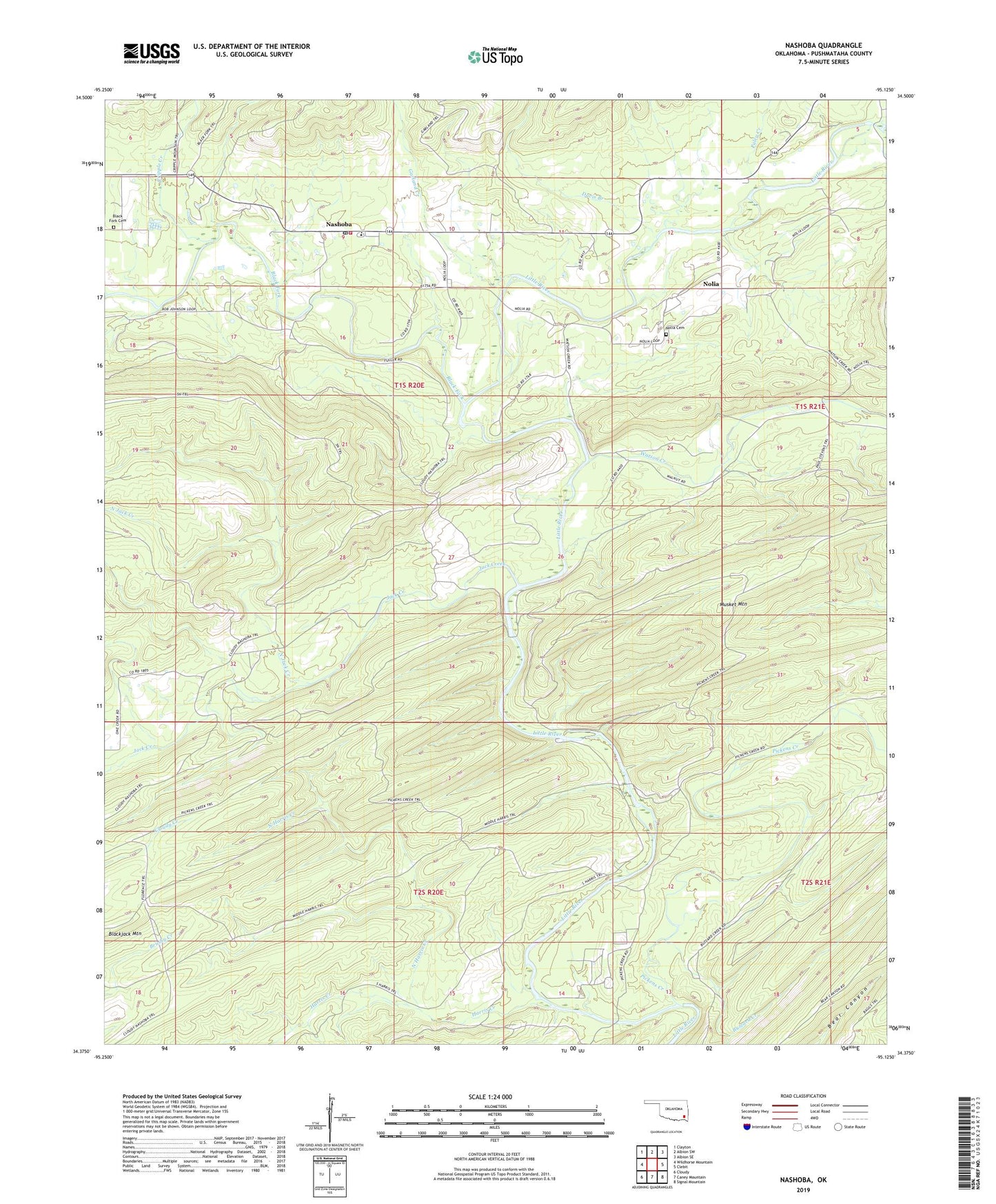
2022 topographic map quadrangle Nashoba in the state of Oklahoma. Scale: 1:24000. Based on the newly updated USGS 7.5' US Topo map series, this map is in the following counties: Pushmataha. The map contains contour data, water features, and other items you are used to seeing on USGS maps, but also has updated roads and other features. This is the next generation of topographic maps. Printed on high-quality waterproof paper with UV fade-resistant inks.
Quads adjacent to this one:
West: Wildhorse Mountain
Northwest: Clayton
North: Albion SW
Northeast: Albion SE
East: Clebit
Southeast: Signal Mountain
South: Caney Mountain
Southwest: Cloudy
This map covers the same area as the classic USGS quad with code o34095d2.
Contains the following named places: Black Fork, Black Fork Cemetery, Buzzard Creek, Cripple Creek, Davis Branch, Garland Creek, Harris Creek, Jack Creek, Leflore Creek, Little River Ranch, Middle Harris Trail, Musket Mountain, Nashoba, Nashoba Census Designated Place, Nashoba Elementary School, Nashoba Fire Department, Nashoba Indian Cemetery, Nashoba Post Office, Nolia, Nolia Cemetery, North Harris Creek, North Jack Creek, Paley Creek, Pickens Creek, Pickens Creek Trail, South Harris Trail, Trails End Camp, Watson Creek