MyTopo
Sobol Oklahoma US Topo Map
Couldn't load pickup availability
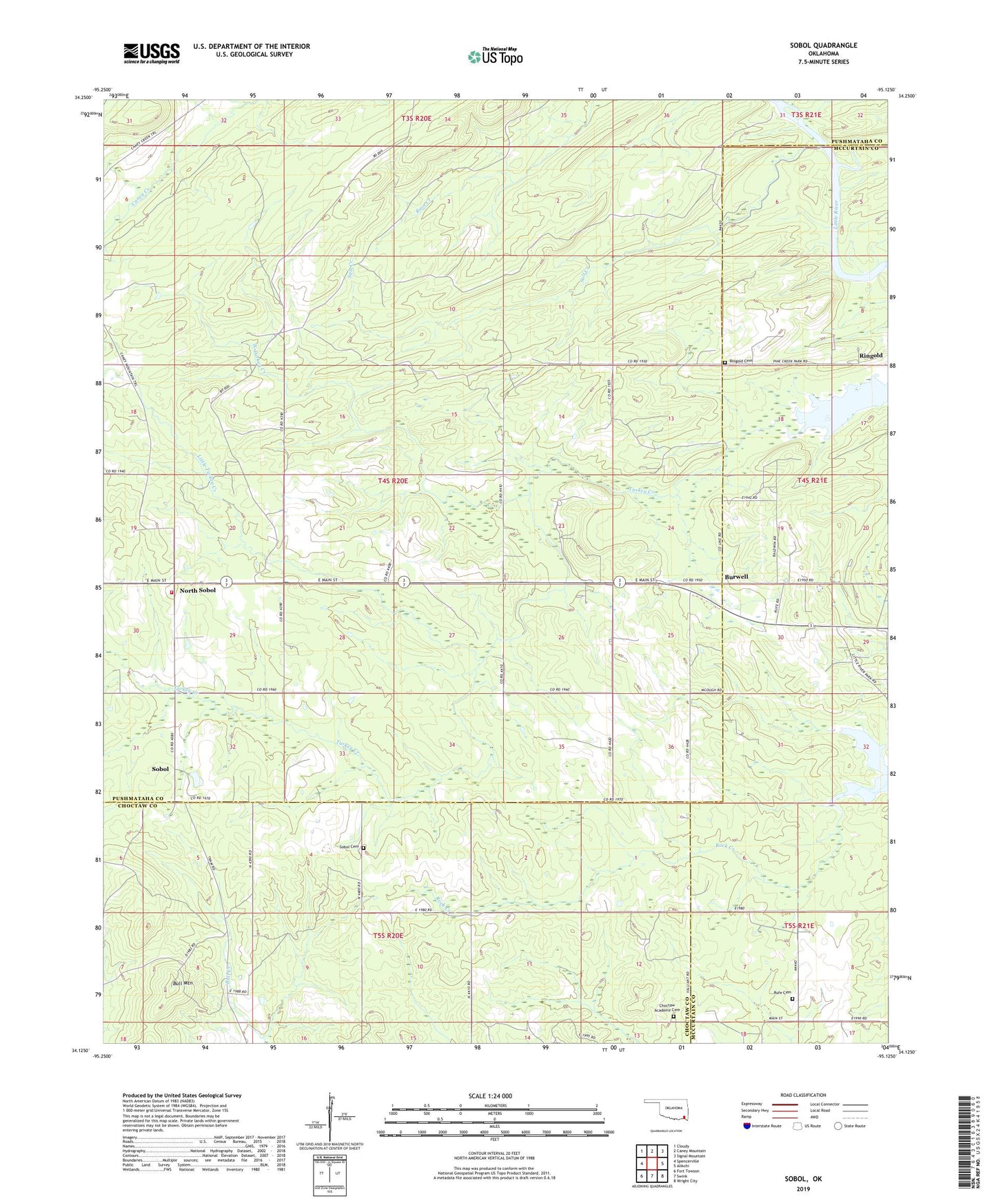
2022 topographic map quadrangle Sobol in the state of Oklahoma. Scale: 1:24000. Based on the newly updated USGS 7.5' US Topo map series, this map is in the following counties: Pushmataha, McCurtain, Choctaw. The map contains contour data, water features, and other items you are used to seeing on USGS maps, but also has updated roads and other features. This is the next generation of topographic maps. Printed on high-quality waterproof paper with UV fade-resistant inks.
Quads adjacent to this one:
West: Spencerville
Northwest: Cloudy
North: Caney Mountain
Northeast: Signal Mountain
East: Alikchi
Southeast: Wright City
South: Swink
Southwest: Fort Towson
This map covers the same area as the classic USGS quad with code o34095b2.
Contains the following named places: Bull Mountain, Burwell, Choctaw Academy Church Cemetery, Little Turkey Creek, North Sobol, North Turkey Creek, Oak Grove School, Pine Creek State Park, Pine Knot Crossing, Ringold, Ringold Cemetery, Rufe Cemetery, Rufe School, Saint Johns Church, Salt Creek, Sobol, Sobol Cemetery, Sobol Church, Sobol Lookout Tower, Sobol Volunteer Fire Department, Terrapin Creek, ZIP Code: 74754