MyTopo
Wildhorse Mountain Oklahoma US Topo Map
Couldn't load pickup availability
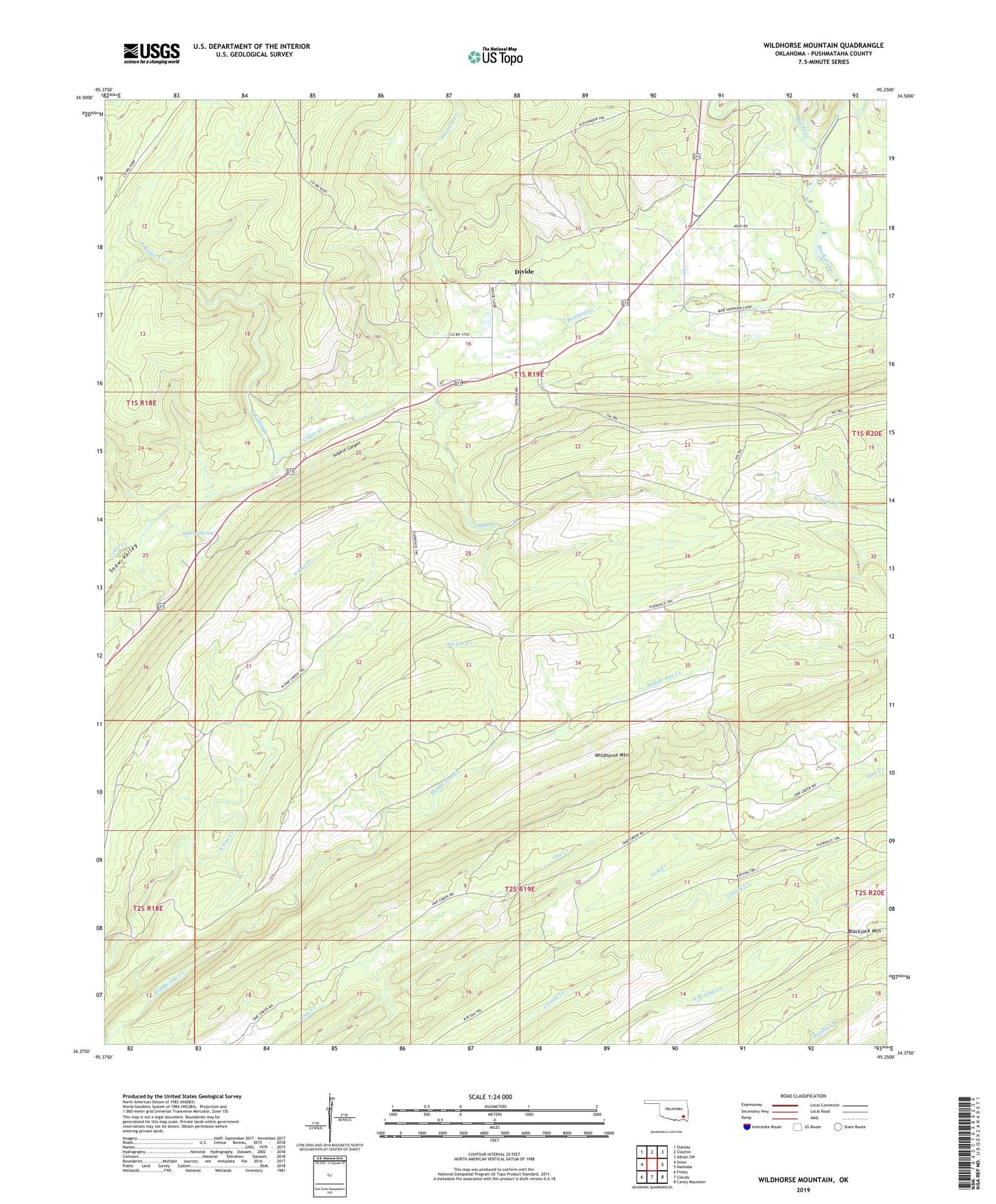
2022 topographic map quadrangle Wildhorse Mountain in the state of Oklahoma. Scale: 1:24000. Based on the newly updated USGS 7.5' US Topo map series, this map is in the following counties: Pushmataha. The map contains contour data, water features, and other items you are used to seeing on USGS maps, but also has updated roads and other features. This is the next generation of topographic maps. Printed on high-quality waterproof paper with UV fade-resistant inks.
Quads adjacent to this one:
West: Snow
Northwest: Stanley
North: Clayton
Northeast: Albion SW
East: Nashoba
Southeast: Caney Mountain
South: Cloudy
Southwest: Finley
This map covers the same area as the classic USGS quad with code o34095d3.
Contains the following named places: Blackjack Mountain, Buzzard Creek, Cloudy Lookout Tower, County District 7, Divide, Divide Church, Five N Trail, Florence Trail, Hardy Creek, Nashoba Y, North Cedar Creek, North One Creek Trail, One Creek Trail, Pryor Creek Site 31 Dam, Pryor Creek Site 31 Reservoir, Six N Trail, Slicker Creek, Sulphur Canyon, Sulphur Spring, Township of Finley, Wildhorse Mountain