MyTopo
Carney Oklahoma US Topo Map
Couldn't load pickup availability
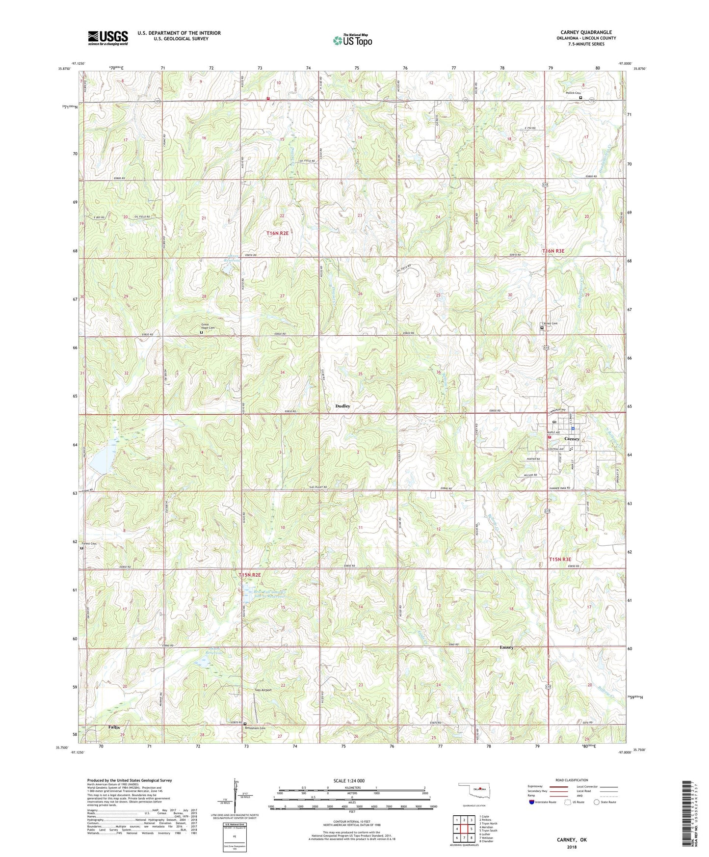
2018 topographic map quadrangle Carney in the state of Oklahoma. Scale: 1:24000. Based on the newly updated USGS 7.5' US Topo map series, this map is in the following counties: Lincoln. The map contains contour data, water features, and other items you are used to seeing on USGS maps, but also has updated roads and other features. This is the next generation of topographic maps. Printed on high-quality waterproof paper with UV fade-resistant inks.
Quads adjacent to this one:
West: Meridian
Northwest: Coyle
North: Perkins
Northeast: Tryon North
East: Tryon South
Southeast: Chandler
South: Wellston
Southwest: Luther
Contains the following named places: Bear Fall Coon Creek Site 2r Dam, Bear Fall Coon Creek Site 2r Reservoir, Bear Fall Coon Creek Site 3r Dam, Bear Fall Coon Creek Site 3r Reservoir, Belton, Bethlehem Cemetery, Carney, Carney Cemetery, Carney Elementary School, Carney High School, Carney Police Department, Carney Post Office, Carney Volunteer Fire Department, Dudley, Emsey, Forest Cemetery, Four Corners, Great Hope Cemetery, Iowa Oklahoma Tribal Statistical Area, Ives Airport, Merrick Volunteer Fire Department, Oknoname 08106 Dam, Oknoname 08106 Reservoir, Oknoname 08113 Dam, Oknoname 08113 Reservoir, Pilgrim Church, Pollick Cemetery, Town of Carney, Township of Tohee, ZIP Code: 74832