MyTopo
Wellston Oklahoma US Topo Map
Couldn't load pickup availability
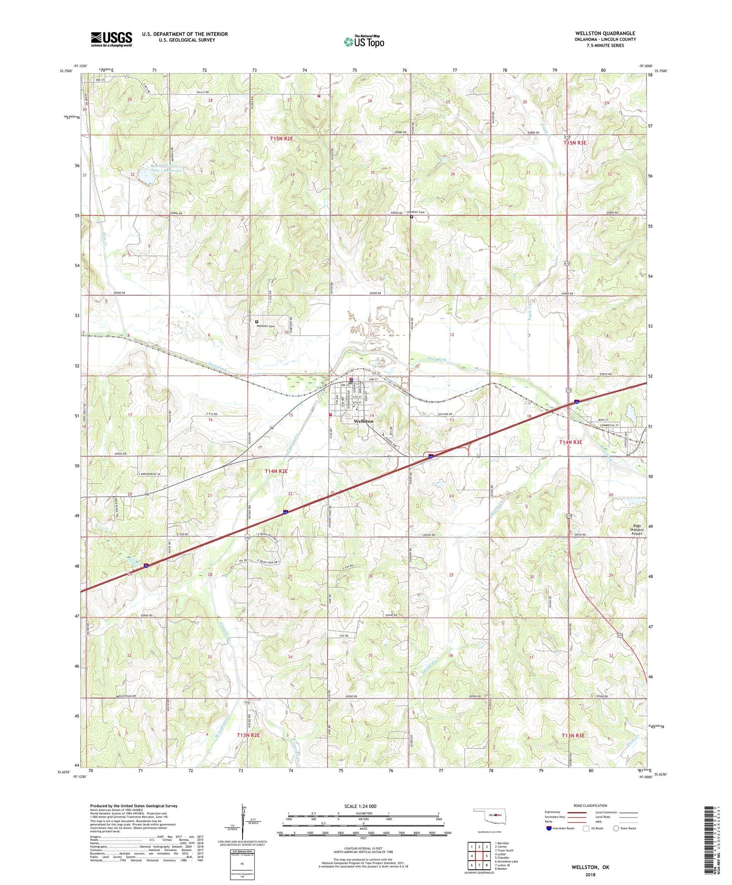
2022 topographic map quadrangle Wellston in the state of Oklahoma. Scale: 1:24000. Based on the newly updated USGS 7.5' US Topo map series, this map is in the following counties: Lincoln. The map contains contour data, water features, and other items you are used to seeing on USGS maps, but also has updated roads and other features. This is the next generation of topographic maps. Printed on high-quality waterproof paper with UV fade-resistant inks.
Quads adjacent to this one:
West: Luther
Northwest: Meridian
North: Carney
Northeast: Tryon South
East: Chandler
Southeast: Meeker
South: Luther SE
Southwest: Horseshoe Lake
This map covers the same area as the classic USGS quad with code o35097f1.
Contains the following named places: Bear Creek, Bear Fall Coon Creek Site 1 Dam, Bear Fall Coon Creek Site 1 Reservoir, Biggs Skypatch Airport, Captain Creek, Church of the Living God, Eagle Creek, East Captain Creek, Fallis, Fallis Fire Department, Gardner Cemetery, Ingram, North Captain Oil and Gas Field, Saint Pauls Lutheran Church, Spring Creek, Town of Fallis, Town of Warwick, Town of Wellston, Township of Wellston, Warwick, Wellston, Wellston Ambulance Service, Wellston Cemetery, Wellston Division, Wellston Elementary School, Wellston Fire Department Main Station, Wellston Fire Department Substation, Wellston High School, Wellston Middle School, Wellston Oil and Gas Field, Wellston Police Department, Wellston Post Office, West Captain Creek, ZIP Code: 74881