MyTopo
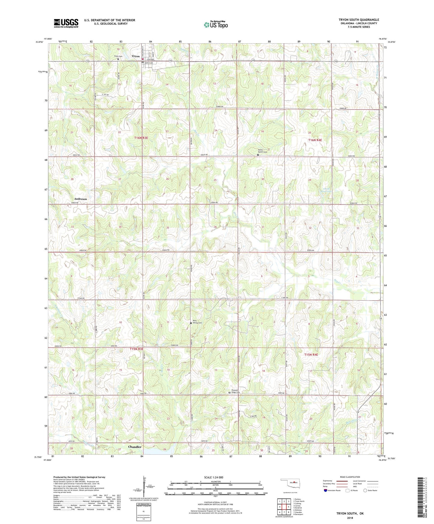
Tryon South Oklahoma US Topo Map
Couldn't load pickup availability
2022 topographic map quadrangle Tryon South in the state of Oklahoma. Scale: 1:24000. Based on the newly updated USGS 7.5' US Topo map series, this map is in the following counties: Lincoln. The map contains contour data, water features, and other items you are used to seeing on USGS maps, but also has updated roads and other features. This is the next generation of topographic maps. Printed on high-quality waterproof paper with UV fade-resistant inks.
Quads adjacent to this one:
West: Carney
Northwest: Perkins
North: Tryon North
Northeast: Cushing
East: Kendrick
Southeast: Davenport
South: Chandler
Southwest: Wellston
This map covers the same area as the classic USGS quad with code o35096g8.
Contains the following named places: Anderson, Iowa-Sac and Fox Tribal Jurisdiction Statistical Area, Melton Airport, North Bellcow Creek, Northwest Lincoln Division, Oknoname 037034 Dam, Oknoname 037034 Reservoir, Oknoname 08116 Dam, Oknoname 08116 Reservoir, Pleasant Ridge Cemetery, Pleasant Ridge Church, Rock Spring Cemetery, Township of Otoe, Township of Union, Tryon, Tryon Cemetery, Tryon Elementary School, Tryon Police Department, Tryon Post Office, Tryon Volunteer Fire Department, Union Church, Valley Queen Cemetery