MyTopo
Tryon North Oklahoma US Topo Map
Couldn't load pickup availability
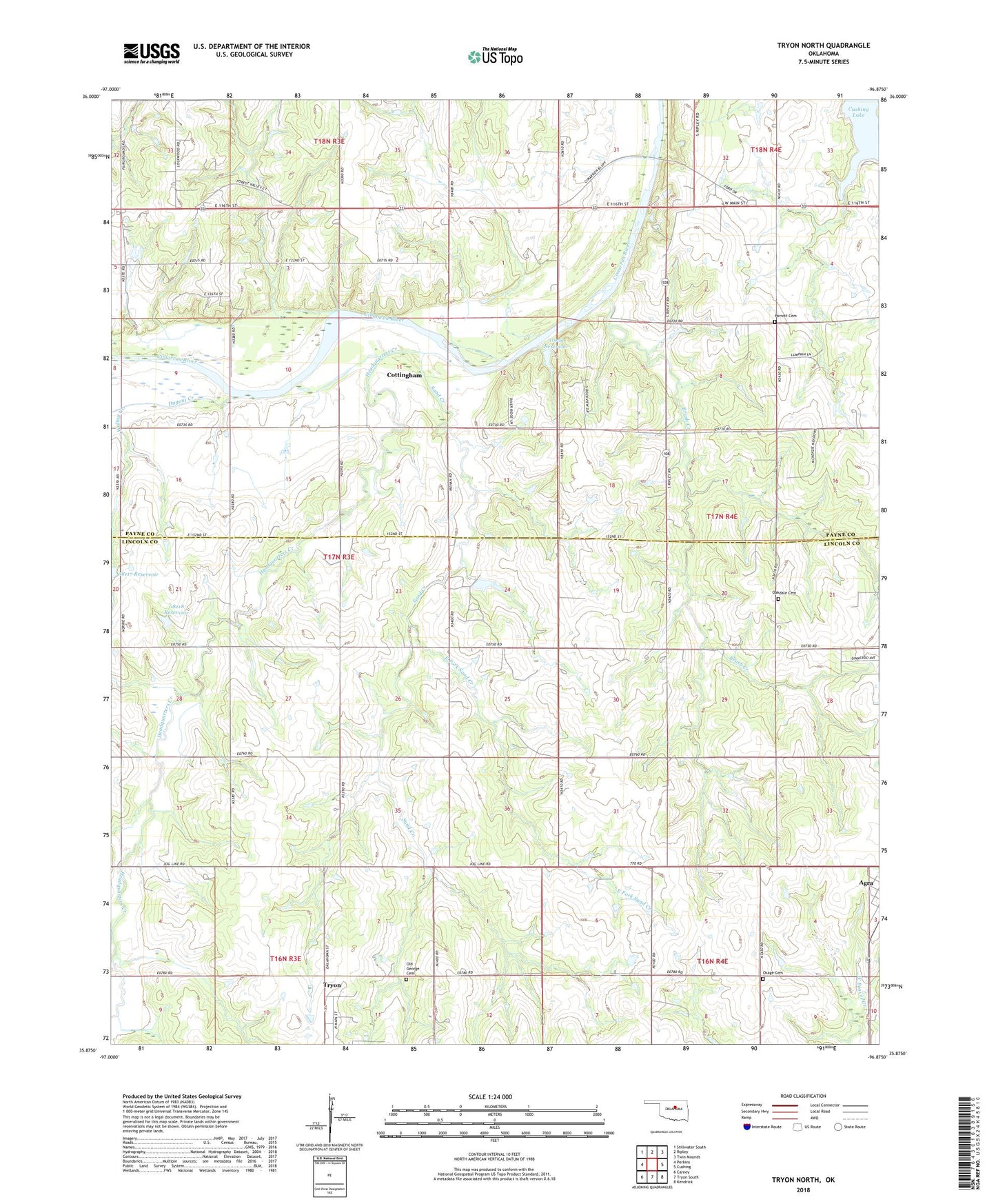
2022 topographic map quadrangle Tryon North in the state of Oklahoma. Scale: 1:24000. Based on the newly updated USGS 7.5' US Topo map series, this map is in the following counties: Lincoln, Payne. The map contains contour data, water features, and other items you are used to seeing on USGS maps, but also has updated roads and other features. This is the next generation of topographic maps. Printed on high-quality waterproof paper with UV fade-resistant inks.
Quads adjacent to this one:
West: Perkins
Northwest: Stillwater South
North: Ripley
Northeast: Twin Mounds
East: Cushing
Southeast: Kendrick
South: Tryon South
Southwest: Carney
This map covers the same area as the classic USGS quad with code o35096h8.
Contains the following named places: Brush Creek, Cottingham, Cushing Lake, Dugout Creek, East Fork Sand Creek, Free Methodist Church, Headquarters Creek, Iowa Indian Cemetery, Lost Creek, Oakdale Cemetery, Oknoname 08117 Reservoir, Oknoname 08118 Dam, Oknoname 08118 Reservoir, Oknoname 11909 Dam, Oknoname 11909 Reservoir, Old George Cemetery, Osage Cemetery, Parotte Cemetery, Sand Creek, Town of Tryon, Township of Cimarron, Walnut Creek, ZIP Code: 74875