MyTopo
Cashion Oklahoma US Topo Map
Couldn't load pickup availability
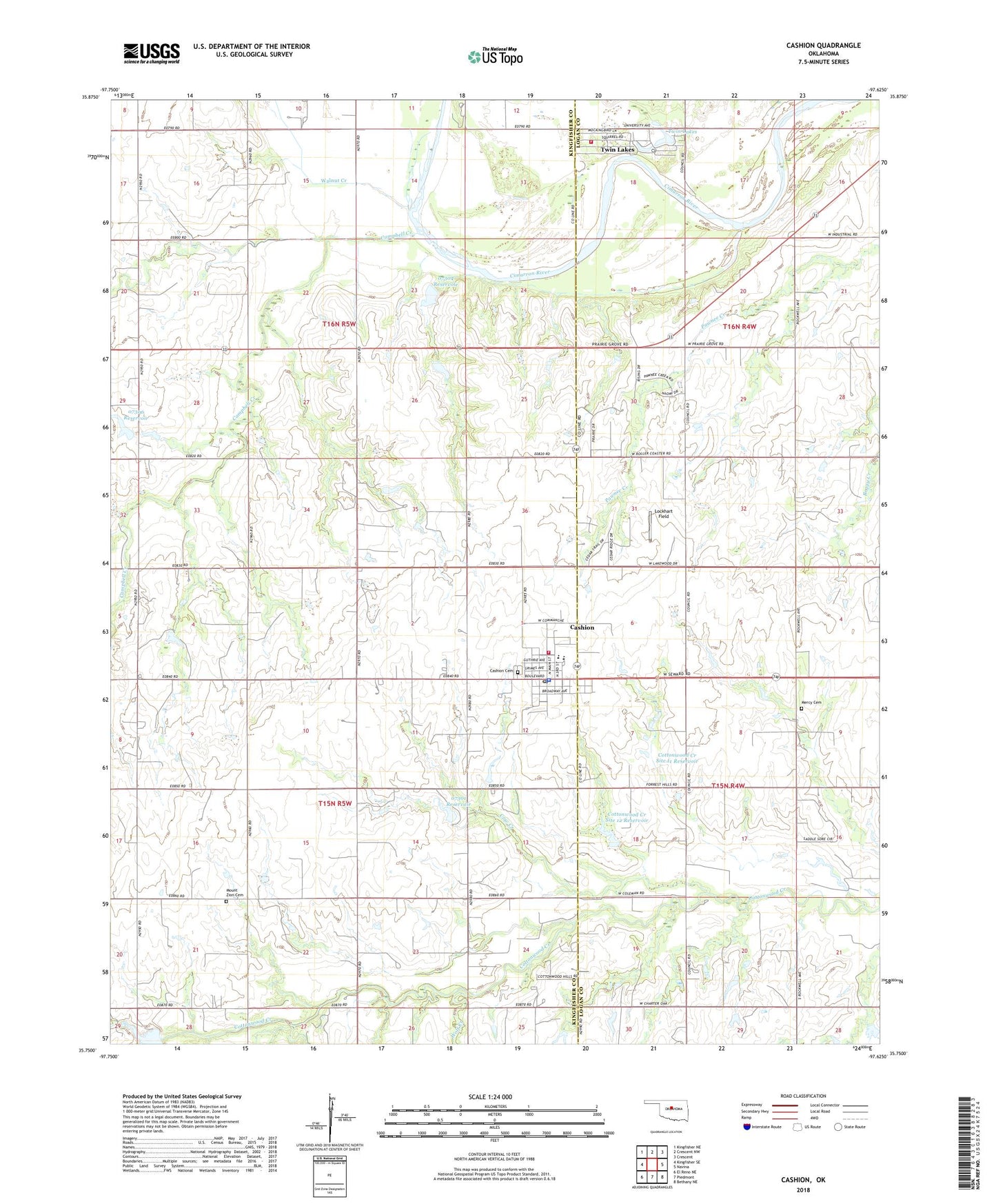
2018 topographic map quadrangle Cashion in the state of Oklahoma. Scale: 1:24000. Based on the newly updated USGS 7.5' US Topo map series, this map is in the following counties: Kingfisher, Logan. The map contains contour data, water features, and other items you are used to seeing on USGS maps, but also has updated roads and other features. This is the next generation of topographic maps. Printed on high-quality waterproof paper with UV fade-resistant inks.
Quads adjacent to this one:
West: Kingfisher SE
Northwest: Kingfisher NE
North: Crescent NW
Northeast: Crescent
East: Navina
Southeast: Bethany NE
South: Piedmont
Southwest: El Reno NE
Contains the following named places: Campbell Creek, Cashion, Cashion Cemetery, Cashion Elementary School, Cashion Fire Station, Cashion High School Ag Farm, Cashion Police Department, Cashion Post Office, Chuck's Private Airstrip, Cottonwood Creek Site 11 Dam, Cottonwood Creek Site 11 Reservoir, Cottonwood Creek Site 12 Dam, Cottonwood Creek Site 12 Reservoir, Cottonwood Creek Site 15 Dam, Cow Creek, Lockhart Field, Mercy Cemetery, Mount Zion Cemetery, Oknoname 07301 Dam, Oknoname 07301 Reservoir, Oknoname 07302 Dam, Oknoname 07302 Reservoir, Oknoname 07304 Dam, Oknoname 07304 Reservoir, Oknoname 07305 Dam, Oknoname 07305 Reservoir, Oknoname 07306 Dam, Oknoname 07306 Reservoir, Oknoname 18 Dam, Oknoname 18 Reservoir, Town of Cashion, Township of Downs, Township of Logan, Twin Lakes, Twin Lakes Census Designated Place, Twin Lakes Volunteer Fire Department, Walnut Creek, West Edmond Oil Field, Wolf Creek, ZIP Code: 73016