MyTopo
Piedmont Oklahoma US Topo Map
Couldn't load pickup availability
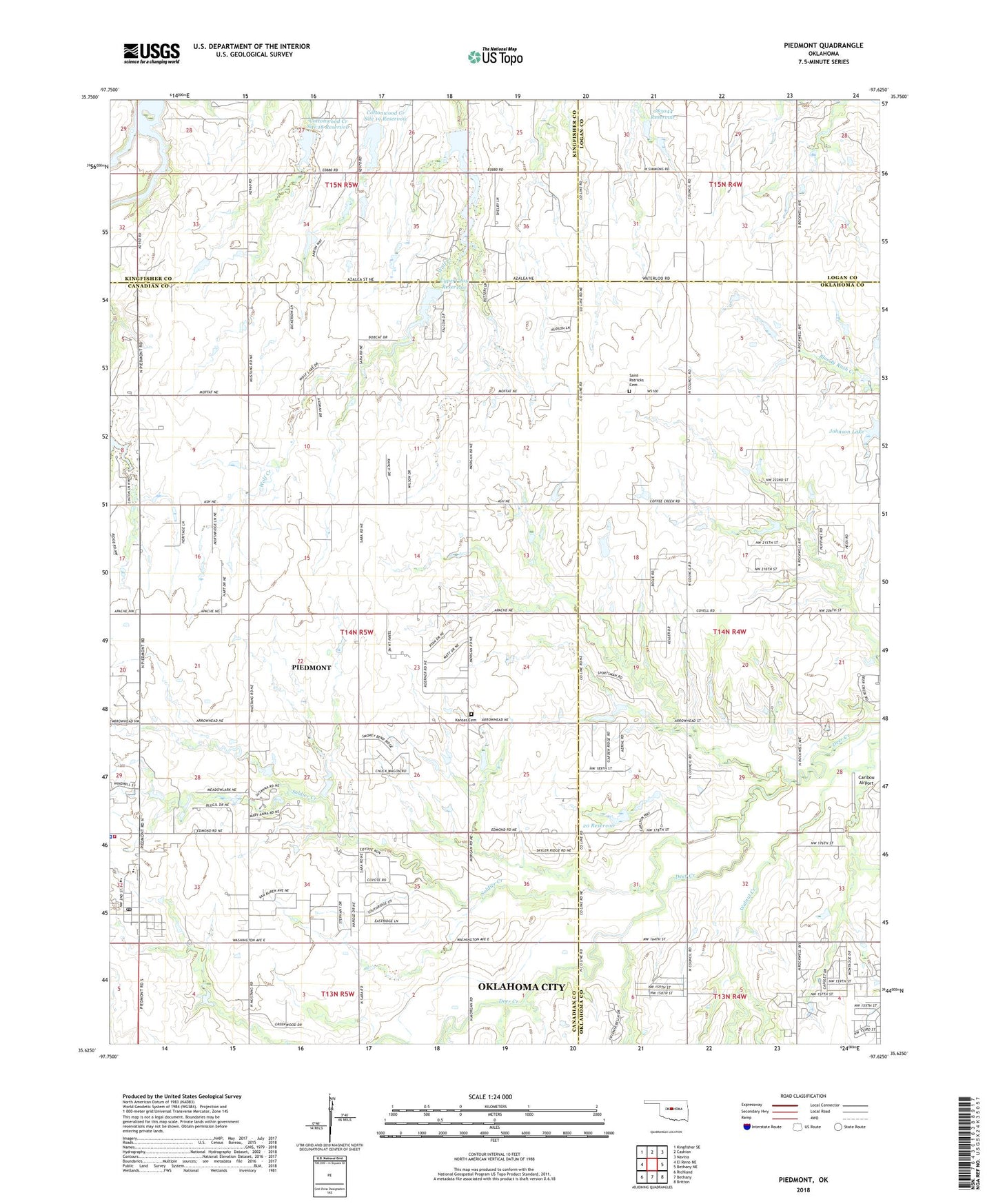
2022 topographic map quadrangle Piedmont in the state of Oklahoma. Scale: 1:24000. Based on the newly updated USGS 7.5' US Topo map series, this map is in the following counties: Canadian, Oklahoma, Kingfisher, Logan. The map contains contour data, water features, and other items you are used to seeing on USGS maps, but also has updated roads and other features. This is the next generation of topographic maps. Printed on high-quality waterproof paper with UV fade-resistant inks.
Quads adjacent to this one:
West: El Reno NE
Northwest: Kingfisher SE
North: Cashion
Northeast: Navina
East: Bethany NE
Southeast: Britton
South: Bethany
Southwest: Richland
This map covers the same area as the classic USGS quad with code o35097f6.
Contains the following named places: Caribou Airport, Cottonwood Creek Site 15 Reservoir, Cottonwood Creek Site 18 Dam, Cottonwood Creek Site 18 Reservoir, Cottonwood Creek Site 19 Dam, Cottonwood Creek Site 19 Reservoir, Cottonwood Creek Site 20 Dam, Cottonwood Creek Site 20 Reservoir, Cottonwood Creek Site 54 Dam, Cottonwood Creek Site 54 Reservoir, Cypert 209 Dam, Cypert 209 Reservoir, Cypert-Holcomb-Eli 209 Dam, Johnson Lake, Kansas Cemetery, Oknoname 083044 Dam, Oknoname 083044 Reservoir, Oknoname 083045 Dam, Oknoname 083045 Reservoir, Oknoname 20 Dam, Oknoname 20 Reservoir, Piedmont, Piedmont Elementary School, Piedmont Fire Department Station 1, Piedmont Middle School, Piedmont Police Department, Piedmont Post Office, Rush Creek Site 24 Dam, Rush Creek Site 24 Reservoir, Saint Patrick Cemetery, Soldier Creek, Township of Mathewson, West Edmond Oil and Gas Field, Winding Creek