MyTopo
Sageeyah Oklahoma US Topo Map
Couldn't load pickup availability
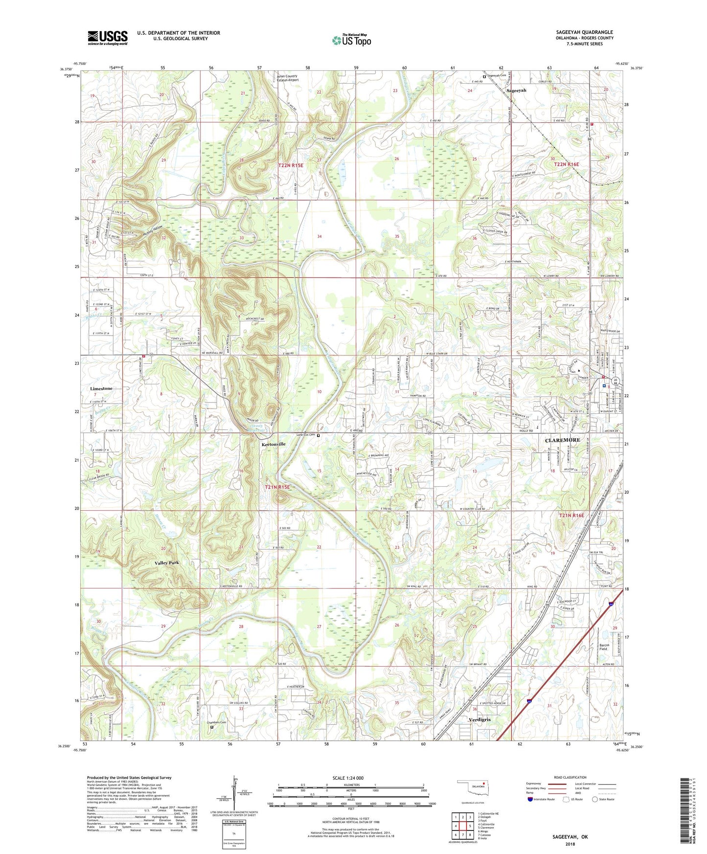
2022 topographic map quadrangle Sageeyah in the state of Oklahoma. Scale: 1:24000. Based on the newly updated USGS 7.5' US Topo map series, this map is in the following counties: Rogers. The map contains contour data, water features, and other items you are used to seeing on USGS maps, but also has updated roads and other features. This is the next generation of topographic maps. Printed on high-quality waterproof paper with UV fade-resistant inks.
Quads adjacent to this one:
West: Collinsville
Northwest: Collinsville NE
North: Oologah
Northeast: Foyil
East: Claremore
Southeast: Inola
South: Catoosa
Southwest: Mingo
This map covers the same area as the classic USGS quad with code o36095c6.
Contains the following named places: Avian Country Estates Airport, Barcus Field, Caney River, Catoosa Division, Central Christian Church, Chambers Cemetery, Claremore Fire Department Station 2, Claremore Indian Hospital, First Assembly of God, Hickory Hollow, Honey Creek, Keetonville, KNGX-FM (Claremore), KTRT-AM (Claremore), KXON-TV (Claremore), Limestone, Limestone Census Designated Place, Limestone Fire Protection District Station 1, Lone Elm Cemetery, Lone Elm Church, Lone Elm School, Memorial Heights Baptist Church, Northwest Rogers County Fire Protection District Station 3, Oklahoma Military Academy, Oknoname 131002 Dam, Oknoname 131002 Reservoir, Oknoname 131003 Dam, Oknoname 131003 Reservoir, Osage Village, Rogers State University, Rogers State University Police Department, Sageeyah, Sageeyah Cemetery, Sageeyah School, South Limestone School, Town of Valley Park, Town of Verdigris, Valley Park, Westside Elementary School, Will and Wileys Aerodrome