MyTopo
Catoosa SE Oklahoma US Topo Map
Couldn't load pickup availability
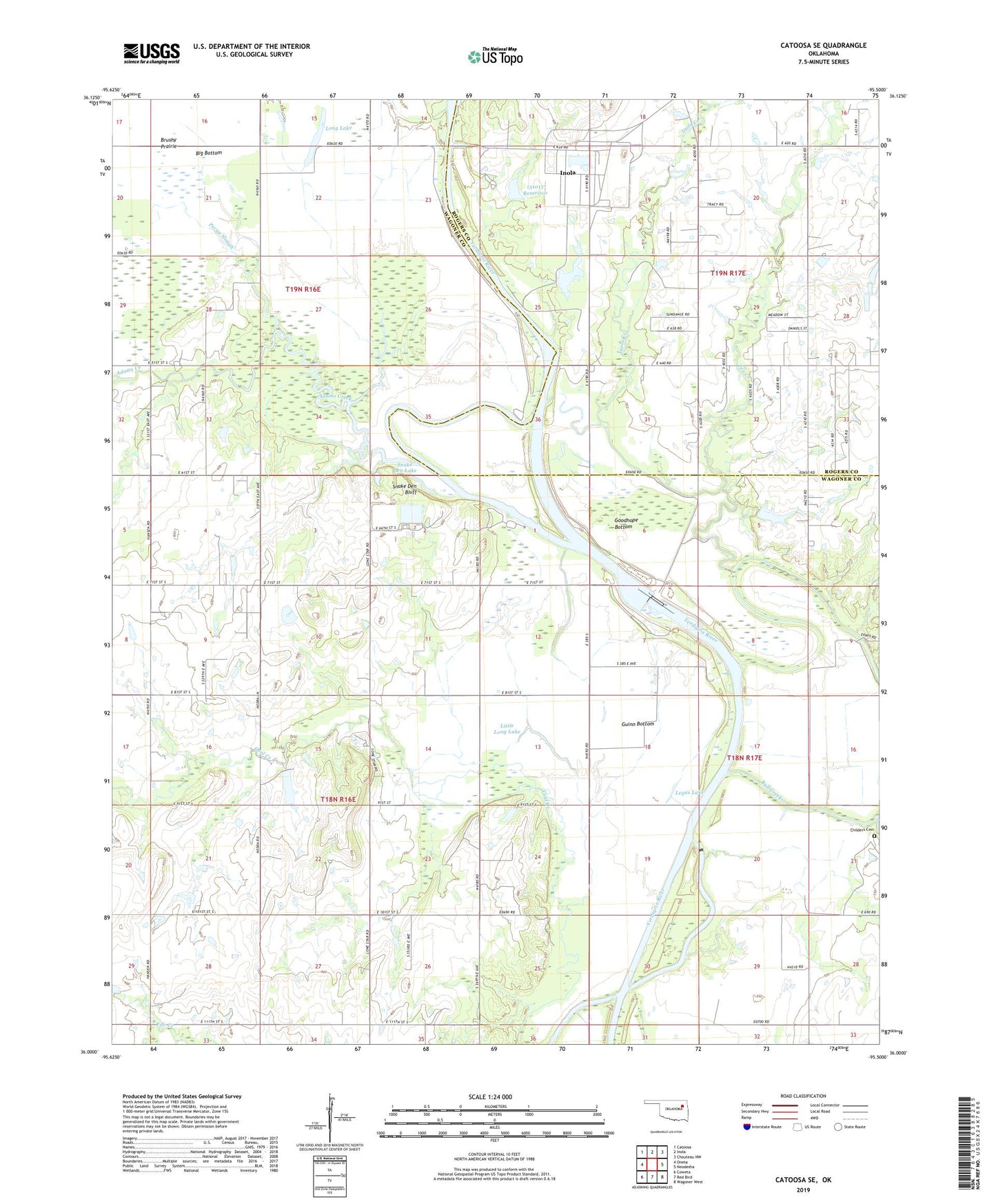
2019 topographic map quadrangle Catoosa SE in the state of Oklahoma. Scale: 1:24000. Based on the newly updated USGS 7.5' US Topo map series, this map is in the following counties: Wagoner, Rogers. The map contains contour data, water features, and other items you are used to seeing on USGS maps, but also has updated roads and other features. This is the next generation of topographic maps. Printed on high-quality waterproof paper with UV fade-resistant inks.
Quads adjacent to this one:
West: Oneta
Northwest: Catoosa
North: Inola
Northeast: Chouteau NW
East: Neodesha
Southeast: Wagoner West
South: Red Bird
Southwest: Coweta
Contains the following named places: Adams Creek, Big Bottom, Bluegill Point Public Use Area, Bluff Landing Public Use Area, Brushy Prairie, Channel View Public Use Area, Childers Cemetery, Flagg Lake, Friendship Church, Goodhope Bottom, Goodhope Ramp Public Use Area, Guinn Bottom, Inola Creek, Legas Lake, Little Long Lake, Lock and Dam 18, Lone Star Church, Long Lake, Newt Graham Lake, Newt Graham Lock and Dam, Newt Graham Lock and Dam 18, Oknoname 131015 Dam, Oknoname 131015 Reservoir, Old Channel Verdigris River, Pea Creek, Pecan Slough, Runaround Lake, Snake Den Bluff, Snake Den Lake, Thomas Church, Town of Inola, Township of Coal Creek, Willow Spring Church