MyTopo
Cayuga Oklahoma US Topo Map
Couldn't load pickup availability
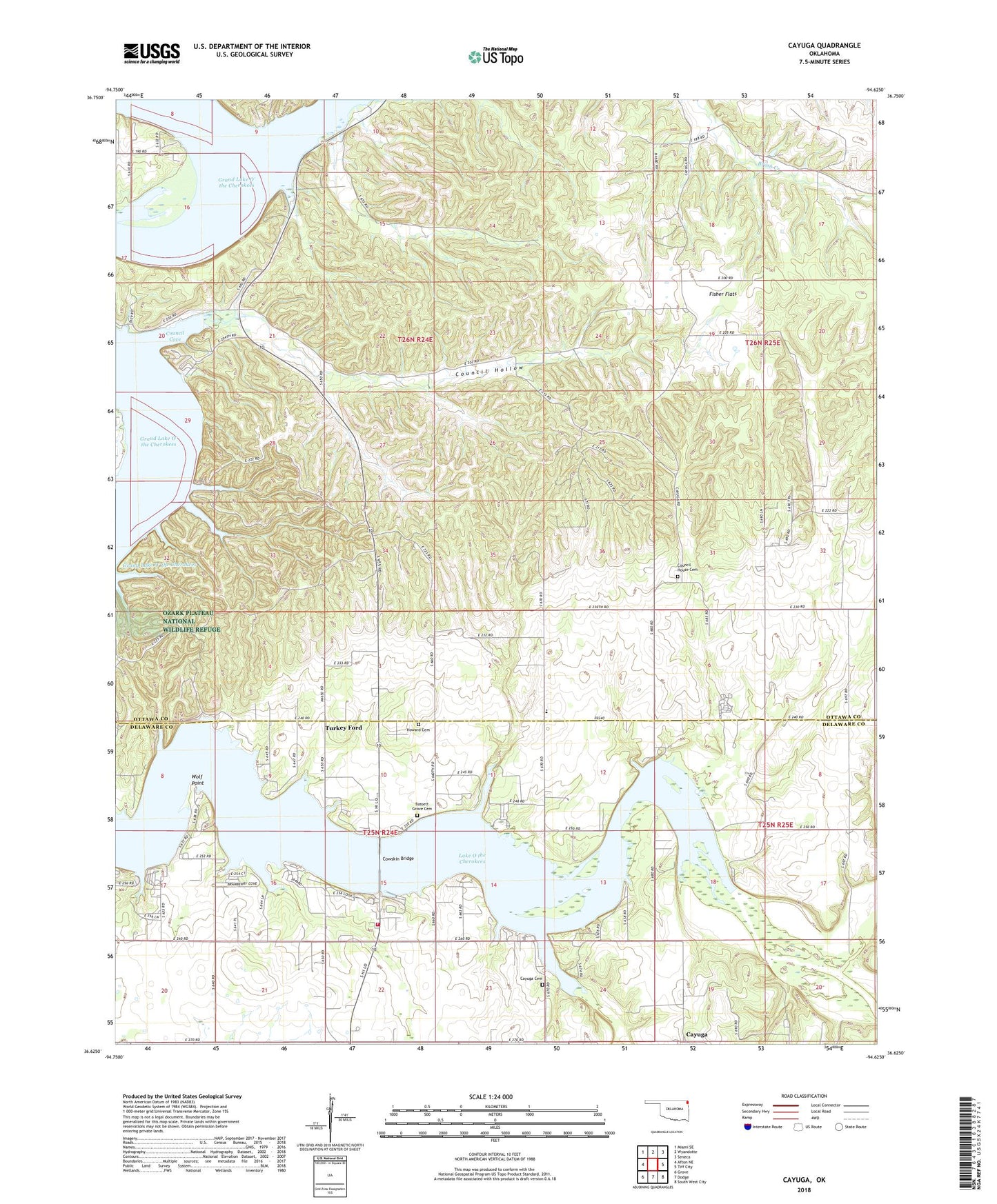
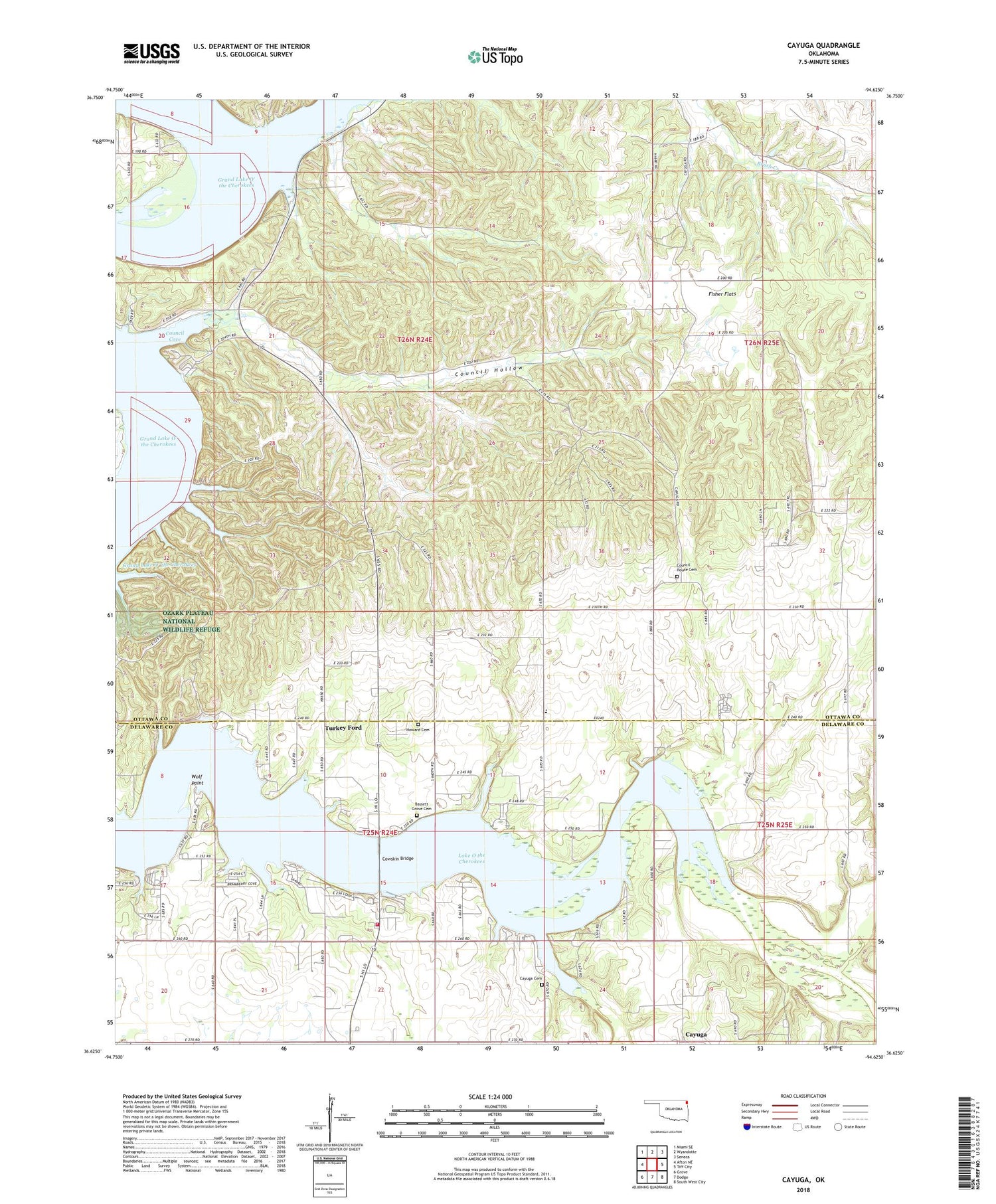
2018 topographic map quadrangle Cayuga in the state of Oklahoma. Scale: 1:24000. Based on the newly updated USGS 7.5' US Topo map series, this map is in the following counties: Ottawa, Delaware. The map contains contour data, water features, and other items you are used to seeing on USGS maps, but also has updated roads and other features. This is the next generation of topographic maps. Printed on high-quality waterproof paper with UV fade-resistant inks.
Quads adjacent to this one:
West: Afton NE
Northwest: Miami SE
North: Wyandotte
Northeast: Seneca
East: Tiff City
Southeast: South West City
South: Dodge
Southwest: Grove
Contains the following named places: Bassett Grove Cemetery, Buffalo Creek, Camp Cherokee, Cayuga, Cayuga Cemetery, Cayuga Census Designated Place, Council Cove, Council Hollow, Council Hollow Creek, Council House Cemetery, Council House Church, Cowskin Bridge, Cowskin Fire Department, Fisher Flats, Fisher Flats Church, Howard Cemetery, Lake O the Cherokees, Seneca-Cayuga Oklahoma Tribal Statistical Area, Three Finger Cove, Township of Council House, Turkey Ford, Turkey Ford Elementary School, Wolf Point, ZIP Code: 74370