MyTopo
Dodge Oklahoma US Topo Map
Couldn't load pickup availability
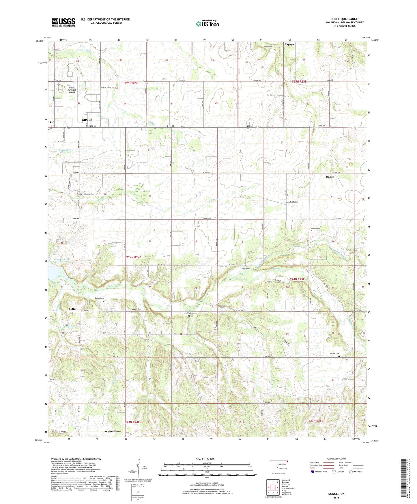
2022 topographic map quadrangle Dodge in the state of Oklahoma. Scale: 1:24000. Based on the newly updated USGS 7.5' US Topo map series, this map is in the following counties: Delaware. The map contains contour data, water features, and other items you are used to seeing on USGS maps, but also has updated roads and other features. This is the next generation of topographic maps. Printed on high-quality waterproof paper with UV fade-resistant inks.
Quads adjacent to this one:
West: Grove
Northwest: Afton NE
North: Cayuga
Northeast: Tiff City
East: South West City
Southeast: Colcord NE
South: Sycamore
Southwest: Jay
This map covers the same area as the classic USGS quad with code o36094e6.
Contains the following named places: Butler, Butler Cemetery, Butler Census Designated Place, Butler Church, Butler Volunteer Fire Department, Carr Church, Cave Springs Branch, Cayuga, Cowskin Rural Fire District Station 2, Dodge, Dodge Census Designated Place, Dodge Church, Fields Cemetery, Grove High School, Grove Municipal Airport, Honey Creek, Olympus Cemetery, Peters Prairie Church, Pollan Cemetery, Polson Cemetery, Scraper Cemetery, Sloan Cemetery, Snail Creek, Snell Cemetery, Township 6, White Water, White Water Census Designated Place, ZIP Code: 74344