MyTopo
Grove Oklahoma US Topo Map
Couldn't load pickup availability
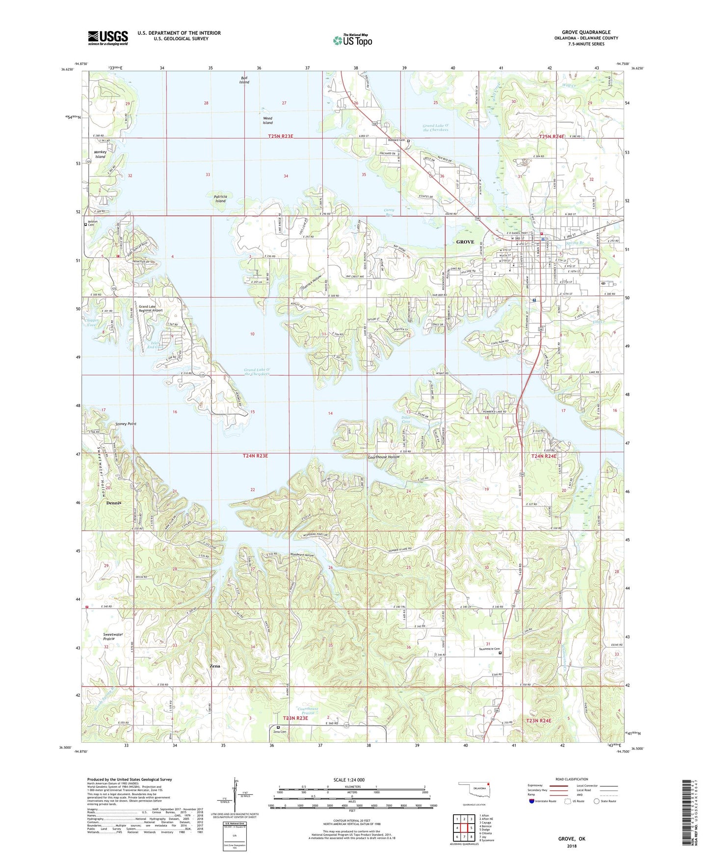
2022 topographic map quadrangle Grove in the state of Oklahoma. Scale: 1:24000. Based on the newly updated USGS 7.5' US Topo map series, this map is in the following counties: Delaware. The map contains contour data, water features, and other items you are used to seeing on USGS maps, but also has updated roads and other features. This is the next generation of topographic maps. Printed on high-quality waterproof paper with UV fade-resistant inks.
Quads adjacent to this one:
West: Bernice
Northwest: Afton
North: Afton NE
Northeast: Cayuga
East: Dodge
Southeast: Sycamore
South: Jay
Southwest: Chloeta
This map covers the same area as the classic USGS quad with code o36094e7.
Contains the following named places: Albert Lodge Heliport, Bad Island, Baptist First Southern Church, Buzzard Cemetery, Carey Bay, Chigger Cove, Christian First Church, Church of Christ, City of Grove, Cornerstone Church, Courthouse Hollow, Courthouse Prairie, Delaware Church, Dennis, Dennis Census Designated Place, Dilar Cove, Elm Creek, Flatrock Hollow, Grace Presbyterian Church, Grand Lake O' The Cherokees, Grand Lake Regional Airport, Grove, Grove Division, Grove Emergency Medical Services, Grove Fire Department, Grove General Hospital Heliport, Grove Lower Elementary School, Grove Middle School, Grove Police Department, Grove Post Office, Grove Primary School, Grove Upper Elementary School, Honey Creek Recreation Area, Integris Grove General Hospital, Isles' End Cove, KGVE-FM (Grove), Monkey Island Fire Association, New Life Assembly of God Church, Patricia Island, Rolston Cemetery, Spring Branch, Stoney Point, Sweetwater Prairie, Tauuneacie Cemetery, Teramiranda Airport, Weed Island, Whitewater Creek, Woodward Hollow, Zena, Zena Cemetery, Zena Census Designated Place, Zena Volunteer Fire Department Station 1, Zena Volunteer Fire Department Station 2