MyTopo
South West City Missouri US Topo Map
Couldn't load pickup availability
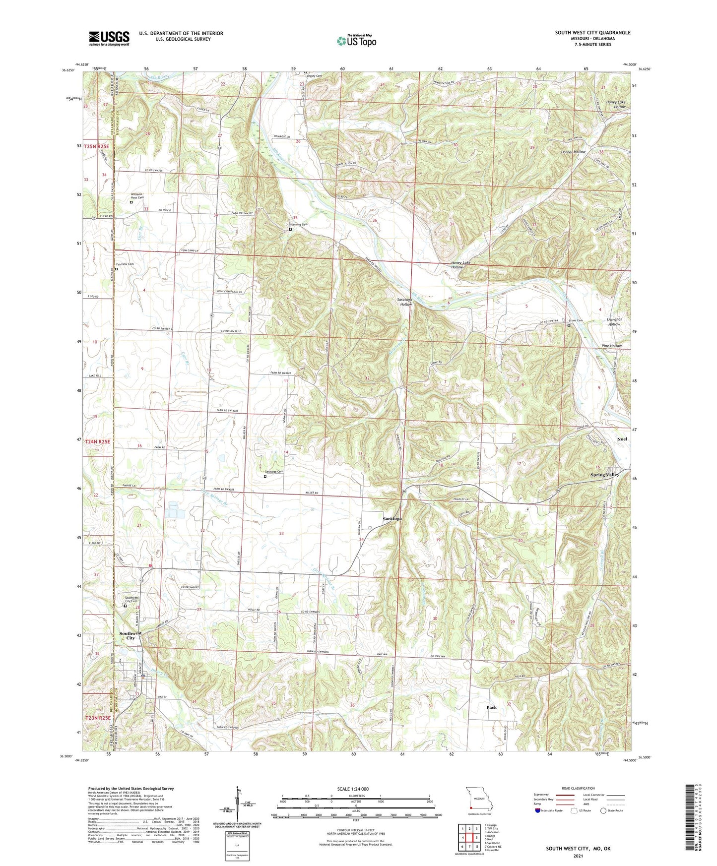
2021 topographic map quadrangle South West City in the states of Missouri, Oklahoma. Scale: 1:24000. Based on the newly updated USGS 7.5' US Topo map series, this map is in the following counties: McDonald, Delaware. The map contains contour data, water features, and other items you are used to seeing on USGS maps, but also has updated roads and other features. This is the next generation of topographic maps. Printed on high-quality waterproof paper with UV fade-resistant inks.
Quads adjacent to this one:
West: Dodge
Northwest: Cayuga
North: Tiff City
Northeast: Anderson
East: Noel
Southeast: Gravette
South: Colcord NE
Southwest: Sycamore
Contains the following named places: Church of Christ, Cowskin, Cowskin Prairie, Fairview Cemetery, Fisher Lake Dam, Greenwood Church, Honey Creek Post Office, Honey Lake Church, Honey Lake Hollow, Horner Hollow, Kingdom Church, KLTK-AM (Southwest City), Liberty Church, Manning Cemetery, Noel Primary School, Pack, Pine Hollow, Round Grove School, Saratoga, Saratoga Cemetery, Saratoga Creek, Saratoga Hollow, Shanghai Hollow, South West City, South West City Post Office, Southwest City Cemetery, Southwest City Elementary School, Southwest City Structure E-1 Dam, Southwest City Volunteer Fire Department, Stone Cemetery, Town of Southwest City, Township of Elk River West, Township of Prairie, White River Hills, Williams - Hays Cemetery, ZIP Code: 64863