MyTopo
Clearview Oklahoma US Topo Map
Couldn't load pickup availability
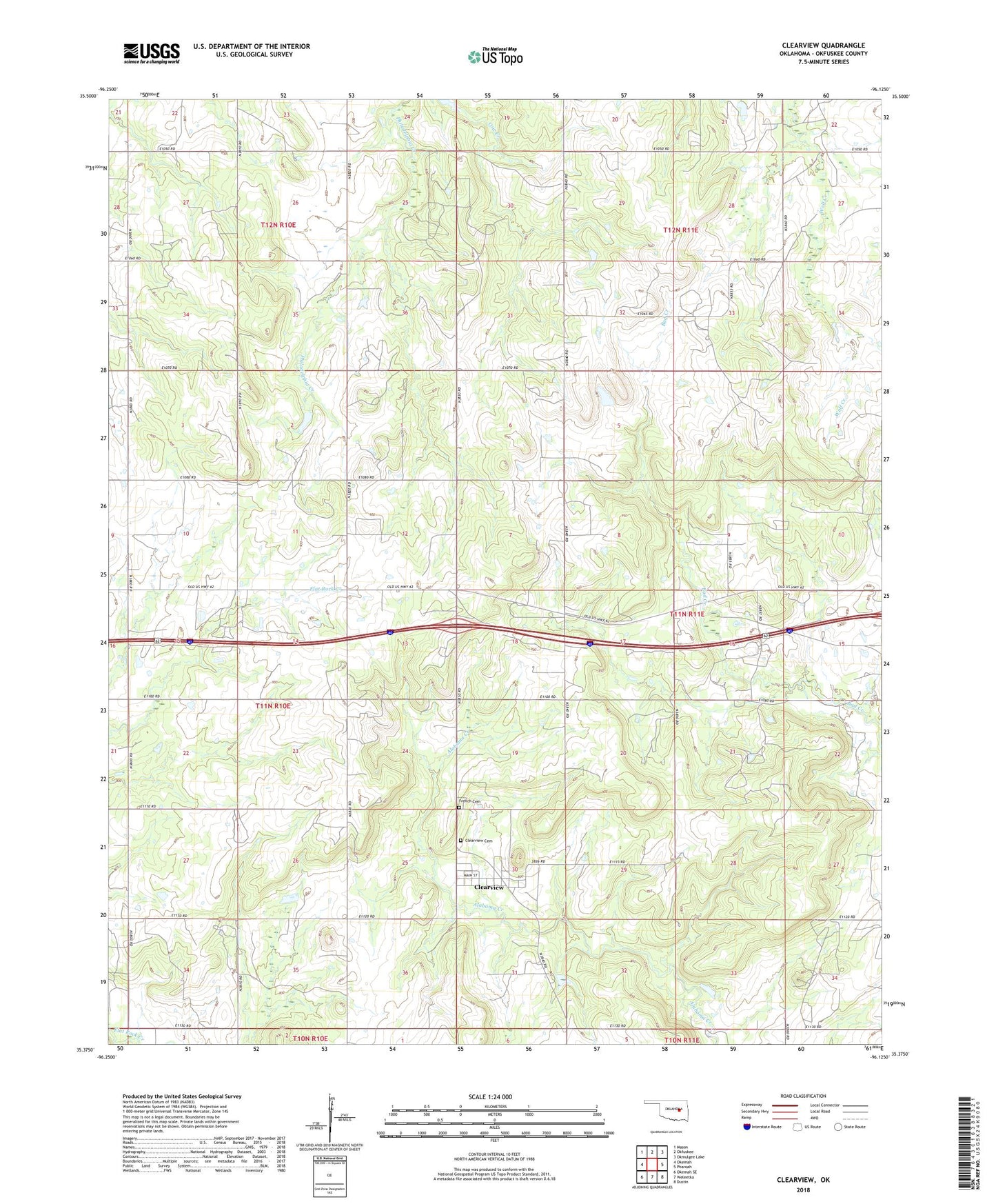
2022 topographic map quadrangle Clearview in the state of Oklahoma. Scale: 1:24000. Based on the newly updated USGS 7.5' US Topo map series, this map is in the following counties: Okfuskee. The map contains contour data, water features, and other items you are used to seeing on USGS maps, but also has updated roads and other features. This is the next generation of topographic maps. Printed on high-quality waterproof paper with UV fade-resistant inks.
Quads adjacent to this one:
West: Okemah
Northwest: Mason
North: Okfuskee
Northeast: Okmulgee Lake
East: Pharoah
Southeast: Dustin
South: Weleetka
Southwest: Okemah SE
This map covers the same area as the classic USGS quad with code o35096d2.
Contains the following named places: Clearview, Clearview Cemetery, Clearview Oil Field, Creek Chapel, Deaner Oil Field, East Okemah Oil Field, French Family Cemetery, North Clearview Oil Field, Northwest Clearview Oil and Gas Field, Oknoname 107026 Dam, Oknoname 107026 Reservoir, Oknoname 107027 Dam, Oknoname 107027 Reservoir, Oknoname 107028 Dam, Oknoname 107028 Reservoir, Salt Creek Church, Southeast Blakely Oil Field, Springfield Church, Town of Clearview, Township of Lincoln