MyTopo
Coalgate Oklahoma US Topo Map
Couldn't load pickup availability
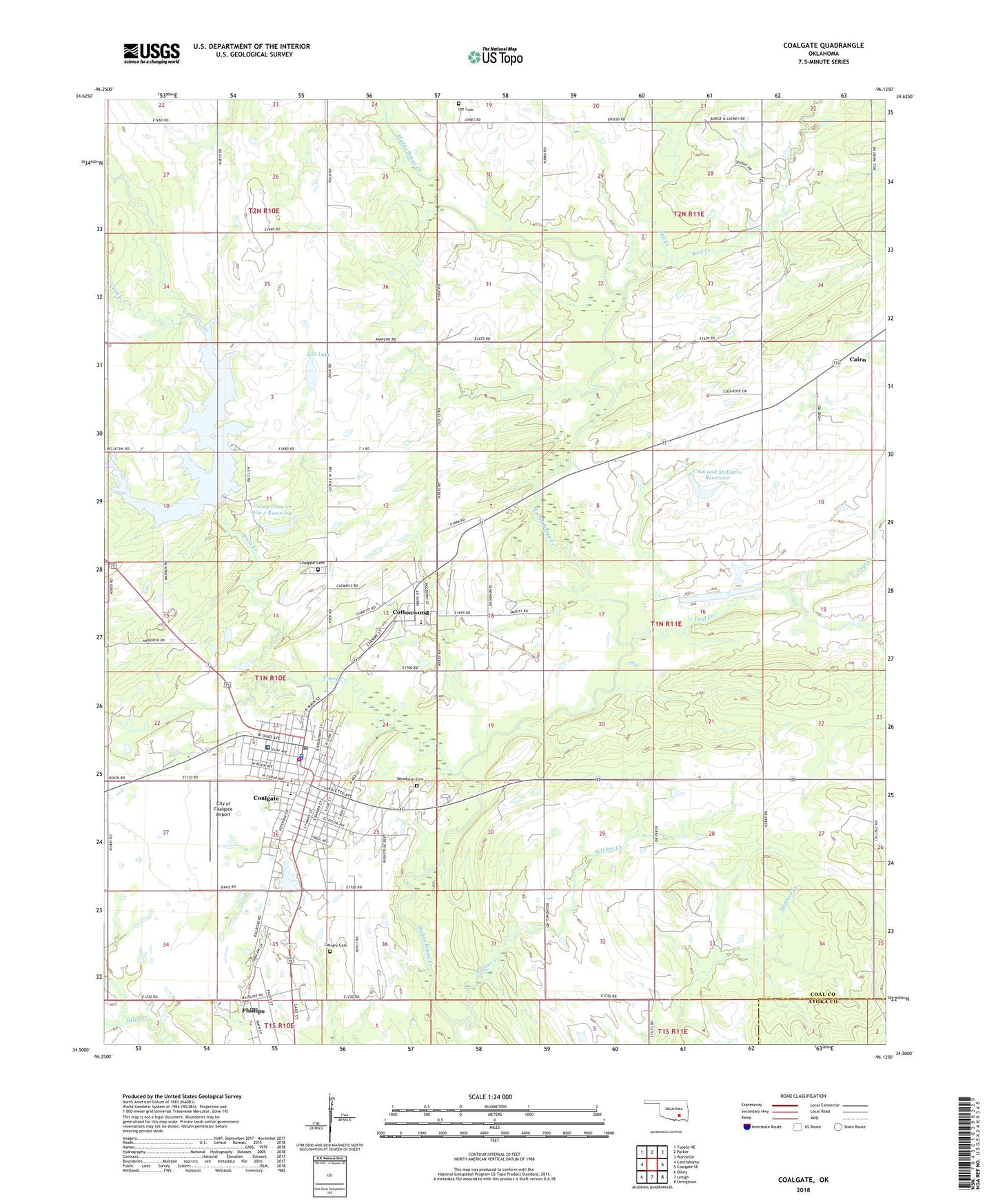
2018 topographic map quadrangle Coalgate in the state of Oklahoma. Scale: 1:24000. Based on the newly updated USGS 7.5' US Topo map series, this map is in the following counties: Coal, Atoka. The map contains contour data, water features, and other items you are used to seeing on USGS maps, but also has updated roads and other features. This is the next generation of topographic maps. Printed on high-quality waterproof paper with UV fade-resistant inks.
Quads adjacent to this one:
West: Centrahoma
Northwest: Tupelo NE
North: Parker
Northeast: Wardville
East: Coalgate SE
Southeast: Stringtown
South: Lehigh
Southwest: Olney
Contains the following named places: Bill Lake Dam, Cairo, Calvary Cemetery, Caney Coon Creek Site 2 Dam, Caney Coon Creek Site 2 Reservoir, Caney Creek, Caney-Coon Creek Site 3 Dam, Caney-Coon Creek Site 3 Reservoir, Church of Christ, City of Coalgate, City of Coalgate Airport, Coal County Jail, Coal County Sheriff, Coal Creek, Coalgate, Coalgate Cemetery, Coalgate Fire Department and Emergency Medical Services, Coalgate High School, Coalgate Police Dept, Coalgate Post Office, Coalgate Reservoir, Cook and McEntire Reservoir, Cook Lake Dam, Coon Creek, Cottonwood, Cottonwood Census Designated Place, Cottonwood Elementary School, East Coal Division, Emerson Elementary School, Gill Lake, Keel Creek, Lone Star School, Mary Hurley Hospital, Methodist Church, Mine Number 21, Ott Cemetery, Phillips, Phillips Strip Mine, Saint Peters Episcopal Church, Salt Creek, Sandmann Mine Number 2, Seventh Day Adventist Church, Sulphur Creek, Town of Phillips, Township of Hanraty, Wallace Byrd Middle School, Woodman Cemetery