MyTopo
Wardville Oklahoma US Topo Map
Couldn't load pickup availability
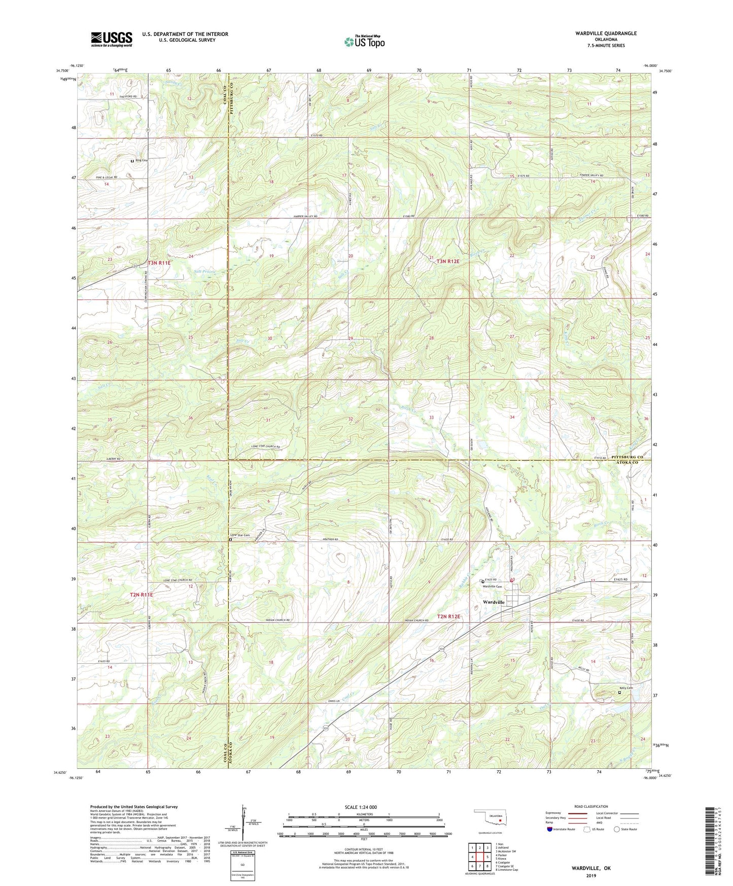
2022 topographic map quadrangle Wardville in the state of Oklahoma. Scale: 1:24000. Based on the newly updated USGS 7.5' US Topo map series, this map is in the following counties: Atoka, Pittsburg, Coal. The map contains contour data, water features, and other items you are used to seeing on USGS maps, but also has updated roads and other features. This is the next generation of topographic maps. Printed on high-quality waterproof paper with UV fade-resistant inks.
Quads adjacent to this one:
West: Parker
Northwest: Non
North: Ashland
Northeast: McAlester SW
East: Kiowa
Southeast: Limestone Gap
South: Coalgate SE
Southwest: Coalgate
This map covers the same area as the classic USGS quad with code o34096f1.
Contains the following named places: Kelly Cemetery, King Cemetery, King Creek, Legal Church, Lone Star Cemetery, Lone Star Church, Owl Creek, Rabbit Creek, Salt Prairie, Sandy Creek, Wardville, Wardville Cemetery, Wardville Census Designated Place, Wardville Rural Volunteer Fire Department, ZIP Code: 74576