MyTopo
Washington Oklahoma US Topo Map
Couldn't load pickup availability
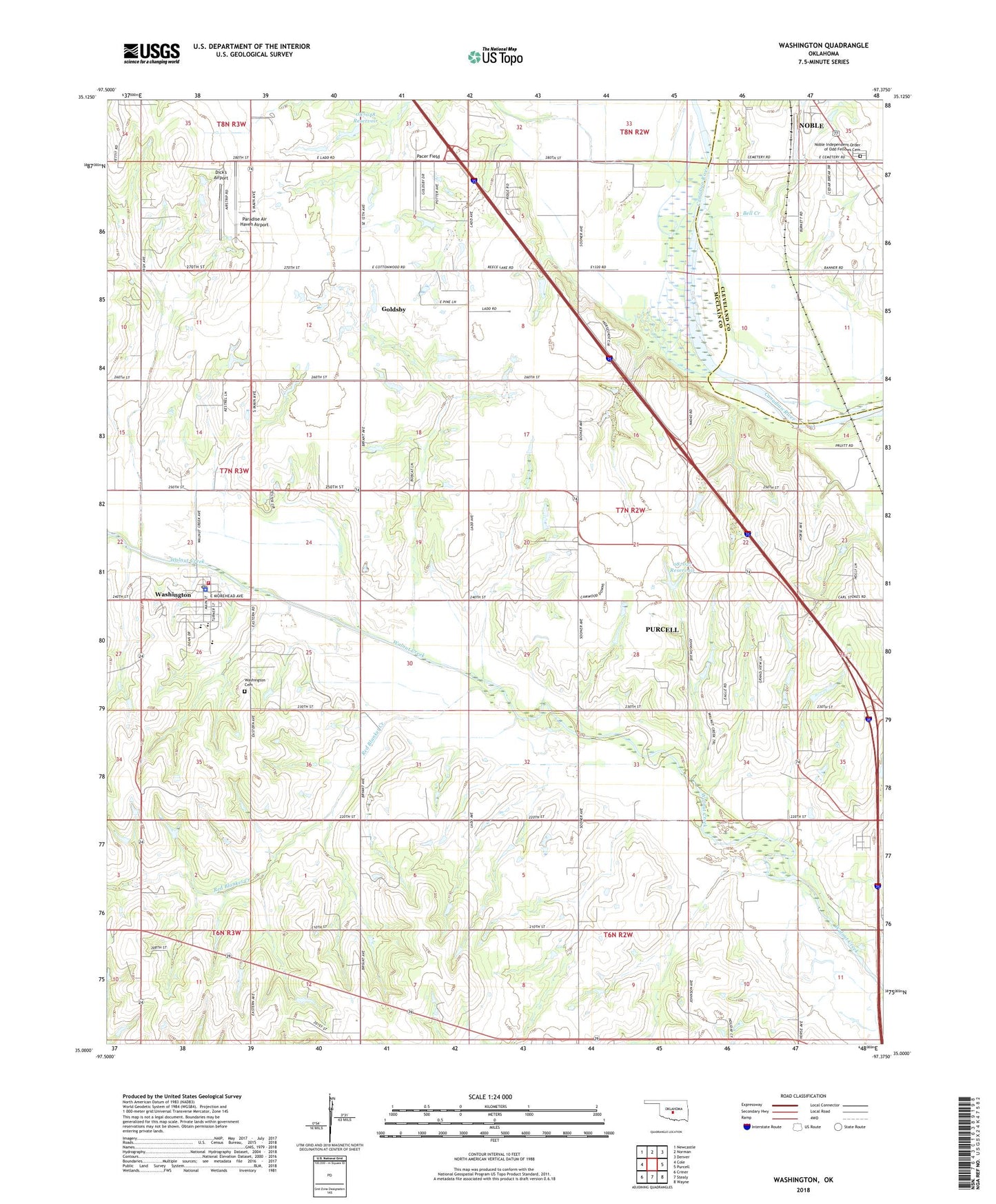
2022 topographic map quadrangle Washington in the state of Oklahoma. Scale: 1:24000. Based on the newly updated USGS 7.5' US Topo map series, this map is in the following counties: McClain, Cleveland. The map contains contour data, water features, and other items you are used to seeing on USGS maps, but also has updated roads and other features. This is the next generation of topographic maps. Printed on high-quality waterproof paper with UV fade-resistant inks.
Quads adjacent to this one:
West: Cole
Northwest: Newcastle
North: Norman
Northeast: Denver
East: Purcell
Southeast: Wayne
South: Stealy
Southwest: Criner
This map covers the same area as the classic USGS quad with code o35097a4.
Contains the following named places: Beefor Ranch Airport, Bell Creek, City of Purcell, Dick's Airport, East Washington Oil Field, McClain County, Noble Independent Order of Odd Fellows Cemetery, Oknoname 087027 Dam, Oknoname 087027 Reservoir, Oknoname 087028 Dam, Oknoname 087028 Reservoir, Oknoname 087048 Dam, Oknoname 087048 Reservoir, Pacer Field, Paradise Air Haven Airport, Red Blanket Creek, Sandy Creek, South Noble Oil Field, Town of Washington, Township of Perry, Union Hill Church, Washington, Washington Cemetery, Washington Elementary School, Washington High School, Washington Middle School, Washington Police Department, Washington Post Office, Washington Volunteer Fire Department, Woody Chapel, Wyatt Airport, ZIP Code: 73093