MyTopo
Blanchard Oklahoma US Topo Map
Couldn't load pickup availability
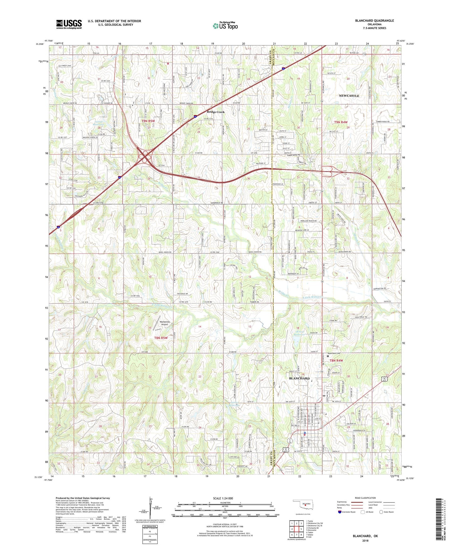
2022 topographic map quadrangle Blanchard in the state of Oklahoma. Scale: 1:24000. Based on the newly updated USGS 7.5' US Topo map series, this map is in the following counties: Grady, McClain. The map contains contour data, water features, and other items you are used to seeing on USGS maps, but also has updated roads and other features. This is the next generation of topographic maps. Printed on high-quality waterproof paper with UV fade-resistant inks.
Quads adjacent to this one:
West: Chickasha NE
Northwest: Tuttle
North: Oklahoma City SW
Northeast: Oklahoma City SE
East: Newcastle
Southeast: Cole
South: Dibble
Southwest: Tabler
This map covers the same area as the classic USGS quad with code o35097b6.
Contains the following named places: Blanchard, Blanchard Cemetery, Blanchard Elementary School, Blanchard Fire Department, Blanchard High School, Blanchard Intermediate Elementary School, Blanchard Middle School, Blanchard Police Department, Blanchard Post Office, Bridge Creek, Bridge Creek Elementary School, Bridge Creek Fire Department, Bridge Creek High School, Bridge Creek Middle School, Christ Chapel Freewill Baptist Church, Church of Christ, City of Blanchard, D and G Farms Airport, First Assembly of God Church, First Baptist Church, First Pentecostal Church, First United Methodist Church, Marantha Baptist Church, MCClain - Grady County EMS, Mission Church, Nelson High Point Airport, New Hope Church, Oknoname 051013 Dam, Oknoname 051013 Reservoir, Oknoname 051041 Dam, Oknoname 051041 Reservoir, Oknoname 087010 Dam, Oknoname 087010 Reservoir, Pleasant Hill Baptist Church, Stinson Creek, Town of Bridge Creek, Township of Vincent, Township of Waldron, Warbonnet Airport