MyTopo
Lake Valley Oklahoma US Topo Map
Couldn't load pickup availability
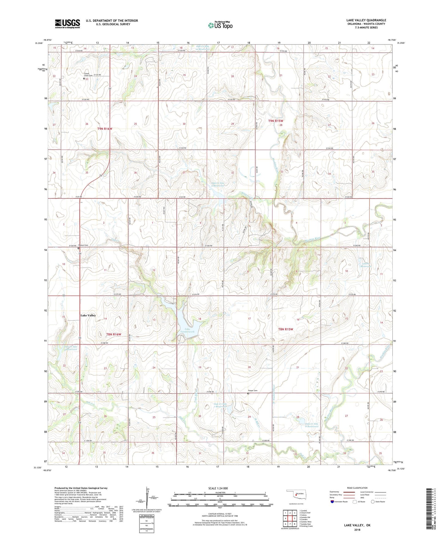
2022 topographic map quadrangle Lake Valley in the state of Oklahoma. Scale: 1:24000. Based on the newly updated USGS 7.5' US Topo map series, this map is in the following counties: Washita. The map contains contour data, water features, and other items you are used to seeing on USGS maps, but also has updated roads and other features. This is the next generation of topographic maps. Printed on high-quality waterproof paper with UV fade-resistant inks.
Quads adjacent to this one:
West: Gotebo NW
Northwest: Cordell
North: Cloud Chief
Northeast: Colony
East: Cowden
Southeast: Stinking Creek
South: Gotebo East
Southwest: Gotebo West
This map covers the same area as the classic USGS quad with code o35098b7.
Contains the following named places: Cloud Chief Cemetery, Fesser Cemetery, Gyp Creek, Indian Village, Lake Valley, Lake Vanderwork, Oak Creek, Oak Creek Site 4 Dam, Oak Creek Site 4 Reservoir, Oak Creek Site 5 Dam, Oak Creek Site 5 Reservoir, Oak Creek Site 7 Dam, Oak Creek Site 7 Reservoir, Oak Creek Site 8 Dam, Oak Creek Site 8 Reservoir, Oak Creek Site 9 Dam, Oak Creek Site 9 Reservoir, Oknoname 149007 Dam, Oknoname 149007 Reservoir, Sharon Cemetery, Sharon Church, Southeast Washita Division