MyTopo
Connerville NE Oklahoma US Topo Map
Couldn't load pickup availability
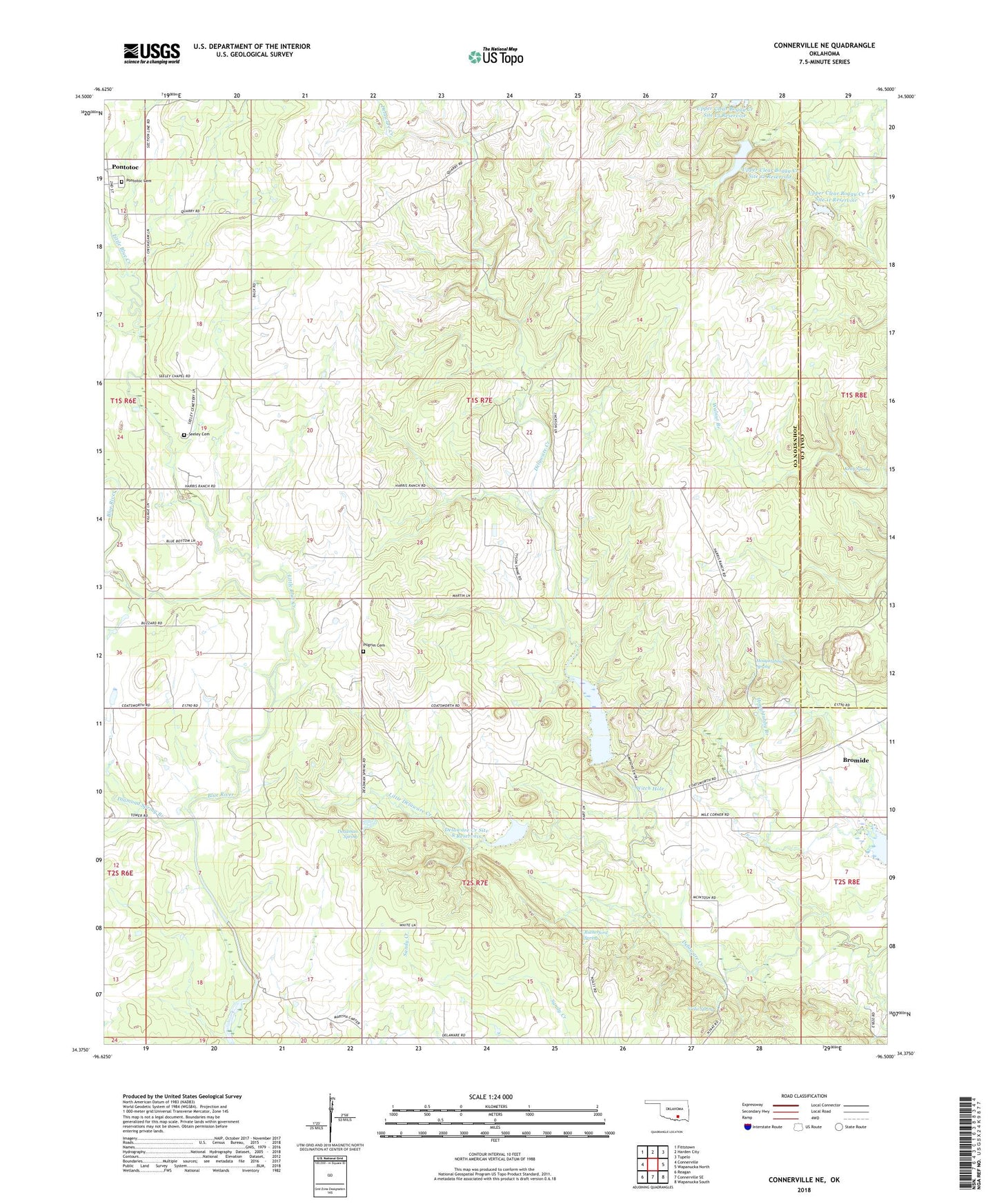
2018 topographic map quadrangle Connerville NE in the state of Oklahoma. Scale: 1:24000. Based on the newly updated USGS 7.5' US Topo map series, this map is in the following counties: Johnston, Coal. The map contains contour data, water features, and other items you are used to seeing on USGS maps, but also has updated roads and other features. This is the next generation of topographic maps. Printed on high-quality waterproof paper with UV fade-resistant inks.
Quads adjacent to this one:
West: Connerville
Northwest: Fittstown
North: Harden City
Northeast: Tupelo
East: Wapanucka North
Southeast: Wapanucka South
South: Connerville SE
Southwest: Reagan
Contains the following named places: Camp Simpson, Deadman Spring, Delaware Creek Site 10 Dam, Delaware Creek Site 10 Reservoir, Delaware Creek Site 8 Dam, Delaware Creek Site 8 Reservoir, Delaware Creek Site 9 Dam, Delaware Creek Site 9 Reservoir, Diamond Spring Branch, Houghtubby Spring, Kelly Spring, Little Blue Creek, Little Delaware Creek, Pilgrim Cemetery, Pontotoc Cemetery, Rutherford Spring, Seeley Cemetery, Seely Chapel, Township of Brogdon, Upper Clear Boggy Creek Site 11 Dam, Upper Clear Boggy Creek Site 11 Reservoir, Upper Clear Boggy Creek Site 12 Dam, Upper Clear Boggy Creek Site 12 Reservoir, Viola Spring, Witch Hole