MyTopo
Reagan Oklahoma US Topo Map
Couldn't load pickup availability
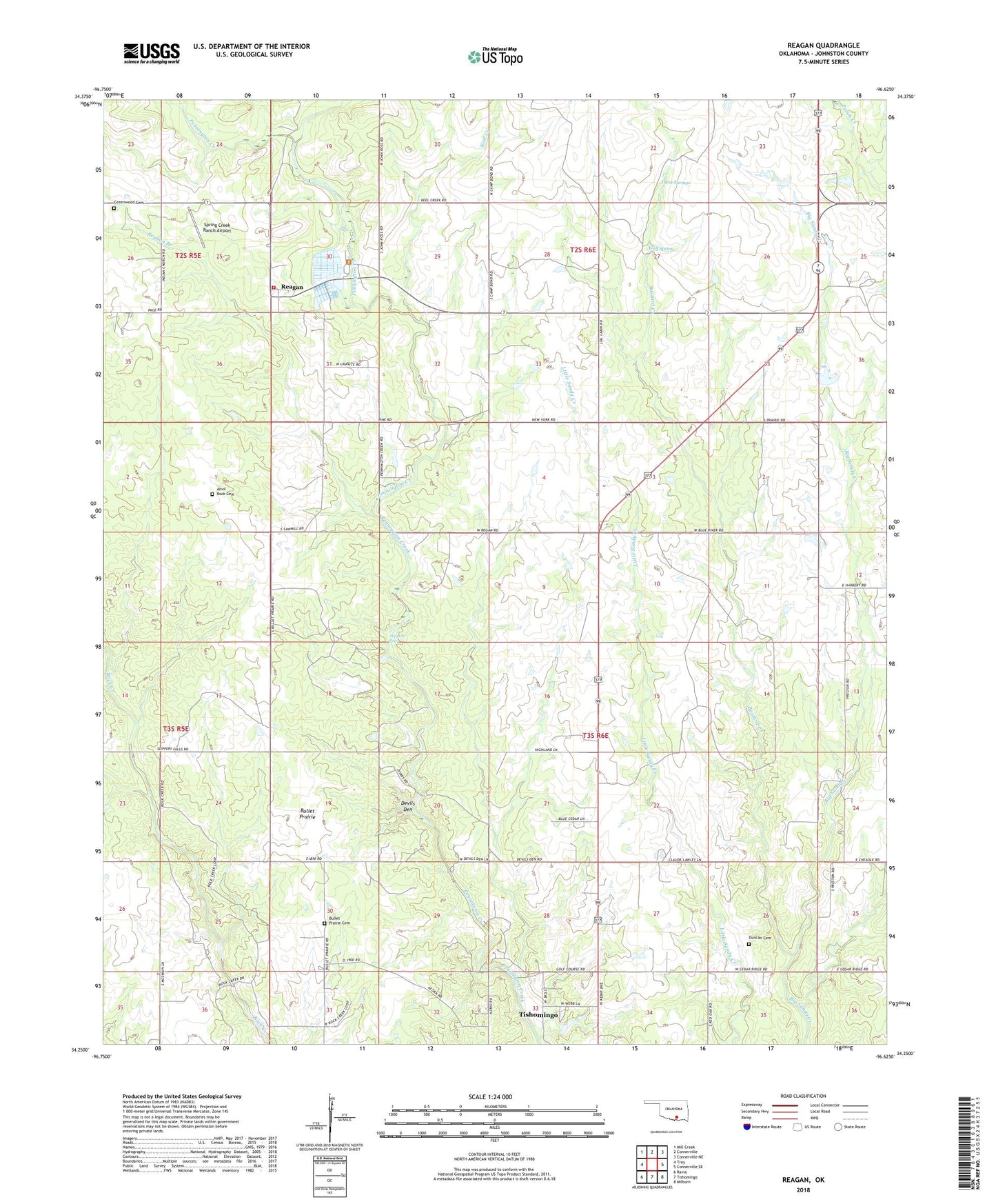
2022 topographic map quadrangle Reagan in the state of Oklahoma. Scale: 1:24000. Based on the newly updated USGS 7.5' US Topo map series, this map is in the following counties: Johnston. The map contains contour data, water features, and other items you are used to seeing on USGS maps, but also has updated roads and other features. This is the next generation of topographic maps. Printed on high-quality waterproof paper with UV fade-resistant inks.
Quads adjacent to this one:
West: Troy
Northwest: Mill Creek
North: Connerville
Northeast: Connerville NE
East: Connerville SE
Southeast: Milburn
South: Tishomingo
Southwest: Ravia
This map covers the same area as the classic USGS quad with code o34096c6.
Contains the following named places: Anvil Rock Cemetery, Bullet Prairie, Bullet Prairie Cemetery, Buzzard Creek, Devils Den, Duncan Cemetery, Greenwood Cemetery, Johnston County, Keel Creek, Oknoname 069001 Dam, Oknoname 069001 Reservoir, Oknoname 069003 Dam, Oknoname 069003 Reservoir, Pennington Church, Reagan, Reagan Branch, Reagan Census Designated Place, Reagan Volunteer Fire Department, Slippery Falls, Spring Creek, Spring Creek Ranch Airport, Three Springs, Tishomingo Division, Township of Garrett, Webb Lake, Webb Lake Dam, Wolf Spring, ZIP Code: 73460