MyTopo
Connerville SE Oklahoma US Topo Map
Couldn't load pickup availability
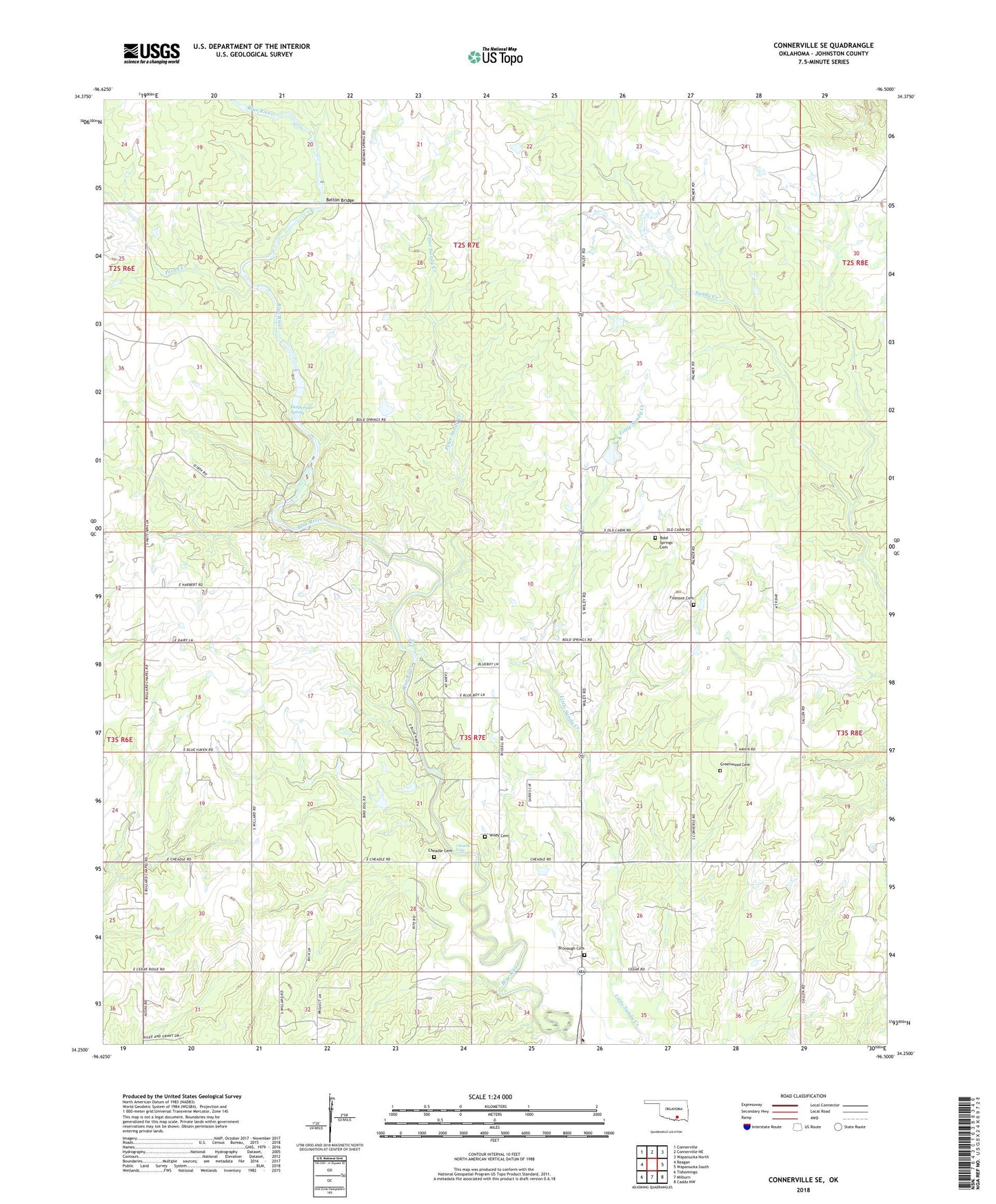
2022 topographic map quadrangle Connerville SE in the state of Oklahoma. Scale: 1:24000. Based on the newly updated USGS 7.5' US Topo map series, this map is in the following counties: Johnston. The map contains contour data, water features, and other items you are used to seeing on USGS maps, but also has updated roads and other features. This is the next generation of topographic maps. Printed on high-quality waterproof paper with UV fade-resistant inks.
Quads adjacent to this one:
West: Reagan
Northwest: Connerville
North: Connerville NE
Northeast: Wapanucka North
East: Wapanucka South
Southeast: Caddo NW
South: Milburn
Southwest: Tishomingo
This map covers the same area as the classic USGS quad with code o34096c5.
Contains the following named places: Belton Bridge, Big Falls, Blue River Public Hunting Area, Bold Springs Cemetery, Bold Springs Church, Bronaugh Cemetery, Bullard Chapel, Cheadle Cemetery, Cheadle Falls, Desperado Spring, East Johnston Division, Fillmore Cemetery, Greenwood Cemetery, KTEN-TV (Ada), Oknoname 069004 Dam, Oknoname 069004 Reservoir, Pecan Creek, Peter Sandy Creek, Sardis Church, Smith Lake Dam, Township of Myrick, Wiley Cemetery, ZIP Code: 73450