MyTopo
Wapanucka South Oklahoma US Topo Map
Couldn't load pickup availability
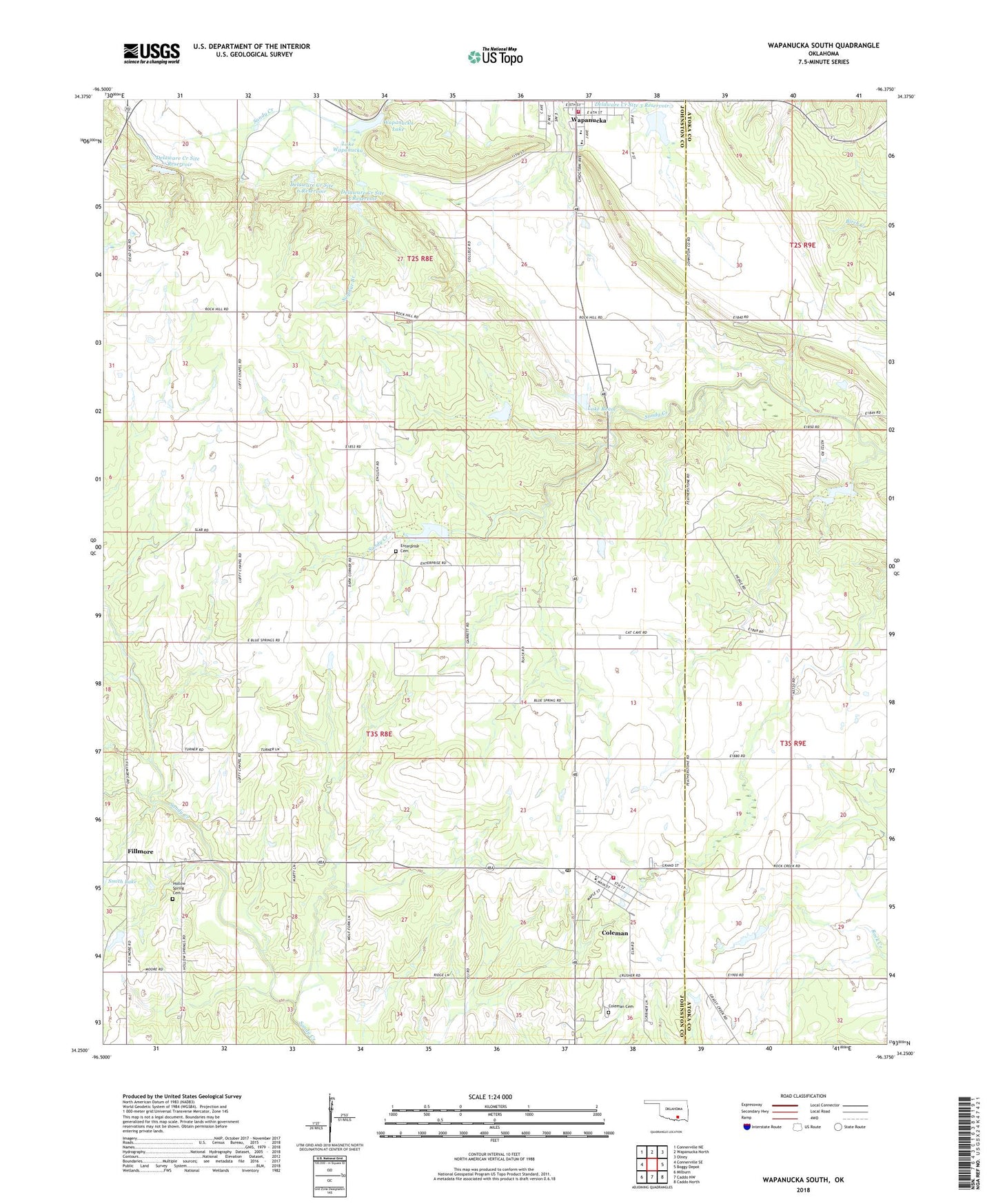
2022 topographic map quadrangle Wapanucka South in the state of Oklahoma. Scale: 1:24000. Based on the newly updated USGS 7.5' US Topo map series, this map is in the following counties: Johnston, Atoka. The map contains contour data, water features, and other items you are used to seeing on USGS maps, but also has updated roads and other features. This is the next generation of topographic maps. Printed on high-quality waterproof paper with UV fade-resistant inks.
Quads adjacent to this one:
West: Connerville SE
Northwest: Connerville NE
North: Wapanucka North
Northeast: Olney
East: Boggy Depot
Southeast: Caddo North
South: Caddo NW
Southwest: Milburn
This map covers the same area as the classic USGS quad with code o34096c4.
Contains the following named places: Coleman, Coleman Cemetery, Coleman Census Designated Place, Coleman Elementary School, Coleman Fire Department, Coleman High School, Coleman Post Office, Delaware Creek Site 3 Dam, Delaware Creek Site 3 Reservoir, Delaware Creek Site 5 Dam, Delaware Creek Site 5 Reservoir, Delaware Creek Site 6 Dam, Delaware Creek Site 6 Reservoir, Delaware Creek Site 7 Dam, Delaware Creek Site 7 Reservoir, Enterprise Cemetery, Fillmore, Hollow Spring Cemetery, Lake Ream, Lake Ream Dam, Lake Wapanucka Dam, Lower Clear Boggy Creek Site 14 Dam, Lower Clear Boggy Creek Site 14 Reservoir, Lower Clear Boggy Creek Site 17 Dam, Lower Clear Boggy Creek Site 17 Reservoir, Presbyterian Church, Sandy Creek Church, Smith Lake, Sulphur Branch, Town of Wapanucka, Wapanucka, Wapanucka Elementary School, Wapanucka Fire Department, Wapanucka High School, Wapanucka Lake, ZIP Code: 73461