MyTopo
Connerville Oklahoma US Topo Map
Couldn't load pickup availability
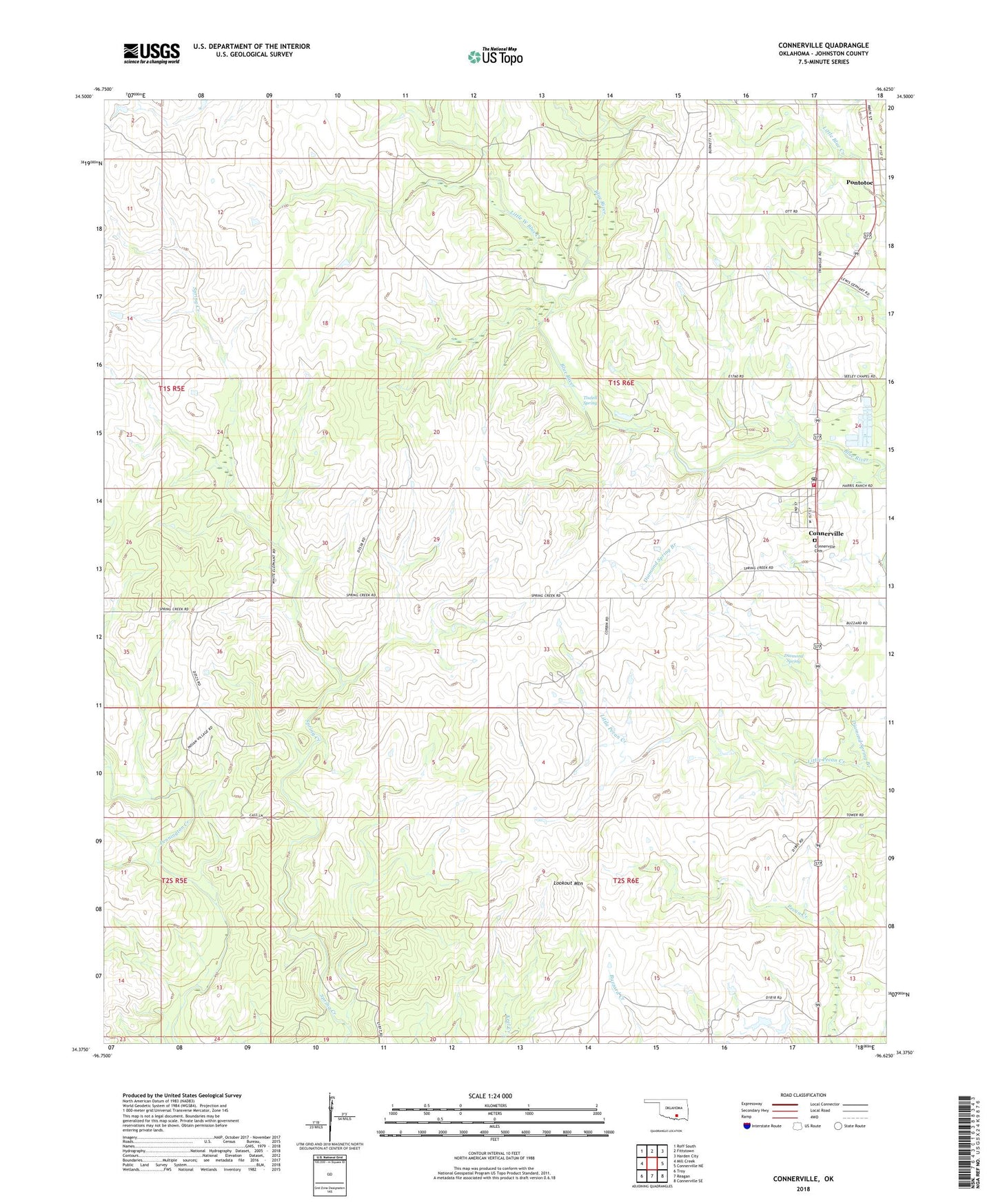
2022 topographic map quadrangle Connerville in the state of Oklahoma. Scale: 1:24000. Based on the newly updated USGS 7.5' US Topo map series, this map is in the following counties: Johnston. The map contains contour data, water features, and other items you are used to seeing on USGS maps, but also has updated roads and other features. This is the next generation of topographic maps. Printed on high-quality waterproof paper with UV fade-resistant inks.
Quads adjacent to this one:
West: Mill Creek
Northwest: Roff South
North: Fittstown
Northeast: Harden City
East: Connerville NE
Southeast: Connerville SE
South: Reagan
Southwest: Troy
This map covers the same area as the classic USGS quad with code o34096d6.
Contains the following named places: Blue Church, Connerville, Connerville Cemetery, Connerville Census Designated Place, Connerville Fire Department, Connerville Post Office, Diamond Spring, Little Pecan Creek, Little West Blue Creek, Lookout Mountain, Pontotoc, Pontotoc Census Designated Place, Tisdell Spring, Tishomingo National Fish Hatchery, Township of Harris, Upper Clear Boggy Creek Site 37 Dam, Upper Clear Boggy Creek Site 37 Reservoir, ZIP Code: 74836