MyTopo
Cottonwood Creek Oklahoma US Topo Map
Couldn't load pickup availability
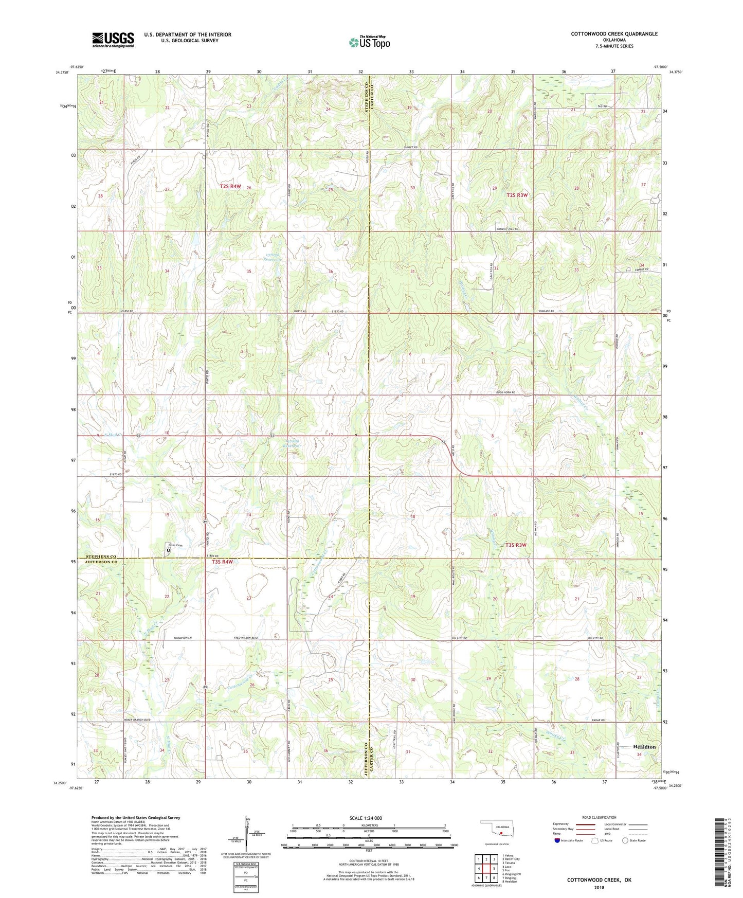
2018 topographic map quadrangle Cottonwood Creek in the state of Oklahoma. Scale: 1:24000. Based on the newly updated USGS 7.5' US Topo map series, this map is in the following counties: Carter, Stephens, Jefferson. The map contains contour data, water features, and other items you are used to seeing on USGS maps, but also has updated roads and other features. This is the next generation of topographic maps. Printed on high-quality waterproof paper with UV fade-resistant inks.
Quads adjacent to this one:
West: Loco
Northwest: Velma
North: Ratliff City
Northeast: Tatums
East: Fox
Southeast: Healdton
South: Ringling
Southwest: Ringling NW
Contains the following named places: Asphaltum Church, Cottonwood Creek, Dixie Cemetery, Healdton North Division, Oknoname 137058 Dam, Oknoname 137058 Reservoir, Oknoname 137080 Dam, Oknoname 137080 Reservoir, Pike City, ZIP Code: 73438