MyTopo
Tatums Oklahoma US Topo Map
Couldn't load pickup availability
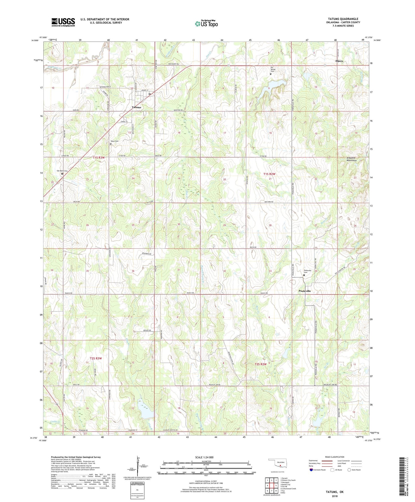
2022 topographic map quadrangle Tatums in the state of Oklahoma. Scale: 1:24000. Based on the newly updated USGS 7.5' US Topo map series, this map is in the following counties: Carter. The map contains contour data, water features, and other items you are used to seeing on USGS maps, but also has updated roads and other features. This is the next generation of topographic maps. Printed on high-quality waterproof paper with UV fade-resistant inks.
Quads adjacent to this one:
West: Ratliff City
Northwest: Pernell
North: Elmore City South
Northeast: Hennepin
East: Fox NE
Southeast: Milo
South: Fox
Southwest: Cottonwood Creek
This map covers the same area as the classic USGS quad with code o34097d4.
Contains the following named places: Alpers, Caddo Creek Site 2 Dam, Caddo Creek Site 2 Reservoir, Caddo Creek Site 4 Dam, Caddo Creek Site 4 Reservoir, Caddo Creek Site 5 Dam, Caddo Creek Site 5 Reservoir, Flat Creek, Monk Cemetery, Oil Spring Cemetery, Pilgrim Church, Pooleville, Pooleville Cemetery, Tatums, Tatums Cemetery, Tatums Post Office, Town of Tatums, Township of Graham, Wildhorse Creek Site 10 Dam, Wildhorse Creek Site 10 Reservoir, Wildhorse Creek Site 11 Dam, Wildhorse Creek Site 11 Reservoir, ZIP Code: 73487