MyTopo
Daisy Oklahoma US Topo Map
Couldn't load pickup availability
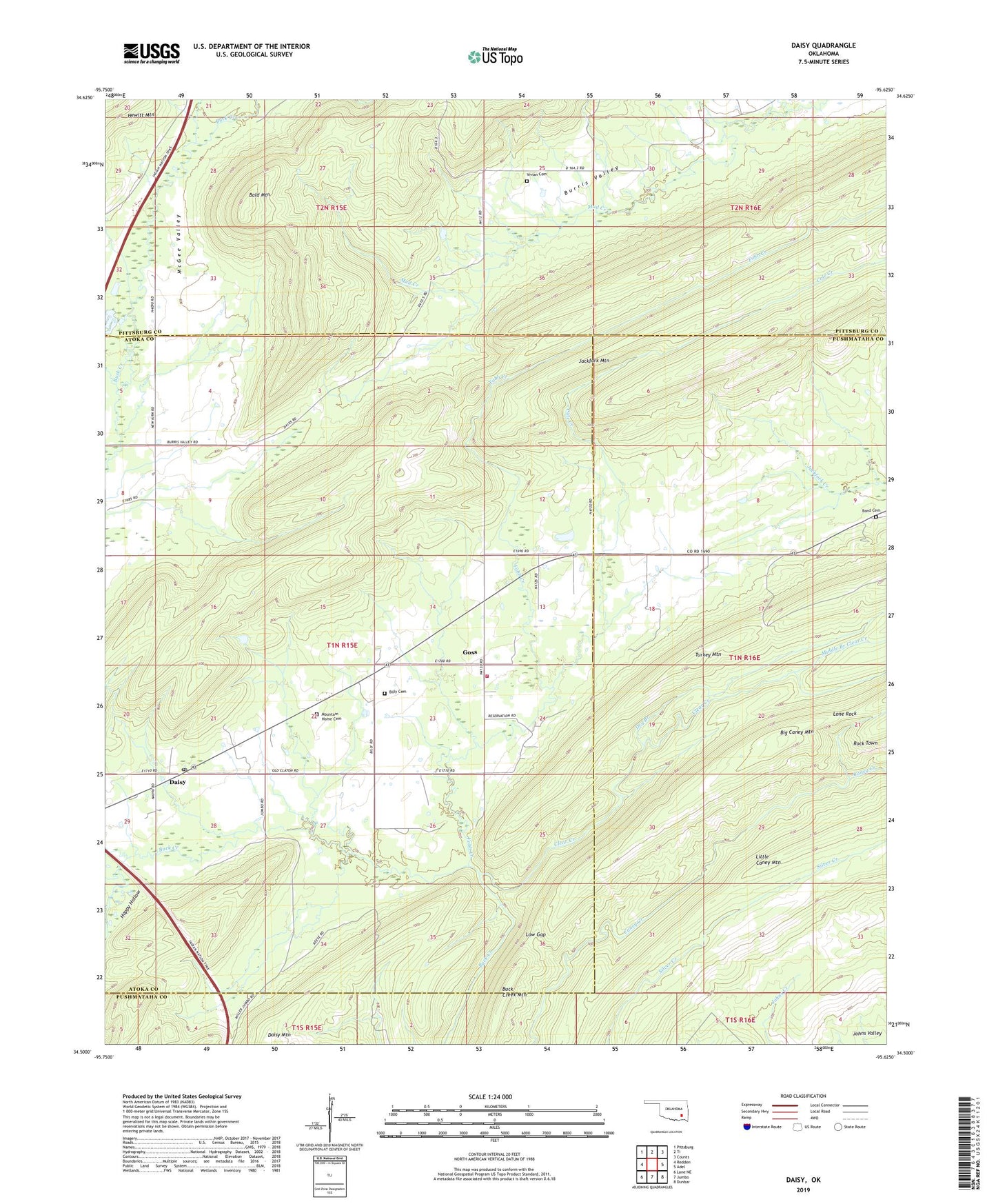
2022 topographic map quadrangle Daisy in the state of Oklahoma. Scale: 1:24000. Based on the newly updated USGS 7.5' US Topo map series, this map is in the following counties: Atoka, Pushmataha, Pittsburg. The map contains contour data, water features, and other items you are used to seeing on USGS maps, but also has updated roads and other features. This is the next generation of topographic maps. Printed on high-quality waterproof paper with UV fade-resistant inks.
Quads adjacent to this one:
West: Redden
Northwest: Pittsburg
North: Ti
Northeast: Counts
East: Adel
Southeast: Dunbar
South: Jumbo
Southwest: Lane NE
This map covers the same area as the classic USGS quad with code o34095e6.
Contains the following named places: Bald Mountain, Billy Cemetery, Bond Cemetery, Clear Creek, Cole Creek, Daisy, Daisy Mountain, Daisy Post Office, Daisy Volunteer Fire Department, Dry Branch, Fobb Creek, Goss, Happy Hollow, Lone Rock, Low Gap, Middle Branch Clear Creek, Mountain Home Cemetery, Vivian Cemetery, ZIP Code: 74540