MyTopo
Jumbo Oklahoma US Topo Map
Couldn't load pickup availability
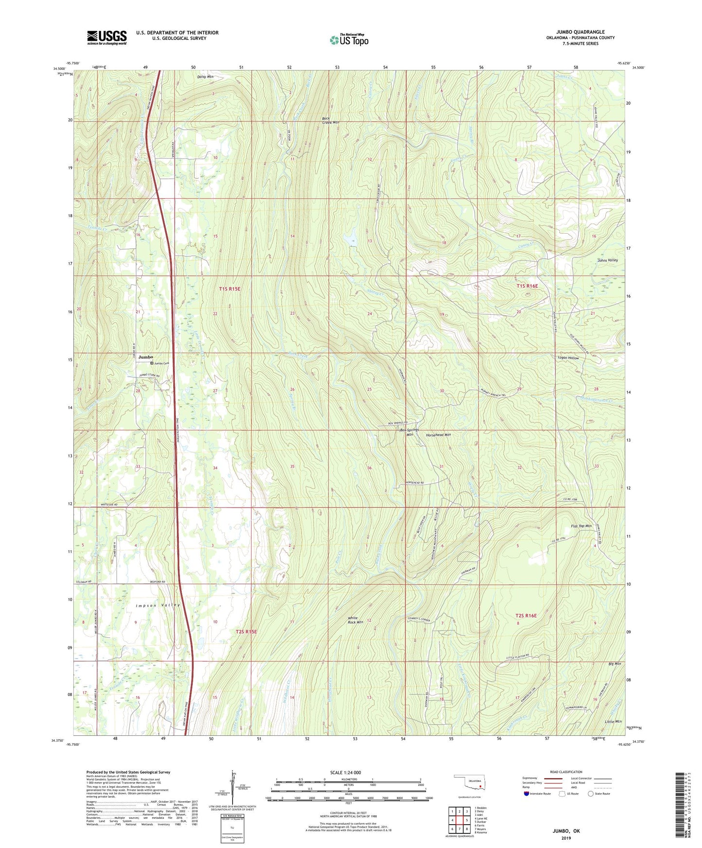
2022 topographic map quadrangle Jumbo in the state of Oklahoma. Scale: 1:24000. Based on the newly updated USGS 7.5' US Topo map series, this map is in the following counties: Pushmataha. The map contains contour data, water features, and other items you are used to seeing on USGS maps, but also has updated roads and other features. This is the next generation of topographic maps. Printed on high-quality waterproof paper with UV fade-resistant inks.
Quads adjacent to this one:
West: Lane NE
Northwest: Redden
North: Daisy
Northeast: Adel
East: Dunbar
Southeast: Kosoma
South: Moyers
Southwest: Farris
This map covers the same area as the classic USGS quad with code o34095d6.
Contains the following named places: Box Springs Mountain, Buck Creek Mountain, Caney Creek, Flat Top Mountain, Horsehead Mountain, Jumbo, Jumbo Cemetery, Little Tenmile Creek, Pole Creek, Shorty Creek, Silver Creek, Spring Branch, Township of Kosoma, ZIP Code: 74557