MyTopo
Redden Oklahoma US Topo Map
Couldn't load pickup availability
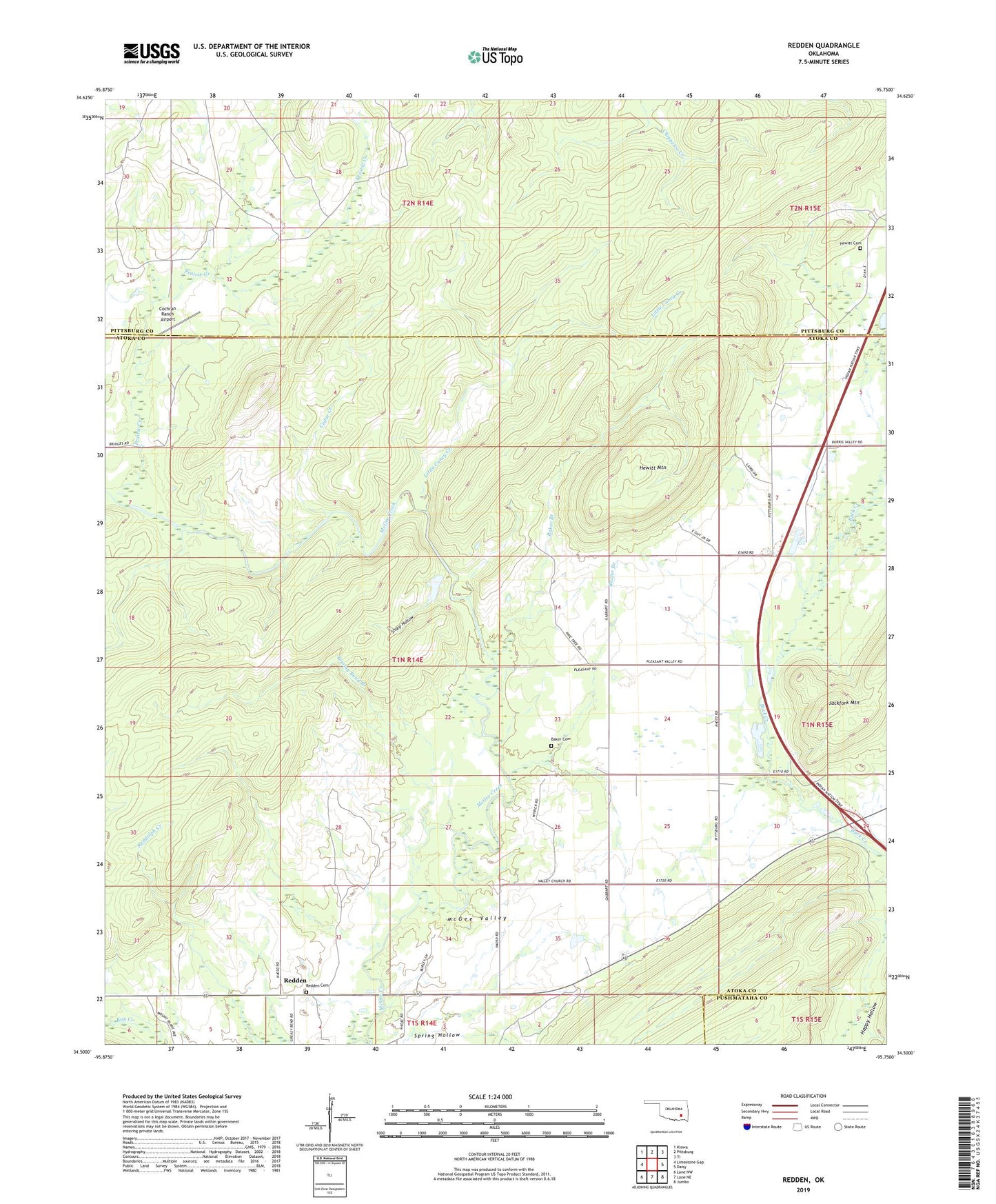
2022 topographic map quadrangle Redden in the state of Oklahoma. Scale: 1:24000. Based on the newly updated USGS 7.5' US Topo map series, this map is in the following counties: Atoka, Pittsburg, Pushmataha. The map contains contour data, water features, and other items you are used to seeing on USGS maps, but also has updated roads and other features. This is the next generation of topographic maps. Printed on high-quality waterproof paper with UV fade-resistant inks.
Quads adjacent to this one:
West: Limestone Gap
Northwest: Kiowa
North: Pittsburg
Northeast: Ti
East: Daisy
Southeast: Jumbo
South: Lane NE
Southwest: Lane NW
This map covers the same area as the classic USGS quad with code o34095e7.
Contains the following named places: Baker Branch, Baker Cemetery, Baxter Branch, Cedar Creek, Cochran Ranch Airport, Hewitt Cemetery, Hewitt Mountain, Little Caney Creek, McGee Church, Prairie Creek, Redden, Redden Cemetery, Sharp Hollow, Spring Hollow, Tommy Bond Branch