MyTopo
Durant North Oklahoma US Topo Map
Couldn't load pickup availability
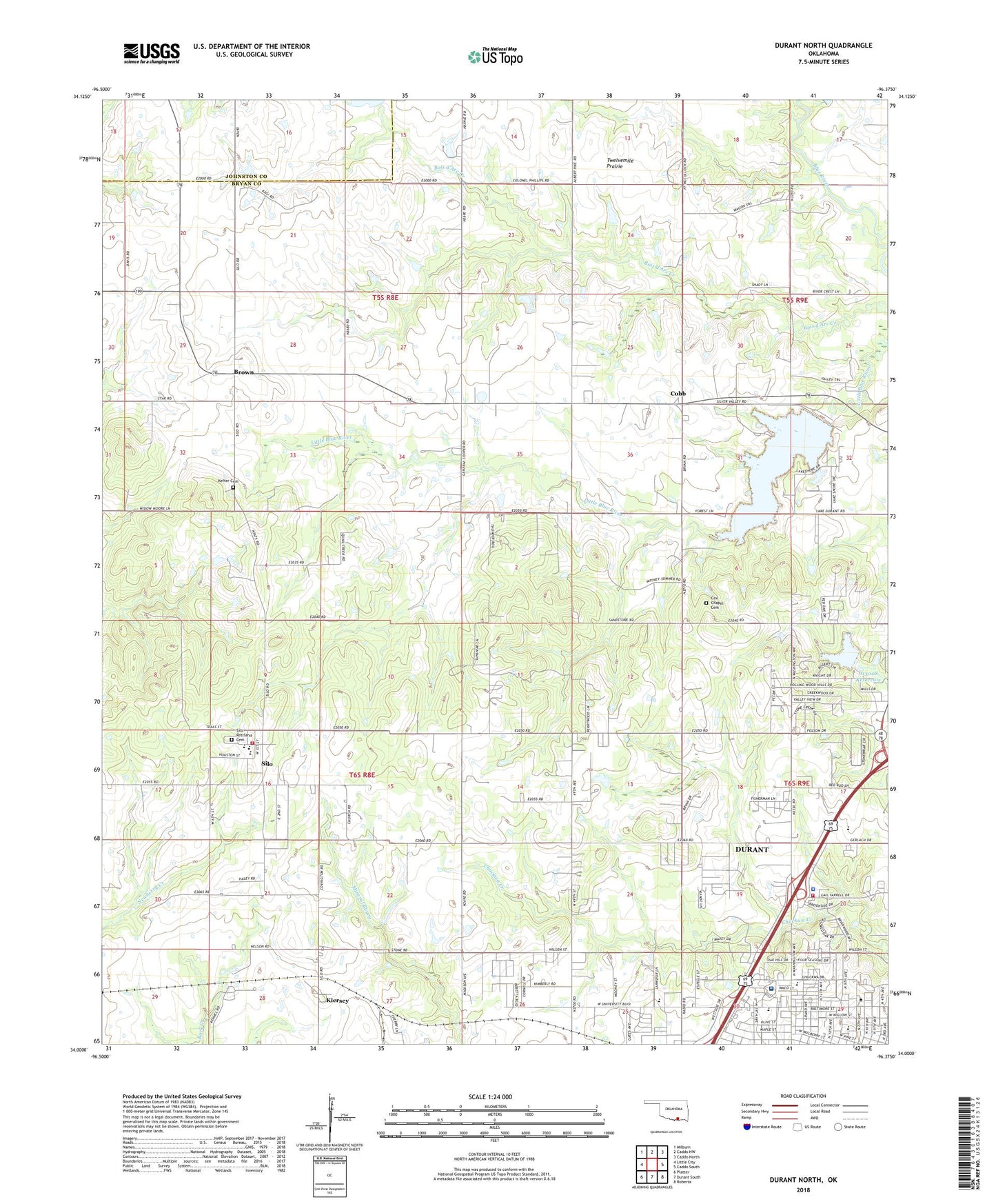
2022 topographic map quadrangle Durant North in the state of Oklahoma. Scale: 1:24000. Based on the newly updated USGS 7.5' US Topo map series, this map is in the following counties: Bryan, Johnston. The map contains contour data, water features, and other items you are used to seeing on USGS maps, but also has updated roads and other features. This is the next generation of topographic maps. Printed on high-quality waterproof paper with UV fade-resistant inks.
Quads adjacent to this one:
West: Little City
Northwest: Milburn
North: Caddo NW
Northeast: Caddo North
East: Caddo South
Southeast: Roberta
South: Durant South
Southwest: Platter
This map covers the same area as the classic USGS quad with code o34096a4.
Contains the following named places: Abundant Life Temple, Bible Missionary Church, Brown, Cobb, Cox Chapel Cemetery, Durant Fire Department Station 2, Durant High School, Durant Intermediate Elementary School, Durant Middle School, Durant Police Department, Fairview Baptist Church, Fairview Baptist Church Day Care, Faith Missionary Baptist Church, Folsom Highway Church, Keffer Cemetery, KHIB-FM (Durant), Kiersey, KLBC-FM (Durant), KSEO-AM (Durant), Mc Laughlin Farm Airport, Medical Center of Southeastern Oklahoma, Medical Center of Southeastern Oklahoma Heliport, Mount Zion Church, Northwest Church of Christ, Northwest Heights Elementary School, Oklahoma State Highway Patrol Troop E, Oknoname 013008 Dam, Oknoname 013008 Reservoir, Pentecostal Church of God, Pentecostal Holiness Church, Saint Williams Catholic Church, Silo, Silo Community Volunteer Fire Department, Silo Elementary School, Silo High School, Silo Junior High School, Silo Restland Cemetery, Southeastern Oklahoma State University, Town of Silo, Victory Life, Victory Life Academy, ZIP Code: 74701